Boylston, Massachusetts
Boylston is a town in Worcester County, Massachusetts, United States. The population was 4,355 at the 2010 census.
Boylston, Massachusetts | |
|---|---|
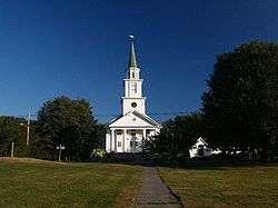 Boylston Town Common | |
 Seal | |
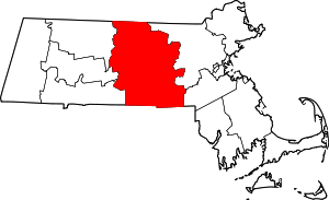
 Location in Worcester County and the state of Massachusetts. | |
| Coordinates: 42°23′30″N 71°42′15″W | |
| Country | United States |
| State | Massachusetts |
| County | Worcester |
| Settled | 1705 |
| Incorporated | 1786 |
| Government | |
| • Type | Open town meeting |
| • Town Administrator | Martin McNamara |
| Area | |
| • Total | 19.7 sq mi (51.0 km2) |
| • Land | 16.0 sq mi (41.5 km2) |
| • Water | 3.6 sq mi (9.4 km2) |
| Elevation | 443 ft (135 m) |
| Population (2010) | |
| • Total | 4,355 |
| • Density | 220/sq mi (85/km2) |
| Time zone | UTC-5 (Eastern) |
| • Summer (DST) | UTC-4 (Eastern) |
| ZIP code | 01505 |
| Area code(s) | 508 / 774 |
| FIPS code | 25-07525 |
| GNIS feature ID | 0619478 |
| Website | www.boylston-ma.gov |
History
Boylston was first settled by Europeans around 1706 in the northern part of the present-day town, most notably by the Sawyer family. In 1697, the residents petitioned to form a local town and government, but the British colonial Governor of Massachusetts denied their request since he wanted to keep the number of towns to a minimum and to restrict popular representation.[1]
A meeting house was built in 1743, and the Reverend Ebenezer Morse, ordained in October 1743, was the first minister in charge of the church.
The town was made up of a large part of land from Shrewsbury and the remainder from Lancaster[1] and was known as the North Parish of Shrewsbury from 1742 until 1786, when it was incorporated as Boylston.[2]
It was named after Ward Nicholas Boylston (1747–1828),[3][4] a benefactor of the town. The fund he set up in 1797 finally accumulated $1,450, which was used to build the town hall and school building.[5][6][7]
The locals used to live off agriculture, and erected mills on the Nashua River, until the construction of Wachusett Reservoir terminated their operation.[7]
Geography
According to the United States Census Bureau, the town has a total area of 19.7 square miles (51 km2), of which 16.0 square miles (41 km2) is land and 3.6 square miles (9.3 km2), or 18.50%, is water.
With a population of nearly 4400 residents, the town is predominantly a residential community. The Wachusett Reservoir, part of the water supply system managed by the Massachusetts Water Resources Authority for Greater Boston area, lies in the northwestern part of the town and covers about 5,000 acres (20 km2) of land. The town maintains approximately 45 miles (72 km) of roadway, has 9 miles (14 km) of sidewalks, and has its own Municipal Light Department, Water District, and volunteer fire and ambulance service.
The town of Boylston is bordered by the towns of Shrewsbury, West Boylston, Sterling, Clinton, Berlin, and Northborough.
Demographics
| Historical population | ||
|---|---|---|
| Year | Pop. | ±% |
| 1850 | 918 | — |
| 1860 | 929 | +1.2% |
| 1870 | 800 | −13.9% |
| 1880 | 854 | +6.7% |
| 1890 | 770 | −9.8% |
| 1900 | 1,364 | +77.1% |
| 1910 | 714 | −47.7% |
| 1920 | 794 | +11.2% |
| 1930 | 1,097 | +38.2% |
| 1940 | 1,388 | +26.5% |
| 1950 | 1,700 | +22.5% |
| 1960 | 2,367 | +39.2% |
| 1970 | 2,774 | +17.2% |
| 1980 | 3,470 | +25.1% |
| 1990 | 3,517 | +1.4% |
| 2000 | 4,008 | +14.0% |
| 2010 | 4,355 | +8.7% |
| * = population estimate. Source: United States Census records and Population Estimates Program data.[8][9][10][11][12][13][14][15][16][17] | ||
As of the 2000 census, there were 4,008 people, 1,573 households, and 1,140 families residing in the town. The population density was 250.0 inhabitants per square mile (96.5/km2). There were 1,606 housing units at an average density of 100.2 per square mile (38.7/km2). The racial makeup of the town was 96.71% White, 0.67% African American, 0.22% Native American, 1.37% Asian, 0.25% from other races, and 0.77% from two or more races. Hispanic or Latino of any race were 0.57% of the population.
There were 1,573 households, out of which 33.2% had children under the age of 18 living with them, 63.9% were married couples living together, 6.6% had a female householder with no husband present, and 27.5% were non-families. 22.3% of all households were made up of individuals, and 8.6% had someone living alone who was 65 years of age or older. The average household size was 2.55 and the average family size was 3.02.
In the town, the population was spread out, with 24.3% under the age of 18, 4.4% from 18 to 24, 31.3% from 25 to 44, 27.8% from 45 to 64, and 12.3% who were 65 years of age or older. The median age was 40 years. For every 100 females, there were 99.0 males. For every 100 females age 18 and over, there were 96.5 males.
The median income for a household in the town was $67,703, and the median income for a family was $77,604. Males had a median income of $56,019 versus $43,277 for females. The per capita income for the town was $32,274. About 2.4% of families and 2.8% of the population were below the poverty line, including 0.5% of those under age 18 and 9.8% of those age 65 or over.
Government
| County-level state agency heads | |
|---|---|
| Clerk of Courts: | Dennis P. McManus (D) |
| District Attorney: | Joe Early Jr. (D) |
| Register of Deeds: | Katie Toomey (D) |
| Register of Probate: | Stephanie Fattman (R) |
| County Sheriff: | Lew Evangelidis (R) |
| State government | |
| State Representative(s): | Harold P. Naughton, Jr (D) |
| State Senator(s): | Harriette L. Chandler (D) |
| Governor's Councilor(s): | Jen Caissie (R) |
| Federal government | |
| U.S. Representative(s): | James P. McGovern (D-2nd District), |
| U.S. Senators: | Elizabeth Warren (D), Ed Markey (D) |
Library
The Boylston Public Library was established in 1880.[18][19] In fiscal year 2008, the town of Boylston spent 1.35% ($152,562) of its budget on its public library—some $35 per person.[20]
Education
Boylston currently operates a junior-senior high school with the neighboring town of Berlin, called the Tahanto Regional Middle/High School. It is part of the Berlin-Boylston Regional School District.[21] The town is also home to the Tower Hill Botanic Garden, operated by the Worcester County Horticultural Society, which offers adult education classes in horticulture, cooking, and gardening.[22]
The school mascot is a stag,[23] and the teams' colors are white and green.
Photos
 Boylston Commons, Winter
Footnotes
- Rice, Franklin P., (compiler), Vital records of the town of Boylston, Massachusetts, to the end of the year 1850, Worcester : Franklin P. Rice, 1900.
- "Centennial celebration of the incorporation of the town of Boylston, Massachusetts : August 18, 1886", Worcester, Mass. : Press of Stanford & Davis, 1887.
- Bentinck-Smith, William, "Nicholas Boylston and His Harvard Chair", Proceedings of the Massachusetts Historical Society, Third Series, Vol. 93, (1981), pp. 17-39
- "A Letter from Nicholas Boylston (1771?-1839)", Bulletin of the Public library of the city of Boston, The Trustees, 1921. Cf.pp.307-309.
- Smith, Henry M (1887). "Historical Address". Centennial celebration of the incorporation of the town of Boylston. Press of Stanford & Davis. pp. 32–33. Retrieved 27 October 2010.
- "The Boylston Historical Society Museum". Retrieved 2010-10-24.
- Town of Boylston (2009), 2009 Annual Report (PDF), p. 4, archived from the original (pdf) on 2011-07-08
- "Total Population (P1), 2010 Census Summary File 1". American FactFinder, All County Subdivisions within Massachusetts. United States Census Bureau. 2010.
- "Massachusetts by Place and County Subdivision - GCT-T1. Population Estimates". United States Census Bureau. Retrieved July 12, 2011.
- "1990 Census of Population, General Population Characteristics: Massachusetts" (PDF). US Census Bureau. December 1990. Table 76: General Characteristics of Persons, Households, and Families: 1990. 1990 CP-1-23. Retrieved July 12, 2011.
- "1980 Census of the Population, Number of Inhabitants: Massachusetts" (PDF). US Census Bureau. December 1981. Table 4. Populations of County Subdivisions: 1960 to 1980. PC80-1-A23. Retrieved July 12, 2011.
- "1950 Census of Population" (PDF). Bureau of the Census. 1952. Section 6, Pages 21-10 and 21-11, Massachusetts Table 6. Population of Counties by Minor Civil Divisions: 1930 to 1950. Retrieved July 12, 2011.
- "1920 Census of Population" (PDF). Bureau of the Census. Number of Inhabitants, by Counties and Minor Civil Divisions. Pages 21-5 through 21-7. Massachusetts Table 2. Population of Counties by Minor Civil Divisions: 1920, 1910, and 1920. Retrieved July 12, 2011.
- "1890 Census of the Population" (PDF). Department of the Interior, Census Office. Pages 179 through 182. Massachusetts Table 5. Population of States and Territories by Minor Civil Divisions: 1880 and 1890. Retrieved July 12, 2011.
- "1870 Census of the Population" (PDF). Department of the Interior, Census Office. 1872. Pages 217 through 220. Table IX. Population of Minor Civil Divisions, &c. Massachusetts. Retrieved July 12, 2011.
- "1860 Census" (PDF). Department of the Interior, Census Office. 1864. Pages 220 through 226. State of Massachusetts Table No. 3. Populations of Cities, Towns, &c. Retrieved July 12, 2011.
- "1850 Census" (PDF). Department of the Interior, Census Office. 1854. Pages 338 through 393. Populations of Cities, Towns, &c. Retrieved July 12, 2011.
- C.B. Tillinghast. The free public libraries of Massachusetts. 1st Report of the Free Public Library Commission of Massachusetts. Boston: Wright & Potter, 1891. Google books
- http://www.boylstonlibrary.org/ Retrieved 2010-11-10
- July 1, 2007 through June 30, 2008; cf. The FY2008 Municipal Pie: What’s Your Share? Commonwealth of Massachusetts, Board of Library Commissioners. Boston: 2009. Available: Municipal Pie Reports Archived 2012-01-23 at the Wayback Machine. Retrieved 2010-08-04
- "Archived copy". Archived from the original on 2013-02-12. Retrieved 2013-03-29.CS1 maint: archived copy as title (link)
- Tower Hill Classes and Programs
- "Archived copy". Archived from the original on 2014-08-12. Retrieved 2013-03-29.CS1 maint: archived copy as title (link)
Further reading
- Flagg, Charles Allcott. A Guide to Massachusetts Local History. Salem, MA: Salem Press Company, 1907. Cf.p. 225.
- Fuhrer, Mary Babson. A Crisis of Community: The Trials and Transformation of a New England Town, 1815-1848. Chapel Hill, NC: University of North Carolina Press, 2014.
- Hastings, Gordon, “ The HASTINGS of Boylston, Massachusetts. Create Space Independent Publishing Platform. 2018. ISBN 1539532844
- Hastings, Gordon, “ Rocky Road To Dublin” Amazon Independent Publishing, 2018, ISBN 9781986307963.
External links
| Wikimedia Commons has media related to Boylston, Massachusetts. |
- Town of Boylston official website
- Boylston Historical Society and Museum
- Berlin-Boylston School District
| Authority control |
|
|---|