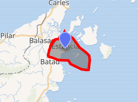
Estancia, Iloilo
Estancia (ɛsˈtanʃa), officially the Municipality of Estancia, (Hiligaynon: Banwa sang Estancia, Tagalog: Bayan ng Estancia), is a 2nd class municipality in the province of Iloilo, Philippines. According to the 2015 census, it has a population of 48,546 people.[3]
Estancia | |
|---|---|
| Municipality of Estancia | |
 Seal | |
| Etymology: its name came from the Spanish word "estancia" (ranch) because it was a part of the wide ranch of Don Felipe Aguilar. | |
| Motto(s): " Kusog Uswag Estancia " | |
 Map of Iloilo with Estancia highlighted | |
| |
.svg.png) Estancia Location within the Philippines | |
| Coordinates: 11°27′N 123°09′E | |
| Country | |
| Region | Western Visayas (Region VI) |
| Province | Iloilo |
| District | 5th district of Iloilo |
| Barangays | 25 (see Barangays) |
| Government | |
| • Type | Sangguniang Bayan |
| • Mayor | Melina D. Requinto |
| • Vice Mayor | Mary Lynn N. Mosqueda |
| • Congressman | Raul C. Tupas |
| • Electorate | 32,895 voters (2019) |
| Area | |
| • Total | 29.38 km2 (11.34 sq mi) |
| Elevation | 17.9 m (58.7 ft) |
| Population (2015 census)[3] | |
| • Total | 48,546 |
| • Density | 1,700/km2 (4,300/sq mi) |
| • Households | 11,102 |
| Economy | |
| • Income class | 2nd municipal income class |
| • Poverty incidence | 23.98% (2015)[4] |
| • Revenue (₱) | 112,382,701.15 (2016) |
| Time zone | UTC+8 (PST) |
| ZIP code | 5017 |
| PSGC | |
| IDD : area code | +63 (0)33 |
| Climate type | tropical climate |
| Native languages | Hiligaynon Capiznon Tagalog |
| Website | www |
Estancia is located in the northern part of the province and is 131 kilometres (81 mi) from the provincial capital, Iloilo City, and 66 kilometres (41 mi) from Roxas City.
Estancia was originally a ranch for a wealthy Spaniard named Rodrigo who married a local woman. Estancia is not known for its agricultural products nor livestock but rather for its location as it is adjacent to Carles' impressive marine resources. Estancia has a fishport and a pier - these being one of the most developed in northern visayas, a banking industry, cable television, a hospital (adjacent only, that belongs to the Municipality of Balasan) and resorts.
Estancia is known around the country as a center for commercial fishing, so much so that it shares to carries the name Alaska of the Philippines . The name “Alaska of the Philippines” reflects back early 1900 up to pre World War II when major commercial fishing activities was within Carles fishing ground ( facing Estancia Town ) and small portion of Estancia water territory, with bountiful catches, running out place to process and preserve their catch ended up rotting by the beaches. Commercial fishing boats from Bantayan Cebu, Province of Capiz, Samar, Leyte, Masbate and Negros came to Carles to fish (The true Alaska of the Philippines). As a testament to its location adjacent to Carles' bountiful marine resources. The reason for this is that Carles lies in the Visayan Sea triangle, an imaginary triangle extending from the provinces of Iloilo, Negros, Cebu, Samar, and Masbate. This triangle is a part of the "Sulu-Sulaweisi Triangle" of the Sulu Sea and neighboring Indonesia where a large concentration of marine organisms coupled with climate conditions support a massive marine ecosystem. Various commercial species are harvested along Carles' waters, namely mackerel, barracuda, sardines, shad, pompano, grouper, squid, cuttlefish, shrimp, prawns, shells, seaweed and others, these all are catches from Carles' water territory and brought to fishports of Estancia and Bancal.
The method predominantly used are purse seining, trawling and gill netting as these are suited for the relatively shallow waters (up to 60 fathoms) of the Visayan Sea.
However, as of recent years, pollution, heavy overfishing, and irresponsible fishing practices have slowly diminished the once abundant fish stocks of Estancia, and now problems like diminishing catches and unpredictable weather are beginning to surface. These factors have raised awareness in the government as well as the private sector and currently an artificial reef is off the shore of Brgy Paon in an attempt to provide juvenile fish with shelter in hopes of restocking these once populous waters. For now, Estancia is experiencing influx of investments as Gaisano Grand put up their first mall in the 5th District of Iloilo, also Prince Hypermart and some mall like CityMall shows interests to come in. Estancia as " Investor's Haven in Northern Iloilo " aspires to become a City in the near future.
Barangays
Climate
| Climate data for Estancia, Iloilo | |||||||||||||
|---|---|---|---|---|---|---|---|---|---|---|---|---|---|
| Month | Jan | Feb | Mar | Apr | May | Jun | Jul | Aug | Sep | Oct | Nov | Dec | Year |
| Average high °C (°F) | 27 (81) |
28 (82) |
29 (84) |
31 (88) |
32 (90) |
31 (88) |
30 (86) |
30 (86) |
29 (84) |
29 (84) |
29 (84) |
27 (81) |
29 (85) |
| Average low °C (°F) | 23 (73) |
23 (73) |
23 (73) |
24 (75) |
25 (77) |
25 (77) |
24 (75) |
24 (75) |
24 (75) |
24 (75) |
24 (75) |
23 (73) |
24 (75) |
| Average precipitation mm (inches) | 61 (2.4) |
39 (1.5) |
46 (1.8) |
48 (1.9) |
90 (3.5) |
144 (5.7) |
152 (6.0) |
145 (5.7) |
163 (6.4) |
160 (6.3) |
120 (4.7) |
90 (3.5) |
1,258 (49.4) |
| Average rainy days | 12.3 | 9.0 | 9.9 | 10.0 | 18.5 | 25.0 | 27.4 | 26.0 | 25.9 | 24.9 | 17.9 | 14.2 | 221 |
| Source: Meteoblue [5] | |||||||||||||
Demographics
| Population census of Estancia | ||
|---|---|---|
| Year | Pop. | ±% p.a. |
| 1903 | 2,461 | — |
| 1939 | 7,608 | +3.18% |
| 1948 | 8,781 | +1.61% |
| 1960 | 13,323 | +3.53% |
| 1970 | 16,510 | +2.17% |
| 1975 | 17,907 | +1.64% |
| 1980 | 19,817 | +2.05% |
| 1990 | 27,229 | +3.23% |
| 1995 | 30,673 | +2.26% |
| 2000 | 35,842 | +3.39% |
| 2007 | 39,479 | +1.34% |
| 2010 | 42,666 | +2.87% |
| 2015 | 48,546 | +2.49% |
| Source: Philippine Statistics Authority[3][6][7][8] | ||
In the 2015 census, the population of Estancia, Iloilo, was 48,546 people,[3] with a density of 1,700 inhabitants per square kilometre or 4,400 inhabitants per square mile.
Natural disasters
Typhoon Haiyan
Parts of Estancia were heavily damaged by Typhoon Haiyan. The roof of Northern Iloilo Polytechnic State College (NIPSC: Estancia) was completely torn off. Estancia Central School was also hit by the said typhoon and almost all of the classrooms were totally damaged. The Principal (Dr. Gerry J. Tingson) of the said school with his utmost will is now trying to restore the damages caused by typhoon Haiyan through national and foreign aid.[9] Other partsof the town that suffered damage included the market and the port.[10]
Media
- 91.5 Radyo Natin / Hot FM
- 106.7 Radyo Natin / Hearts FM
- List of Radio & Television Station in Iloilo
References
- "Municipality". Quezon City, Philippines: Department of the Interior and Local Government. Retrieved 31 May 2013.
- "Province: Iloilo". PSGC Interactive. Quezon City, Philippines: Philippine Statistics Authority. Retrieved 12 November 2016.
- Census of Population (2015). "Region VI (Western Visayas)". Total Population by Province, City, Municipality and Barangay. PSA. Retrieved 20 June 2016.
- "PSA releases the 2015 Municipal and City Level Poverty Estimates". Quezon City, Philippines. Retrieved 12 October 2019.
- "Estancia: Average Temperatures and Rainfall". Meteoblue. Retrieved 3 May 2020.
- Census of Population and Housing (2010). "Region VI (Western Visayas)". Total Population by Province, City, Municipality and Barangay. NSO. Retrieved 29 June 2016.
- Censuses of Population (1903–2007). "Region VI (Western Visayas)". Table 1. Population Enumerated in Various Censuses by Province/Highly Urbanized City: 1903 to 2007. NSO.
- "Province of Iloilo". Municipality Population Data. Local Water Utilities Administration Research Division. Retrieved 17 December 2016.
- Typhoon Haiyan: Images from Panay Island
- "Provincial board declares Iloilo under state of calamity". Archived from the original on 2013-12-08. Retrieved 2013-12-03.
External links
- Estancia Profile at PhilAtlas.com
- Philippine Standard Geographic Code
- Philippine Standard Geographic Code/ Iloilo/ Estancia
- Philippine Census Information
- Local Governance Performance Management System
Places adjacent to Estancia, Iloilo | ||||||||||
|---|---|---|---|---|---|---|---|---|---|---|
| ||||||||||
Iloilo City (capital) | |
| Municipalities |
|
| Component city | |
| Highly urbanized city |
|