Concepcion, Iloilo
Concepcion, officially the Municipality of Concepcion, (Hiligaynon: Banwa sang Concepcion, Tagalog: Bayan ng Concepcion), is a 3rd class municipality in the province of Iloilo, Philippines. According to the 2015 census, it has a population of 43,159 people.[3]
Concepcion | |
|---|---|
| Municipality of Concepcion | |
 The pier and fish market in Concepcion, Iloilo | |
 Seal | |
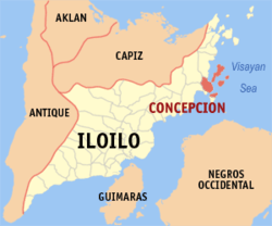 Map of Iloilo with Concepcion highlighted | |
OpenStreetMap 
| |
.svg.png) Concepcion Location within the Philippines | |
| Coordinates: 11°12′N 123°06′E | |
| Country | |
| Region | Western Visayas (Region VI) |
| Province | Iloilo |
| District | 5th district of Iloilo |
| Barangays | 25 (see Barangays) |
| Government | |
| • Type | Sangguniang Bayan |
| • Mayor | Raul Banias |
| • Vice Mayor | Milliard S. Villanueva |
| • Congressman | Raul C. Tupas |
| • Electorate | 26,783 voters (2019) |
| Area | |
| • Total | 86.12 km2 (33.25 sq mi) |
| Elevation | 9.5 m (31.2 ft) |
| Population (2015 census)[3] | |
| • Total | 43,159 |
| • Density | 500/km2 (1,300/sq mi) |
| • Households | 10,044 |
| Economy | |
| • Income class | 3rd municipal income class |
| • Poverty incidence | 27.45% (2015)[4] |
| • Revenue (₱) | 112,289,550.51 (2016) |
| Time zone | UTC+8 (PST) |
| ZIP code | 5013 |
| PSGC | |
| IDD : area code | +63 (0)33 |
| Climate type | tropical climate |
| Native languages | Hiligaynon Capiznon Tagalog |
| Website | www |
It was the capital of the Commandancia of Concepcion, a unit equivalent to a sub-province headed by a corregidor, before it was merged with the Province of Iloilo.
Geography
Concepcion is located on the north-eastern part of Panay Island (known as the mainland), together with some 16 other, smaller, associated islands. It is bounded on the north by the municipality of San Dionisio, in the south by the municipality of Ajuy, in the west by the municipality of Sara, and in the east by the Visayan Sea. It has a total land area of 9,702.04 hectares.[5]
Concepcion is 97 kilometres (60 mi) from Iloilo City.
The largest of the 16 Concepcion Islands is Pan de Azucar at 1,840 hectares (4,500 acres), which has the 573 metres (1,880 ft) high Mount Manaphag rising from its center.[6]
Climate
| Climate data for Concepcion, Iloilo | |||||||||||||
|---|---|---|---|---|---|---|---|---|---|---|---|---|---|
| Month | Jan | Feb | Mar | Apr | May | Jun | Jul | Aug | Sep | Oct | Nov | Dec | Year |
| Average high °C (°F) | 27 (81) |
28 (82) |
29 (84) |
31 (88) |
32 (90) |
31 (88) |
30 (86) |
30 (86) |
29 (84) |
29 (84) |
29 (84) |
27 (81) |
29 (85) |
| Average low °C (°F) | 23 (73) |
23 (73) |
23 (73) |
24 (75) |
25 (77) |
25 (77) |
24 (75) |
24 (75) |
24 (75) |
24 (75) |
24 (75) |
23 (73) |
24 (75) |
| Average precipitation mm (inches) | 61 (2.4) |
39 (1.5) |
46 (1.8) |
48 (1.9) |
90 (3.5) |
144 (5.7) |
152 (6.0) |
145 (5.7) |
163 (6.4) |
160 (6.3) |
120 (4.7) |
90 (3.5) |
1,258 (49.4) |
| Average rainy days | 12.3 | 9.0 | 9.9 | 10.0 | 18.5 | 25.0 | 27.4 | 26.0 | 25.9 | 24.9 | 17.9 | 14.2 | 221 |
| Source: Meteoblue (modeled/calculated data, not measured locally) [7] | |||||||||||||
Barangays
Concepcion is politically subdivided into twenty-five barangays, eleven of which are island barangays, and fourteen of which are on the mainland (Panay Island).
- Aglosong
- Agnaga
- Bacjawan Norte
- Bacjawan Sur
- Bagongon
- Batiti
- Botlog
- Calamigan
- Dungon
- Igbon
- Jamul-awon
- Lo-ong
- Macalbang
- Macatunao
- Malangabang
- Maliogliog
- Nińo
- Nipa
- Plandico
- Poblacion
- Polopińa (Bulubadiangan Island)
- Salvacion
- Talotu-an
- Tambaliza (Pan de Azucar Island)
- Tamis-ac
Demographics
| Population census of Concepcion | ||
|---|---|---|
| Year | Pop. | ±% p.a. |
| 1903 | 4,565 | — |
| 1939 | 8,446 | +1.72% |
| 1948 | 9,184 | +0.94% |
| 1960 | 11,183 | +1.65% |
| 1970 | 15,743 | +3.47% |
| 1975 | 18,554 | +3.35% |
| 1980 | 21,121 | +2.62% |
| 1990 | 28,355 | +2.99% |
| 1995 | 30,111 | +1.13% |
| 2000 | 34,240 | +2.79% |
| 2007 | 36,881 | +1.03% |
| 2010 | 39,617 | +2.64% |
| 2015 | 43,159 | +1.64% |
| Source: Philippine Statistics Authority[3][8][9][10] | ||
In the 2015 census, the population of Concepcion, Iloilo, was 43,159 people,[3] with a density of 500 inhabitants per square kilometre or 1,300 inhabitants per square mile.
Economy
The primary industry of the people of Concepcion is in fishing.[5] The Visayan Sea, where Concepcion is situated, is one of the most prolific in fish production and provides a significant proportion of fish in the region. In 2007, the number of registered fishermen stood at 7,957.[11] Fishing is followed second by farming, with much of it being subsistence farming. The principle cash crops are rice, corn and vegetables,[5] along with bamboo and coconuts. Poultry and livestock are raised for local consumption.[5]
Poverty incidence was extremely high in the early 21st century, with 87% of the population being below the government poverty line in 2000,[5] with a reduction to 47% in 2004.[12] A contributing factor was the rapidity of population growth in the municipality, with a growth rate of 2.76% in 2002, or four babies being born every day in the municipality.
Education
There is one institution of higher learning in the municipality, Concepcion Polytechnic College, which offers bachelor's degrees in fisheries and agriculture, as well as a masters in public administration.[5]
Tourism
Concepcion is a host to beautiful islands with white sand beaches and sandbars. Among them are Bulobadiangan Island, Agho Island, and Pan de Azucar.[13]
Culture
The annual Tampisaw Festival, held the fourth week of April[14] on four of the islands, attracts tourism.[12]
Concepcion Power Station
The Concepcion Power Station is a 270-megawatt (MW) coal-fired power plant located by the coast of Barangay Nipa, Concepcion, Iloilo. The plant is sponsored by the Palm Concepcion Power Corporation (PCPC), a subsidiary of real estate company A Brown Company. Currently Unit 1 of the station has begun operating since August 2016 while Unit 2 is planned for 2019.[15]
References
- "Municipality". Quezon City, Philippines: Department of the Interior and Local Government. Retrieved 31 May 2013.
- "Province: Iloilo". PSGC Interactive. Quezon City, Philippines: Philippine Statistics Authority. Retrieved 12 November 2016.
- Census of Population (2015). "Region VI (Western Visayas)". Total Population by Province, City, Municipality and Barangay. PSA. Retrieved 20 June 2016.
- "PSA releases the 2015 Municipal and City Level Poverty Estimates". Quezon City, Philippines. Retrieved 12 October 2019.
- Latoza, Jigger S. (2009) "KALAHI-CIDSS Institutional Mapping in Concepcion, Iloilo: Salient Findings" Augustinian Journal 12: pp. 33–58, doi:10.3860/aug.v12i0.1228
- (19 June 2010) "Island Hopping: Pan de Azucar Island, Iloilo", archived at Freezepage, 12 October 2010
- "Concepcion: Average Temperatures and Rainfall". Meteoblue. Retrieved 3 May 2020.
- Census of Population and Housing (2010). "Region VI (Western Visayas)". Total Population by Province, City, Municipality and Barangay. NSO. Retrieved 29 June 2016.
- Censuses of Population (1903–2007). "Region VI (Western Visayas)". Table 1. Population Enumerated in Various Censuses by Province/Highly Urbanized City: 1903 to 2007. NSO.
- "Province of Iloilo". Municipality Population Data. Local Water Utilities Administration Research Division. Retrieved 17 December 2016.
- Philippine Statistics Authority statistics, 2007
- Staff (2006) "Eradicating Poverty Completely by 2020 - Concepcion, Iloilo" Archived 2010-02-19 at the Wayback Machine Galing Pook Foundation, last accessed 12 October 2010
- "Concepcion Travel Guide: Stunning Island Wonders of Iloilo | Freedom Wall". Freedom Wall. 2017-03-04. Retrieved 2017-04-20.
- "Tampisaw Festival" Archived 2011-07-16 at the Wayback Machine Official Website of the Province of Iloilo
- Concepcion Power Station. Sourcewatch. Retrieved February 7, 2017
External links
| Wikimedia Commons has media related to Concepcion, Iloilo. |
- Concepcion Profile at PhilAtlas.com
- Official Homepage
- Philippine Standard Geographic Code
- Philippine Census Information
- Local Governance Performance Management System
Places adjacent to Concepcion, Iloilo | ||||||||||
|---|---|---|---|---|---|---|---|---|---|---|
| ||||||||||
Iloilo City (capital) | |
| Municipalities |
|
| Component city | |
| Highly urbanized city |
|