San Rafael, Iloilo
San Rafael, officially the Municipality of San Rafael, (Hiligaynon: Banwa sang San Rafael, Tagalog: Bayan ng San Rafael), is a 5th class municipality in the province of Iloilo, Philippines. According to the 2015 census, it has a population of 16,532 people.[3]
San Rafael | |
|---|---|
| Municipality of San Rafael | |
 Public Market | |
 Map of Iloilo with San Rafael highlighted | |

| |
.svg.png) San Rafael Location within the Philippines | |
| Coordinates: 11°10′22″N 122°49′36″E | |
| Country | |
| Region | Western Visayas (Region VI) |
| Province | Iloilo |
| District | 5th district of Iloilo |
| Founded | 1969 |
| Barangays | 9 (see Barangays) |
| Government | |
| • Type | Sangguniang Bayan |
| • Mayor | Roberto T. Belleza Jr. |
| • Vice Mayor | Antonio D. Gumban |
| • Congressman | Raul C. Tupas |
| • Electorate | 63,481 voters (2019) |
| Area | |
| • Total | 67.05 km2 (25.89 sq mi) |
| Elevation | 123.8 m (406.2 ft) |
| Population (2015 census)[3] | |
| • Total | 16,532 |
| • Density | 250/km2 (640/sq mi) |
| • Households | 3,826 |
| Economy | |
| • Income class | 5th municipal income class |
| • Poverty incidence | 23.79% (2015)[4] |
| • Revenue (₱) | 55,166,505.29 (2016) |
| Time zone | UTC+8 (PST) |
| ZIP code | 5039 |
| PSGC | |
| IDD : area code | +63 (0)33 |
| Climate type | tropical climate |
| Native languages | Kinaray-a language Hiligaynon Capiznon Ati Tagalog |
| Website | www |
San Rafael is located 74 kilometres (46 mi) from the provincial capital, Iloilo City. It is bordered by Dumarao to the north, Lemery to the east, Barotac Viejo to the south, and Passi City to the west.
History
In 1969, all or part of 16 barrios (barangays) of Barotac Viejo were separated from that town and consolidated into the new municipality.[5] However, in 1971 Republic Act No. 6267 decreed that 5 barrios be restored to Barotac Viejo, with the barrio of Omio becoming part of Lemery.[6]
Fire
In February 2012, a fire damaged 18 stalls in the public market.[7] Because San Rafael has no fire station, fire trucks had to be called in from nearby towns.
Typhoon Haiyan
Typhoon Haiyan passed over Panay Island on November 8, 2013,[8] affecting San Rafael along with several other coastal cities. The provincial board declared the state of Iloilo to be in a state of emergency, after acting governor Raul C. Tupas toured the fifth district.[9] Local convenience stores were heavily damaged during the storm, although at least one reopened soon after.[10] Several houses were damaged during the typhoon. They were destroyed by strong wind and falling trees. After a few days, relief soon arrived. Several new houses were built by a religious organization.
Climate
| Climate data for San Rafael, Iloilo | |||||||||||||
|---|---|---|---|---|---|---|---|---|---|---|---|---|---|
| Month | Jan | Feb | Mar | Apr | May | Jun | Jul | Aug | Sep | Oct | Nov | Dec | Year |
| Average high °C (°F) | 26 (79) |
27 (81) |
29 (84) |
31 (88) |
31 (88) |
30 (86) |
29 (84) |
29 (84) |
29 (84) |
28 (82) |
28 (82) |
27 (81) |
29 (84) |
| Average low °C (°F) | 22 (72) |
22 (72) |
22 (72) |
23 (73) |
24 (75) |
24 (75) |
24 (75) |
24 (75) |
24 (75) |
23 (73) |
23 (73) |
23 (73) |
23 (74) |
| Average precipitation mm (inches) | 61 (2.4) |
39 (1.5) |
46 (1.8) |
48 (1.9) |
90 (3.5) |
144 (5.7) |
152 (6.0) |
145 (5.7) |
163 (6.4) |
160 (6.3) |
120 (4.7) |
90 (3.5) |
1,258 (49.4) |
| Average rainy days | 12.3 | 9.0 | 9.9 | 10.0 | 18.5 | 25.0 | 27.4 | 26.0 | 25.9 | 24.9 | 17.9 | 14.2 | 221 |
| Source: Meteoblue [11] | |||||||||||||
Barangays
San Rafael is politically subdivided into 9 barangays. [2]
- Aripdip
- Bagacay
- Calaigang
- Ilongbukid
- Poscolon
- San Andres
- San Dionisio
- San Florentino
- Poblacion
Demographics
| Population census of San Rafael | ||
|---|---|---|
| Year | Pop. | ±% p.a. |
| 1970 | 8,322 | — |
| 1975 | 6,953 | −3.54% |
| 1980 | 8,742 | +4.68% |
| 1990 | 11,199 | +2.51% |
| 1995 | 12,000 | +1.30% |
| 2000 | 12,847 | +1.47% |
| 2007 | 13,694 | +0.88% |
| 2010 | 14,655 | +2.50% |
| 2015 | 16,532 | +2.32% |
| Source: Philippine Statistics Authority[3][12][13][14] | ||
In the 2015 census, the population of San Rafael, Iloilo, was 16,532 people,[3] with a density of 250 inhabitants per square kilometre or 650 inhabitants per square mile.
Government
In 2013, Beboy Belleza was re-elected as mayor by an almost 2-1 margin.[15]
Education
San Rafael has elementary schools in almost all barangays. There is a primary school in Bagacay. San Rafael Central School is located in Poblacion.[16] Children spend 2 years in kindergarten and 6 years in elementary.
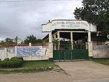
San Rafael has two high schools: San Rafael National High School was established in 1983,[17] while Ilongbukid National High School was created in 2000.[18] Students spend 4 years in high school. There are 4 grading periods each school year. The 4th grading period is the most important because it determines if the student will advance a grade the next school year.
Secondary school starts with 1st Year and ends with 4th Year. The subjects for Grade 1 students are English, Mathematics, Pilipino, and Sibika at Cultura (History and Culture). English language is used as the language of instruction for English, Mathematics, and Science. Grade 2 students take English, Mathematics, Science, Sibika at Kutura, Agriculture. Grade 3-6 students take additional courses, such as Music, Art, P.E., and Hekasi (it contains 5 subjects but is graded as one subject).
References
- "Municipality". Quezon City, Philippines: Department of the Interior and Local Government. Retrieved 31 May 2013.
- "Province: Iloilo". PSGC Interactive. Quezon City, Philippines: Philippine Statistics Authority. Retrieved 12 November 2016.
- Census of Population (2015). "Region VI (Western Visayas)". Total Population by Province, City, Municipality and Barangay. PSA. Retrieved 20 June 2016.
- "PSA releases the 2015 Municipal and City Level Poverty Estimates". Quezon City, Philippines. Retrieved 12 October 2019.
- "Act creating Municipality of San Rafael". Retrieved August 19, 2011.
- "Act Restoring barrios to Barotac Viejo". Retrieved August 19, 2011.
- Iloilo public market razed
- "Typhoon ‘Yolanda’ destroys several towns in Iloilo"
- Provincial board declares Iloilo under state of calamity Archived 2013-12-08 at the Wayback Machine
- Typhoon Haiyan: Images from Panay Island
- "San Dionisio: Average Temperatures and Rainfall". Meteoblue. Retrieved 3 May 2020.
- Census of Population and Housing (2010). "Region VI (Western Visayas)". Total Population by Province, City, Municipality and Barangay. NSO. Retrieved 29 June 2016.
- Censuses of Population (1903–2007). "Region VI (Western Visayas)". Table 1. Population Enumerated in Various Censuses by Province/Highly Urbanized City: 1903 to 2007. NSO.
- "Province of Iloilo". Municipality Population Data. Local Water Utilities Administration Research Division. Retrieved 17 December 2016.
- 2013 Election Results for San Rafael, Iloilo
- "List of primary schools in San Rafael". Retrieved August 19, 2011.
- "An Act Converting San Rafael Barangay HS into San Rafael NHS". Retrieved August 19, 2011.
- "Act creating Ilongbukid NHS". Retrieved August 18, 2011.
External links
- San Rafael Profile at PhilAtlas.com
- Philippine Standard Geographic Code
- Philippine Census Information
- Local Governance Performance Management System
- "San Rafael at Illongos.net".
Places adjacent to San Rafael, Iloilo | ||||||||||
|---|---|---|---|---|---|---|---|---|---|---|
| ||||||||||
Iloilo City (capital) | |
| Municipalities |
|
| Component city | |
| Highly urbanized city |
|