Gladstone Parish, New Brunswick
Gladstone is a Canadian parish in Sunbury County, New Brunswick.[2]
Gladstone | |
|---|---|
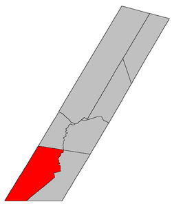 Location within Sunbury County, New Brunswick | |
| Country | |
| Province | |
| County | Sunbury County |
| Established | 1874 |
| Area | |
| • Land | 362.23 km2 (139.86 sq mi) |
| Population (2016)[1] | |
| • Total | 452 |
| • Density | 1.2/km2 (3/sq mi) |
| • Change 2011-2016 | |
| • Dwellings | 239 |
| Time zone | UTC-4 (AST) |
| • Summer (DST) | UTC-3 (ADT) |
History
Sunbury Parish set off from Blissville Parish in 1874 and named for the Right Honourable William Ewart Gladstone, (1809-1898), prime minister of the United Kingdom.
Delineation
Gladstone Parish is defined in the Territorial Division Act[3] as being bounded:
- All that part of the County to the southwest of the Saint John river, not included in the parishes of Burton, Lincoln and Blissville.
Communities
All communities within the parish are unincorporated.
- Gladstone
- Three Tree Creek
- Tracyville
- Upper Tracy
- Vespra
Bodies of water & Islands
This is a list of rivers, lakes, streams, creeks, marshes and Islands that are at least partially in this parish
- Peltoma Lake
- Oromocto River
Demographics
Access Routes
Highways and numbered routes that run through the parish, including external routes that start or finish at the parish limits:[6]
See also
References
- "Census Profile, 2016 Census: Gladstone, Parish [Census subdivision], New Brunswick". Statistics Canada. Retrieved September 30, 2019.
- "Sunbury Parish". New Brunswick Provincial Archives.
- "Territorial Division Act (R.S.N.B. 1973, c. T-3)". Government of New Brunswick website. Retrieved 22 August 2016.
- Statistics Canada: 2001, 2006 census
- 2011 Statistics Canada Census Profile: Gladstone Parish, New Brunswick
- Atlantic Canada Back Road Atlas ISBN 978-1-55368-618-7
Places adjacent to Gladstone Parish, New Brunswick | |
|---|---|
| Subdivisions |
|
|---|---|
| Cities | |
| Counties | |
| |
This article is issued from Wikipedia. The text is licensed under Creative Commons - Attribution - Sharealike. Additional terms may apply for the media files.