Coonawarra, South Australia
Coonawarra is a small town north of Penola in South Australia.
| Coonawarra South Australia | |||||||||||||||
|---|---|---|---|---|---|---|---|---|---|---|---|---|---|---|---|
 Coonawarra railway station, looking south | |||||||||||||||
 Coonawarra | |||||||||||||||
| Coordinates | 37°17′31″S 140°49′59″E[1] | ||||||||||||||
| Population | 137 (2016 census)[2] | ||||||||||||||
| Established | 13 December 2001 (locality)[3] | ||||||||||||||
| Postcode(s) | 5263[4] | ||||||||||||||
| Elevation | 57 m (187 ft)[5] | ||||||||||||||
| Time zone | ACST (UTC+9:30) | ||||||||||||||
| • Summer (DST) | ACST (UTC+10:30) | ||||||||||||||
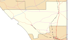
| Location |
| ||||||||||||||
| LGA(s) | Wattle Range Council | ||||||||||||||
| Region | Limestone Coast[1] | ||||||||||||||
| County | Robe[1] | ||||||||||||||
| State electorate(s) | MacKillop[6] | ||||||||||||||
| Federal Division(s) | Barker[7] | ||||||||||||||
| |||||||||||||||
| |||||||||||||||
| Footnotes | Locations[4] Adjoining localities[1] | ||||||||||||||
It is best known for the Coonawarra wine region named after it.
Coonawarra was a station on the Mount Gambier railway line. which opened in 1887 until it closed to freight on 12 April 1995. The Limestone Coast Railway tourist trains stopped at the station from Mount Gambier until 20 March 1999.

The township of Coonawarra is a few hundred metres west of the Riddoch Highway which passes along the ridge in the middle of the Coonawarra wine region. The historic Wynn's Coonawarra Winery in Memorial Drive is listed on the South Australian Heritage Register.[8]
Population
In the 2016 Census, there were 137 people in Coonawarra. 84.9% of people were born in Australia and 89.9% of people spoke only English at home.[2]
References
| Wikimedia Commons has media related to Coonawarra, South Australia. |
- "Search results for "Coonawarra, LOCB" with the following datasets selected – 'Suburbs and Localities', 'Counties', 'Local Government Areas', 'SA Government Regions', 'Railways', 'Roads' and 'Gazetteer'". Location SA Map Viewer. South Australian Government. Retrieved 8 December 2018.
- Australian Bureau of Statistics (27 June 2017). "Coonawarra(SA)(SSC) (State Suburb)". 2016 Census QuickStats. Retrieved 20 November 2018.


- Lawson, R. (13 December 2001). "GEOGRAPHICAL NAMES ACT 1991 Notice to Assign Boundaries and Names to Places (in the Wattle Range Council)" (PDF). The South Australian Government Gazette. South Australian Government. p. 5365. Retrieved 27 February 2018.
- "Coonawarra, South Australia (Postcode)". postcodes-australia.com. Retrieved 8 December 2018.
- "Summary statistics COONAWARRA". Bureau of Meteorology. Australian Government. Retrieved 7 December 2018.
- "District of MacKillop Background Profile". Electoral Commission SA. Retrieved 29 March 2016.
- "Federal electoral division of Barker" (PDF). Australian Electoral Commission. Retrieved 28 March 2016.
- "Wynn's Coonawarra Winery". South Australian Heritage Register. Department of Environment, Water and Natural Resources. Retrieved 26 August 2016.