Clarendon Parish, New Brunswick
Clarendon Parish is a Statistics Canada census subdivision, and local service district in the province of New Brunswick.[2]
Clarendon Parish Paroisse de Clarendon | |
|---|---|
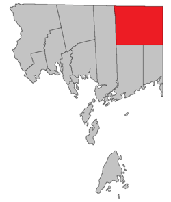 Location within Charlotte County. | |
| Country | |
| Province | |
| County | Charlotte County |
| Established | 1869 |
| Named for | George Villiers, 4th Earl of Clarendon |
| Government | |
| • Type | Local service district |
| Area | |
| • Land | 492.19 km2 (190.04 sq mi) |
| Population (2016)[1] | |
| • Total | 63 |
| • Density | 0.1/km2 (0.3/sq mi) |
| • Change 2011-2016 | |
| • Dwellings | 90 |
| Time zone | UTC-4 (AST) |
| • Summer (DST) | UTC-3 (ADT) |
It was established in 1869, named for George Villiers, 4th Earl of Clarendon. Following the abolition of county councils with the 1966 Municipalities Act,[3] the Local service district of the parish of Clarendon was established 1975[4] to assess for fire protection. Recreational and sports facilities were added to the assessment in 2008. The local service district is part of Regional Service Commission 11.
It is defined in the Territorial Division Act[5] as: "West by Saint George Parish; north and east by the County lines, and south by a line run true west from the most southern angle of Queens County to the eastern boundary of Saint George Parish."
Census data
Population
| Canada census – Clarendon Parish, New Brunswick community profile | |||
|---|---|---|---|
| 2016 | 2011 | 2006 | |
| Population: | 63 (+21.2% from 2011) | 52 (-26.8% from 2006) | 71 (+73.2% from 2001) |
| Land area: | 492.19 km2 (190.04 sq mi) | 492.91 km2 (190.31 sq mi) | 492.84 km2 (190.29 sq mi) |
| Population density: | 0.1/km2 (0.26/sq mi) | 0.1/km2 (0.26/sq mi) | 0.1/km2 (0.26/sq mi) |
| Median age: | 59.2 (M: 59.8, F: 57.7) | 58.0 (M: 59.5, F: 56.5) | 48.8 (M: 50.0, F: 47.8) |
| Total private dwellings: | 90 | 76 | 64 |
| Median household income: | $44,928 | $.N/A | $.N/A |
| Notes: Income data for this area has been suppressed for data quality or confidentiality reasons. – References: 2016[6] 2011[7] 2006[8] earlier[9] | |||
| Historical Census Data - Clarendon Parish, New Brunswick | |||||||||||||||||||||||||||||
|---|---|---|---|---|---|---|---|---|---|---|---|---|---|---|---|---|---|---|---|---|---|---|---|---|---|---|---|---|---|
|
|
| |||||||||||||||||||||||||||
| [10][1] | |||||||||||||||||||||||||||||
Language
| Canada Census Mother Tongue - Clarendon Parish, New Brunswick[10] 2001 & 2006 language data for this area has been suppressed for data quality or confidentiality reasons. | ||||||||||||||||||
|---|---|---|---|---|---|---|---|---|---|---|---|---|---|---|---|---|---|---|
| Census | Total | French |
English |
French & English |
Other | |||||||||||||
| Year | Responses | Count | Trend | Pop % | Count | Trend | Pop % | Count | Trend | Pop % | Count | Trend | Pop % | |||||
2011 |
50 |
50 | 100.00% | 0 | 0.00% | 0 | 0.00% | 0 | 0.00% | |||||||||
1996 |
50 |
50 | n/a | 100.00% | 0 | n/a | 0.00% | 0 | n/a | 0.00% | 0 | n/a | 0.00% | |||||
See also
References
- "Census Profile, 2016 Census: Clarendon, Parish [Census subdivision], New Brunswick". Statistics Canada. Retrieved 8 September 2019.
- "Clarendon Parish". Provincial Archives of New Brunswick. Retrieved 24 June 2020.
- "Local Government Legislation in New Brunswick" (PDF). Government of New Brunswick. Retrieved 24 June 2020.
- Regulation 75-4 (O.C. 75-33), filed 1975-01-15. Parish of Clarendon established; first aid and ambulance services added to five other LSDs in Charlotte County.
- "Territorial Division Act (R.S.N.B. 1973, c. T-3)". Government of New Brunswick website. Retrieved 18 August 2016.
- "2016 Community Profiles". 2016 Canadian Census. Statistics Canada. 21 February 2017. Retrieved 8 September 2019.
- "2011 Community Profiles". 2011 Canadian Census. Statistics Canada. 5 July 2013. Retrieved 15 March 2014.
- "2006 Community Profiles". 2006 Canadian Census. Statistics Canada. 30 March 2011. Retrieved 15 March 2014.
- "2001 Community Profiles". 2001 Canadian Census. Statistics Canada. 17 February 2012.
- Statistics Canada: 1996, 2001, 2006, 2011 census
- Atlantic Canada Back Road Atlas ISBN 978-1-55368-618-7 Pages 4, 12
Places adjacent to Clarendon Parish, New Brunswick | |
|---|---|
| Subdivisions |
|
|---|---|
| Cities | |
| Counties | |
| |