Pennfield Parish, New Brunswick
Pennfield Parish is a Statistics Canada census subdivision, and local service district in the province of New Brunswick.
Pennfield Parish Paroisse de Pennfield | |
|---|---|
 Pennfield Parish Location of Saint James Parish in Canada 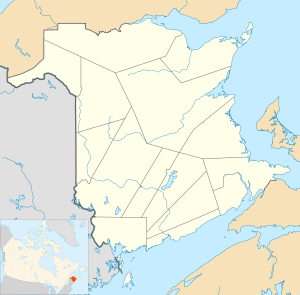 Pennfield Parish Pennfield Parish (New Brunswick) | |
| Coordinates: | |
| Country | |
| Province | |
| County | Charlotte County |
| Established | 1786 |
| Government | |
| • Type | Local service district |
| Area | |
| • Land | 363.86 km2 (140.49 sq mi) |
| Population (2016)[1] | |
| • Total | 2,170 |
| • Density | 6.0/km2 (16/sq mi) |
| • Pop 2011-2016 | |
| • Dwellings | 996 |
| Time zone | UTC-4 (AST) |
| • Summer (DST) | UTC-3 (ADT) |
It is one of 14 parishes in Charlotte County, formed in 1784 when New Brunswick was partitioned from Nova Scotia.[2]
Parish population includes the unincorporated settlements of Pennfield, and Seeleys Cove and excludes the incorporated town of Blacks Harbour and the local service district of Beaver Harbour.
Local governance is provided by the Pennfield Local Service District which is in the Southwest New Brunswick Service Area.[3]
Census data
Population
| Canada census – Pennfield Parish, New Brunswick community profile | |||
|---|---|---|---|
| 2016 | 2011 | 2006 | |
| Population: | 2,170 (-2.2% from 2011) | 2,218 (-4.5% from 2006) | 2,322 (-3.9% from 2001) |
| Land area: | 363.86 km2 (140.49 sq mi) | 363.88 km2 (140.49 sq mi) | 363.88 km2 (140.49 sq mi) |
| Population density: | 6.0/km2 (16/sq mi) | 6.1/km2 (16/sq mi) | 6.4/km2 (17/sq mi) |
| Median age: | 46.7 (M: 46.5, F: 47.0) | 44.3 (M: 44.1, F: 44.4) | 41.8 (M: 42.2, F: 41.4) |
| Total private dwellings: | 996 | 1,099 | 1,120 |
| Median household income: | $60,992 | $58,972 | $42,996 |
| References: 2016[4] 2011[5] 2006[6] earlier[7] | |||
| Historical Census Data - Pennfield Parish, New Brunswick | |||||||||||||||||||||||||||||
|---|---|---|---|---|---|---|---|---|---|---|---|---|---|---|---|---|---|---|---|---|---|---|---|---|---|---|---|---|---|
|
|
| |||||||||||||||||||||||||||
| [8][1] | |||||||||||||||||||||||||||||
Language
| Canada Census Mother Tongue - Pennfield Parish, New Brunswick[8] | ||||||||||||||||||
|---|---|---|---|---|---|---|---|---|---|---|---|---|---|---|---|---|---|---|
| Census | Total | English |
French |
English & French |
Other | |||||||||||||
| Year | Responses | Count | Trend | Pop % | Count | Trend | Pop % | Count | Trend | Pop % | Count | Trend | Pop % | |||||
2011 |
2,195 |
2,045 | 93.17% | 90 | 4.10% | 5 | 0.23% | 55 | 2.50% | |||||||||
2006 |
2,305 |
2,205 | 95.66% | 55 | 2.39% | 0 | 0.00% | 45 | 1.95% | |||||||||
2001 |
2,410 |
2,265 | 93.98% | 115 | 4.77% | 10 | 0.42% | 20 | 0.83% | |||||||||
1996 |
2,240 |
2,145 | n/a | 95.76% | 70 | n/a | 3.12% | 0 | n/a | 0.00% | 25 | n/a | 1.12% | |||||
References
- "Census Profile, 2016 Census: Pennfield, Parish [Census subdivision], New Brunswick". Statistics Canada. Retrieved 7 September 2019.
- Slumkoski, Corey (2005). "The Partition of Nova Scotia". The Winslow Papers. Electronic text centre (UNB Libraries). Retrieved 5 May 2020.
- "Municipalities Order, NB Reg 85-6". CanLII. Retrieved 7 June 2020.
- "2016 Community Profiles". 2016 Canadian Census. Statistics Canada. 21 February 2017. Retrieved 7 September 2019.
- "2011 Community Profiles". 2011 Canadian Census. Statistics Canada. 5 July 2013. Retrieved 15 March 2014.
- "2006 Community Profiles". 2006 Canadian Census. Statistics Canada. 30 March 2011. Retrieved 15 March 2014.
- "2001 Community Profiles". 2001 Canadian Census. Statistics Canada. 17 February 2012.
- Statistics Canada: 1996, 2001, 2006, 2011 census
External links
Territorial Division Act (R.S.N.B. 1973, c. T-3): detailed definitions of New Brunswick's internal divisions.
Places adjacent to Pennfield Parish, New Brunswick | |
|---|---|
| Subdivisions |
|
|---|---|
| Cities | |
| Counties | |
| |
This article is issued from Wikipedia. The text is licensed under Creative Commons - Attribution - Sharealike. Additional terms may apply for the media files.