Westfield Parish, New Brunswick
Westfield is a civil parish in Kings County, New Brunswick.[2]
Westfield | |
|---|---|
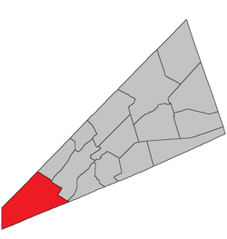 Location within Kings County, New Brunswick. | |
| Country | |
| Province | |
| County | Kings County |
| Established | 1786 |
| Area | |
| • Land | 295.70 km2 (114.17 sq mi) |
| Population (2016)[1] | |
| • Total | 1,962 |
| • Density | 6.6/km2 (17/sq mi) |
| • Change 2011-2016 | |
| • Dwellings | 952 |
| Time zone | UTC-4 (AST) |
| • Summer (DST) | UTC-3 (ADT) |
History
Westfield Parish created in 1786: possibly named for the town of Westfield in Massachusetts.
Delineation
Westfield Parish is defined in the Territorial Division Act[3] as being bounded:
- On the northwest, south and west, by the boundary line of the County; and on the northeast by a line beginning on the County line between Kings and Queens, intersected by the northwestern prolongation of the line dividing lots number twenty-three and number twenty-four at Devils Back, on the Long Reach; thence southeasterly along said prolongation and line to the northwestern shore of the Long Reach; thence southeasterly in a direct line across the Saint John River to the line dividing lots number twenty-five and number twenty-six, granted to Robert and Caleb Merritt; thence southeasterly along said line and its southeastern prolongation to the rear line of lots fronting on the northwest side of Kennebecasis Bay; thence southwesterly along said line to the northeast line of lot number twenty-eight, granted to Dennis Coombe; thence southeasterly along said line and its southeastern prolongation to the County line, including Kennebecasis Island.
Communities
Parish population total does not include incorporated municipalities (in bold):
|
|
|
Bodies of water & Islands
This is a list of rivers, lakes, streams, creeks, marshes and Islands that are at least partially in this parish
- Kennebecasis Island
- Loch Alva
- Eagle Lake
- Seven Mile Lake
Demographics
Access Routes
Highways and numbered routes that run through the parish, including external routes that start or finish at the parish limits:[6]
See also
References
- "Census Profile, 2016 Census: Westfield, Parish [Census subdivision], New Brunswick". Statistics Canada. Retrieved September 18, 2019.
- "Westfield Parish". New Brunswick Provincial Archives.
- "Territorial Division Act (R.S.N.B. 1973, c. T-3)". Government of New Brunswick website. Retrieved 30 August 2016.
- Statistics Canada: 2001, 2006 census
- 2011 Statistics Canada Census Profile: Westfield Parish, New Brunswick
- Atlantic Canada Back Road Atlas ISBN 978-1-55368-618-7
External links
Places adjacent to Westfield Parish, New Brunswick | ||||||||||
|---|---|---|---|---|---|---|---|---|---|---|
| ||||||||||
| Subdivisions |
|
|---|---|
| Cities | |
| Counties | |
| |
This article is issued from Wikipedia. The text is licensed under Creative Commons - Attribution - Sharealike. Additional terms may apply for the media files.