Lepreau Parish, New Brunswick
Lepreau Parish is a census subdivision of Statistics Canada and local service district in the province of New Brunswick.[2]
Lepreau Parish Paroisse de Lepreau | |
|---|---|
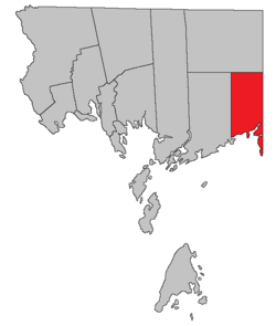 Location within Charlotte County. | |
| Country | |
| Province | |
| County | Charlotte |
| Established | 1857 |
| Government | |
| • Type | Local service district |
| Area | |
| • Land | 209.62 km2 (80.93 sq mi) |
| Population (2016) | |
| • Total | 707 |
| • Density | 3.4/km2 (9/sq mi) |
| • Pop 2011-2016 | |
| • Dwellings | 507 |
| Time zone | UTC-4 (AST) |
| • Summer (DST) | UTC-3 (ADT) |
It was part of Pennfield Parish until 1857. Following the abolition of county councils with the 1966 Municipalities Act,[3] the local service district was established in 1970[4] to assess for fire protection. First aid and ambulance services were added in 1978. The local service district is part of Regional Service Commission 11.
It includes the unincorporated settlements of Lepreau, Maces Bay, and Pocologan, and is defined in the Territorial Division Act[5] as being bounded: "West by Pennfield Parish; north by Clarendon Parish; east by the County line; and south by the Bay of Fundy, including Pocologan, New River and Salkeld Islands, and all other islands in front within two miles of the shore."
Census data
Population
| Canada census – Lepreau Parish, New Brunswick community profile | |||
|---|---|---|---|
| 2016 | 2011 | 2006 | |
| Population: | 708 (-6.0% from 2011) | 752 (-8.7% from 2006) | 824 (-4.7% from 2001) |
| Land area: | 209.62 km2 (80.93 sq mi) | 209.40 km2 (80.85 sq mi) | 209.40 km2 (80.85 sq mi) |
| Population density: | 3.4/km2 (8.8/sq mi) | 3.6/km2 (9.3/sq mi) | 3.9/km2 (10/sq mi) |
| Median age: | 53.0 (M: 51.3, F: 53.9) | 48.2 (M: 47.8, F: 48.5) | 46.8 (M: 46.1, F: 47.4) |
| Total private dwellings: | 507 | 510 | 490 |
| Median household income: | $57,216 | $42,747 | |
| References: 2016[6] 2011[7] 2006[8] earlier[9] | |||
| Historical Census Data - Lepreau Parish, New Brunswick | |||||||||||||||||||||||||||||
|---|---|---|---|---|---|---|---|---|---|---|---|---|---|---|---|---|---|---|---|---|---|---|---|---|---|---|---|---|---|
|
|
| |||||||||||||||||||||||||||
| [10][1] | |||||||||||||||||||||||||||||
Language
| Canada Census Mother Tongue - Lepreau Parish, New Brunswick[10] | ||||||||||||||||||
|---|---|---|---|---|---|---|---|---|---|---|---|---|---|---|---|---|---|---|
| Census | Total | English |
French |
English & French |
Other | |||||||||||||
| Year | Responses | Count | Trend | Pop % | Count | Trend | Pop % | Count | Trend | Pop % | Count | Trend | Pop % | |||||
2011 |
750 |
720 | 96.00% | 20 | 2.67% | 0 | 0.00% | 10 | 1.33% | |||||||||
2006 |
820 |
790 | 96.34% | 20 | 2.44% | 0 | 0.00% | 10 | 1.22% | |||||||||
2001 |
870 |
835 | 95.98% | 25 | 2.87% | 0 | 0.00% | 10 | 1.15% | |||||||||
1996 |
875 |
855 | n/a | 97.71% | 10 | n/a | 1.14% | 0 | n/a | 0.00% | 10 | n/a | 1.14% | |||||
Access Routes
Highways and numbered routes that run through the parish, including external routes that start or finish at the parish limits:[11]
References
- "Census Profile, 2016 Census Lepreau, Parish [Census subdivision], New Brunswick". Statistics Canada. Retrieved 1 September 2019.
- New Brunswick Provincial Archives - Lepreau Parish
- "Local Government Legislation in New Brunswick" (PDF). Government of New Brunswick. Retrieved 24 June 2020.
- "Regulation 70-63 under the Municipalities Act (O. C. 70-385)". The Royal Gazette. Fredericton, NB, Canada. 128: 343–344. 17 June 1970. Filed June 3, 1970.
- "Territorial Division Act (R.S.N.B. 1973, c. T-3)". Government of New Brunswick website. Retrieved 23 August 2016.
- "2016 Community Profiles". 2016 Canadian Census. Statistics Canada. 21 February 2017. Retrieved 1 September 2019.
- "2011 Community Profiles". 2011 Canadian Census. Statistics Canada. 5 July 2013. Retrieved 15 March 2014.
- "2006 Community Profiles". 2006 Canadian Census. Statistics Canada. 30 March 2011. Retrieved 15 March 2014.
- "2001 Community Profiles". 2001 Canadian Census. Statistics Canada. 17 February 2012.
- Statistics Canada: 1996, 2001, 2006, 2011 census
- Atlantic Canada Back Road Atlas ISBN 978-1-55368-618-7 Pages 4, 12
External links
Places adjacent to Lepreau Parish, New Brunswick | |
|---|---|
| Subdivisions |
|
|---|---|
| Cities | |
| Counties | |
| |