Chonburi
Chonburi (Thai: ชลบุรี, RTGS: chonburi, [tɕ͡ʰōn bū.rīː] (![]()
Chonburi ชลบุรี | |
|---|---|
Town | |
| เทศบาลเมืองชลบุรี | |
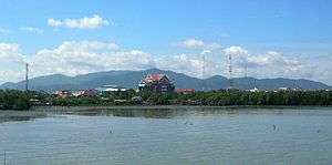 The Khao Khiao Massif rising behind Chonburi town | |
 Seal | |
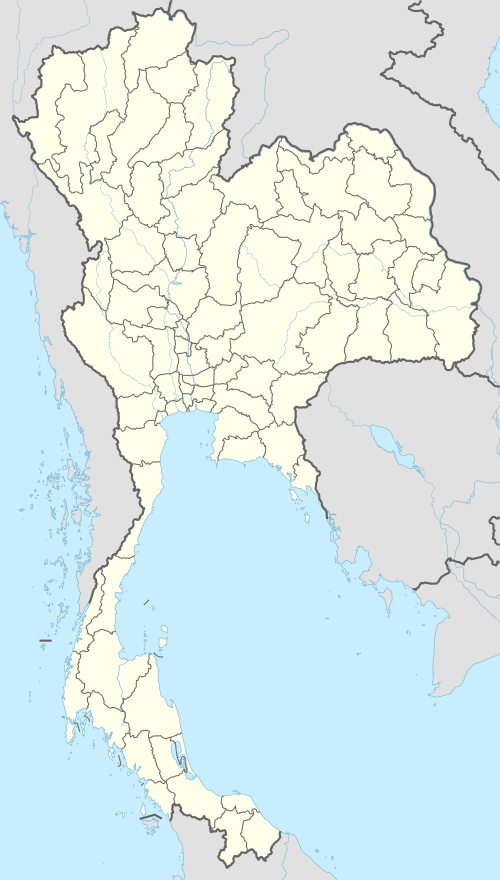 Chonburi Location in Thailand | |
| Coordinates: 13°21′40″N 100°59′6″E | |
| Country | Thailand |
| Province | Chonburi Province |
| District | Mueang Chonburi |
| Government | |
| • Mayor | Decho Kongchayasukkawat |
| Area | |
| • Total | 3.5 km2 (1.4 sq mi) |
| Elevation | 9 m (30 ft) |
| Population (2006) | |
| • Total | 180,000 |
| Time zone | UTC+7 (ICT) |
| Postcode | 20000 |
| Area code | (+66) 38 |
| Geocode | 2099 |
| Website | chonburicity |
Chonburi has had town (thesaban mueang) status since 1935.[1]
Climate
Chonburi has a tropical savanna climate (Köppen climate classification Aw). Winters are fairly dry and very warm. Temperatures rise until April, which is hot with the average daily maximum at 35.2 °C (95.4 °F). The monsoon season runs from May through October, with heavy rain and somewhat cooler temperatures during the day, although nights remain warm.
| Climate data for Chonburi (1981–2010) | |||||||||||||
|---|---|---|---|---|---|---|---|---|---|---|---|---|---|
| Month | Jan | Feb | Mar | Apr | May | Jun | Jul | Aug | Sep | Oct | Nov | Dec | Year |
| Record high °C (°F) | 37.3 (99.1) |
37.5 (99.5) |
38.4 (101.1) |
39.9 (103.8) |
39.0 (102.2) |
36.8 (98.2) |
37.2 (99.0) |
36.2 (97.2) |
35.9 (96.6) |
36.5 (97.7) |
37.9 (100.2) |
36.9 (98.4) |
39.9 (103.8) |
| Average high °C (°F) | 32.6 (90.7) |
33.2 (91.8) |
34.2 (93.6) |
35.2 (95.4) |
34.2 (93.6) |
33.7 (92.7) |
33.2 (91.8) |
33.0 (91.4) |
32.6 (90.7) |
32.7 (90.9) |
32.8 (91.0) |
32.4 (90.3) |
33.3 (91.9) |
| Daily mean °C (°F) | 26.9 (80.4) |
28.1 (82.6) |
29.2 (84.6) |
30.2 (86.4) |
29.8 (85.6) |
29.6 (85.3) |
29.2 (84.6) |
29.0 (84.2) |
28.3 (82.9) |
27.9 (82.2) |
27.6 (81.7) |
26.5 (79.7) |
28.5 (83.3) |
| Average low °C (°F) | 22.1 (71.8) |
24.0 (75.2) |
25.5 (77.9) |
26.6 (79.9) |
26.4 (79.5) |
26.3 (79.3) |
26.1 (79.0) |
25.8 (78.4) |
25.1 (77.2) |
24.5 (76.1) |
23.3 (73.9) |
21.6 (70.9) |
24.8 (76.6) |
| Record low °C (°F) | 13.5 (56.3) |
17.0 (62.6) |
14.0 (57.2) |
22.0 (71.6) |
22.1 (71.8) |
20.8 (69.4) |
21.0 (69.8) |
21.3 (70.3) |
21.0 (69.8) |
18.9 (66.0) |
14.5 (58.1) |
13.0 (55.4) |
13.0 (55.4) |
| Average rainfall mm (inches) | 9.9 (0.39) |
14.3 (0.56) |
47.5 (1.87) |
74.1 (2.92) |
175.3 (6.90) |
147.7 (5.81) |
140.6 (5.54) |
154.1 (6.07) |
268.9 (10.59) |
208.9 (8.22) |
48.8 (1.92) |
5.5 (0.22) |
1,295.6 (51.01) |
| Average rainy days | 1.4 | 2.2 | 4.8 | 7.5 | 14.5 | 14.9 | 14.8 | 16.7 | 19.9 | 16.4 | 5.3 | 1.0 | 119.4 |
| Average relative humidity (%) | 66 | 70 | 71 | 71 | 75 | 74 | 74 | 75 | 79 | 78 | 69 | 63 | 72 |
| Mean monthly sunshine hours | 263.5 | 245.8 | 238.7 | 240.0 | 195.3 | 153.0 | 158.1 | 114.7 | 108.0 | 145.7 | 222.0 | 260.4 | 2,345.2 |
| Mean daily sunshine hours | 8.5 | 8.7 | 7.7 | 8.0 | 6.3 | 5.1 | 5.1 | 3.7 | 3.6 | 4.7 | 7.4 | 8.4 | 6.4 |
| Source 1: Thai Meteorological Department[2] | |||||||||||||
| Source 2: Office of Water Management and Hydrology, Royal Irrigation Department (sun and humidity)[3] | |||||||||||||
Transportation
The main road through Chonburi is Thailand Route 3, also known as Sukhumvit Road. To the northwest it connects to Bangkok and to south it connects to Rayong, Chanthaburi, and Trat. Route 344 leads east to Klaeng, also on Route 3. Route 7 runs parallel to Route 3 but bypasses the densely populated coastal area, connecting to the beach resort city of Pattaya.
Tourism
A number of beaches and Khao Sam Muk hill by the Bangkok Bay seashore are important tourist attractions in Chonburi city.
Military
Unithai Shipyard will serve as the main facility to repair United States Navy ships in the Thailand area.[4]
References
- พระราชกฤษฎีกาจัดตั้งเทศบาลเมืองชลบุรี จังหวัดชลบุรี พุทธศักราช ๒๔๗๘ (PDF). Royal Gazette (in Thai). 52 (0 ก): 1651–1656. 1935-12-10.
- "Climatological Data for the Period 1981–2010". Thai Meteorological Department. p. 19. Retrieved 4 August 2016.
- "ปริมาณการใช้น้ำของพืชอ้างอิงโดยวิธีของ Penman Monteith (Reference Crop Evapotranspiration by Penman Monteith)" (PDF) (in Thai). Office of Water Management and Hydrology, Royal Irrigation Department. p. 93. Retrieved 4 August 2016.
- "Austal, Unithai sign MoU on US ship repairs". The Nation. 2013-04-02. Retrieved 2018-12-22.
External links

- http://www.chonburicity.go.th/ Website of the city
| Authority control |
|
|---|