Chengbu Miao Autonomous County
Chengbu Miao Autonomous County (simplified Chinese: 城步苗族自治县; traditional Chinese: 城步苗族自治縣; pinyin: Chéngbù Miáozú Zìzhìxiàn; usually referred to as "Chengbu County", commonly abbreviated as "Chengbu", simplified Chinese: 城步县; traditional Chinese: 城步縣; pinyin: Chéngbù Xiàn) is an autonomous county of Miao people in the Province of Hunan, China, it is under the administration of Shaoyang City.
Chengbu 城步县 Chengpu | |
|---|---|
| 城步苗族自治县 Chengbu Miao Autonomous County | |
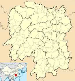 Chengbu Location of the seat in Hunan | |
| Coordinates: 26°23′30″N 110°19′22″E[1] | |
| Country | People's Republic of China |
| Province | Hunan |
| Prefecture-level city | Shaoyang |
| Seat | Rulin |
| Area | |
| • Total | 2,647 km2 (1,022 sq mi) |
| Population (2017) | |
| • Total | 292,033 |
| • Density | 110/km2 (290/sq mi) |
| Time zone | UTC+8 (China Standard) |
Located on the south western margin of Hunan, the county is bordered to the northeast by Wugang City, to the northwest by Suining County, to the southwest by Longsheng Autonomous County of Guangxi, to the southeast by Ziyuan County of Guangxi, to the south by Xinning County. Chengbu County covers 2,647 km2 (1,022 sq mi), as of 2015, it had a registered population of 285,845 and a permanent resident population of 262,245.[2] The county has six towns and six townships under its jurisdiction, the county seat is Chengbei Community of Rulin Town (儒林镇城北社区).[3]
Administrative division
As of October 2015, Chengbu Miao Autonomous County has six townships and six towns under its jurisdiction. The county seat is the town of Rulin.[4]
| Name | Chinese character | Population (2015) | Area (Km2) | Notes |
|---|---|---|---|---|
| Chang'anying | 长安营镇 | 8013 | 260 | |
| Dankou | 丹口镇 | 25800 | 286 | |
| Maoping | 茅坪镇 | 21000 | 151.2 | |
| Rulin | 儒林镇 | 75900 | 311 | |
| Wutuan | 五团镇 | 13476 | 173 | |
| Xiyan | 西岩镇 | 54200 | 150 | |
| Baimaoping Township | 白毛坪乡 | 16600 | 303.16 | |
| Jiangfang Township | 蒋坊乡 | 11100 | 94.8 | |
| Jinzi Township | 金紫乡 | 27885 | 69 | |
| Lanrong Township | 兰蓉乡 | 8982 | 112 | |
| Tingping Township | 汀坪乡 | 17200 | 255.76 | |
| Weixi Township | 威溪乡 | 8780 | 69.48 |
Geography
Chengbu Miao Autonomous County is located in the southwestern Hunan province.[5] It lies in the upper reaches of the Wu River. The county shares a border with Wugang to the north, Xinning County to the east, Guangxi Zhuang Autonomous Region to the southeast and south, and Tongdao Dong Autonomous County and Suining County to the west.[5] The county has a total area of 2,647.07 square kilometres (1,022.04 sq mi).[6] Chengbu Miao Autonomous County is surrounded by mountains in the east, south and west, high in the southern area and low in the northern area, with a large undulating terrain. The terrain is mainly mountainous and distributes in zones.[6]
Climate
Chengbu Miao Autonomous County is in the subtropical monsoon climate zone and exhibits four distinct seasons. It has an average annual temperature of 16.1 °C (61.0 °F), total annual rainfall of 1,218.5-millimetre (47.97 in), a frost-free period of 345 days and annual average sunshine hours between 1134.6 and 1601.5 hours.[7]
Rivers
Chengbu Miao Autonomous County has 816 rivers and streams.[8][9]
Wu River, formerly known as "Xiong River" and commonly known as "Yun River", is a tributary of Yuan River and the largest river in Chengbu Miao Autonomous County. It rises on the southwestern slopes of the Wu Mountain and discharges to Yuan River in Hongjiang City. It is 106 kilometres (66 mi) long and drains an area of 1,576.4 square kilometres (608.7 sq mi) in the county.[8]
Xun River, formerly known as "Tan River", is the second largest river in the county. It rises on the southeastern slopes of the Huangshan or Yellow Mountain and discharges to Rong River in Guangxi. It is 55.5 square kilometres (21.4 sq mi) long and is a tributary of Pearl River, draining an area of 578.1 square kilometres (223.2 sq mi).[8]
Zi River, also known as "Hao River", "Ji River" or "Duliang River", rises on the Guangfu Mountain and joins Dongting Lake. It is 33 kilometres (21 mi) long and drains an area of 418 square kilometres (161 sq mi) in the county.[8]
Qu River (渠水), also known as "Changping River", rises on the northwestern slopes of the Nanshan or Southern Mountain and discharges to Yuan River. It is 29.3 kilometres (18.2 mi) long and drains an area of 153 square kilometres (59 sq mi) in the county.[8]
Mountains
There are more than 657 mountains over 1,000 metres (3,300 ft) above sea level in Chengbu Miao Autonomous County.[9] The highest point in the county is Mount Erbaoding (Chinese: 二宝顶) which stands 2,021 metres (6,631 ft) above sea level. The lowest point is Kuangtang (匡塘), which, at 326 metres (1,070 ft) above sea level. Other famous mountains are Mount Jinzi (金紫山; 1,883-metre (6,178 ft)), Mount Longxuyan (龙须岩; 1,817-metre (5,961 ft)), Nanshan or Southern Mountain (南山; 1,940.6-metre (6,367 ft)), Laoshan or the Old Mountain (老山; 1,801-metre (5,909 ft)), and Mount Huangzhu (黄竹山; 1,740-metre (5,710 ft)).[6]
Demographics
As of 2017, the National Bureau of Statistics of the People's Republic of China estimates the county's population now to be 292,033.[10]
Ethnicity
| Historical population | ||
|---|---|---|
| Year | Pop. | ±% |
| 1504 | 180,000 | — |
| 1816 | 89,390 | −50.3% |
| 1906 | 73,161 | −18.2% |
| 1930 | 182,204 | +149.0% |
| 1936 | 91,260 | −49.9% |
| 1949 | 92,612 | +1.5% |
| 1958 | 122,655 | +32.4% |
| 1978 | 192,382 | +56.8% |
| 1989 | 232,874 | +21.0% |
| 2002 | 255,696 | +9.8% |
| 2004 | 258,494 | +1.1% |
| 2016 | 288,093 | +11.5% |
| 2017 | 292,033 | +1.4% |
| Source: [11] | ||
According to the 2010 Census, the ethnic makeup of Chengbu Miao Autonomous County included: 148,232 Miao people (59.14%), 94,051 Han people (37.53%), 3,288 Dong people (1.31%), 2,363 Yao people (0.94%), and 1,654 Hui people (0.66%).[12]
Language
Mandarin is the official language. The local people speak Kam language, Hmongic languages, and Dungan language.
Education
By the end of 2017, Chengbu Miao Autonomous County had two county vocational secondary schools, 25 high schools and middle schools, 139 primary schools, and 47 kindergartens.[10]
Transportation
Expressway
The S86 Wugang-Jingzhou Expressway runs northwest to east through the northern county's towns of Xiyan and Maoping and Jiangfang Township.[9]
Culture
Chengbu Miao Autonomous County is rich in culture and customs. The Meishan Culture (梅山文化), Witchcraft Culture (巫傩文化) and Folk Songs (山歌) are the most notable.[13]
Tourism
Chengbu Miao Autonomous County enjoys rich natural landscapes. The most popular natural scenic spots are Nanshan Scenic Area or Nanshan Grasslands, Chang'anying Scenic Area, Shiwan Gutian (十万古田; 'One Hundred Thousand Ancient Farmland'), Baiyun Lake (白云湖; 'White Cloud Lake'), Liangjiang Gorge (两江峡谷; 'Gorge of Two Rivers'), Shajiaodong Nature Reserves (沙角洞自然保护区).[14][15]
Chengbu Miao Autonomous County is also the hometown for many celebrities. It has a large number of former residences, such as the Former Residence of Yang Wanzhe (杨完者故居), Former Residence of Wang Lin (王麟故居), Former Residence of Lan Yu, and the Former Residence of Gong Jichang.[16]
Chengbu Miao Autonomous County's most notable feature is its ancient bridges, built in the Song, Yuan, Ming and Qing dynasties (960–1911). The Fengyu Bridge (风雨桥; 'Wind-rain Bridge') is the oldest bridge in the county, which was originally built in the Song dynasty (960–1279). Other ancient bridges are the Guma Bridge (古马桥; 'Ancient Horse Bridge'), Fushou Bridge (福寿桥; 'Bridge of Blessing and Longevity'), Yao Bridge (瑶桥; 'Bridge of Yao People'), Liuxi Bridge (柳溪桥; 'Bridge of Willow River'), Luohan Bridge (罗汉桥; 'Arhat Bridge'), Huilong Bridge (回龙桥; 'Bridge of Curved Dragon'), and Yongzhen Bridge (永镇桥).[16]
The Confucian Temple (孔圣庙) is the largest temple complex in the county. It was built in 1889 during the ruling of Guangxu Emperor of the Qing dynasty (1644–1911).[17] The Baiyun Temple (白云寺; 'White Cloud Temple') is a Buddhist temple in the county and Feishan Temple (飞山庙; 'Temple of Mount Flying') is a Taoist temple in the county.[18][19]
Notable people
Chengbu Miao Autonomous County is the birthplace of:
- Yang Zaixing, a general in the Song dynasty (960–1279).
- Yang Zhengheng (杨正衡; 楊正衡), an official in late Yuan dynasty (1271–1368).
- Lan Yu, a general in late Yuan dynasty (1271–1368) and early Ming dynasty (1368–1644).
- Gong Jichang (龚继昌; 龔繼昌), a general in the Qing dynasty (1644–1911).
- Duan Menghui (段梦晖; 段夢暉), journalist.
References
- Google (2014-07-02). "Chengbu" (Map). Google Maps. Google. Retrieved 2014-07-02.
- 城步县2015年国民经济和社会发展统计公报 (in Chinese). Shaoyang People's Government. 23 March 2016. Archived 2017-01-16 at the Wayback Machine or chengbu.gov
- 《湖南省民政厅关于同意城步苗族自治县乡镇区划调整方案的批复》(湘民行发〔2015〕122号). rednet (in Chinese). 2 December 2015.
- 城步苗族自治县行政区划 [Administrative divisions of Chengbu Miao Autonomous County]. chengbu.gov.cn (in Chinese). 2017.
- Wu Yizhen (2009), p. 1.
- Wu Yizhen (2009), p. 2.
- Wu Yizhen (2009), pp. 3–4.
- Wu Yizhen (2009), p. 5.
- Zhang Hong, ed. (2018). "Chengbu Miao Autonomous County" 《城步苗族自治县》. 《中国分省系列地图册:湖南》 [Maps of Provinces in China: Hunan] (in Chinese). Xicheng District, Beijing: SinoMaps Press. pp. 80–81. ISBN 978-7-5031-8949-4.
- 2017年城步苗族自治县国民经济和社会发展统计公报 [Statistical Communiqué of Chengbu Miao Autonomous County on the 2017 National Economic and Social Development]. shaoyang.gov.cn (in Chinese). 2018-03-19.
- Wu Yizhen (2009), pp. 12–14.
- 人口与民族 [Population and Ethnicity]. chengbu.gov.cn (in Chinese). 2016.
- Wu Yizhen (2009), p. 166.
- Wu Yizhen (2009), pp. 34–35.
- Wu Yizhen (2009), pp. 167–178.
- Wu Yizhen (2009), pp. 37–38.
- Wu Yizhen (2009), p. 38.
- Wu Yizhen (2009), p. 37.
- Wu Yizhen (2009), p. 167.
Bibliography
- Wu Yizhen, ed. (2009). 《城步苗族自治县概况》 [General Situation of Chengbu Miao Autonomous County] (in Chinese). Beijing: Nationalities Publishing House. ISBN 978-7-105-08659-7.CS1 maint: ref=harv (link)
External links
- www.xzqh.org (in Chinese)
| Authority control |
|
|---|