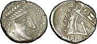
Cavares
The Cavares were a Gallic confederation of tribes[1] located in the lower Rhone valley during the Roman period. Their strongholds were Avignon (Avennio), Orange (Arausio) and Cavaillon (Cabellio).
.png)
Name
They are mentioned as Kaouárōn (Καουάρων) by Strabo (early 1st c. AD),[2] as Cauarum by Pliny (1st c. AD),[3] as Avennio Cavarum and Cavaras by Pomponius Mela (mid-1st c. AD),[4] as Kaúaroi (Καύαροι) by Ptolemy (2nd c. AD),[5] and as Cavares on the Tabula Peutingeriana (5th c. AD).[6]
The name Cauares stems from Gaulish cauaros ('hero, champion'), ultimately from Proto-Celtic *kawaro- ('hero, champion'; cf. Old Irish cuar 'hero, champion, warrior', Breton kaour, Welsh cawr 'giant, champion').[7][8]
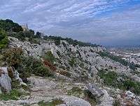
Geography
Their closest neighbours were the Segallauni, the Tricastini, the Salyes, the Albici (or Albioeci) and the Vocontii.[9]
Archaeology
The Tarasque de Noves anthropophagous statue, displayed in the Musée Calvet in Avignon, is attributed to the Cavares.
References
- Falileyev 2010, p. entry 3499.
- Strabo. Geōgraphiká, 4:1:11
- Pliny. Naturalis Historia, 3:34; 3:36
- Pomponius Mela. De situ orbis, 2:5:75; 2:5:79
- Ptolemy. Geōgraphikḕ Hyphḗgēsis, 2:10:8
- Falileyev 2010, entry 3499.
- Delamarre 2003, p. 112.
- Matasović 2009, p. 196.
- Ptolemy, Geography, Book II, Chapter 9, Location of Narbonensis Gallia (Third Map of Europe).
Bibliography
- Delamarre, Xavier (2003). Dictionnaire de la langue gauloise: Une approche linguistique du vieux-celtique continental (in French). Errance. ISBN 9782877723695.CS1 maint: ref=harv (link)
- Falileyev, Alexander (2010). Dictionary of Continental Celtic Place-names: A Celtic Companion to the Barrington Atlas of the Greek and Roman World. CMCS. ISBN 978-0955718236.
- Matasović, Ranko (2009). Etymological Dictionary of Proto-Celtic. Brill. ISBN 9789004173361.CS1 maint: ref=harv (link)
Ancient tribes of Gaul | ||
|---|---|---|
| Belgica | 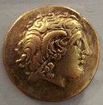 | |
| Celtica |
| |
| Aquitania | ||
| Narbonensis | ||
Part of: Celtic tribes in Europe | ||