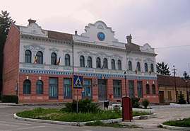
Caraș-Severin County
Caraș-Severin (Romanian pronunciation: [ˈkaraʃ seveˈrin] (![]()
Caraș-Severin County Județul Caraș-Severin | |
|---|---|
County | |
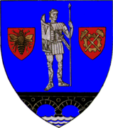 Coat of arms | |
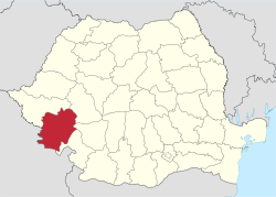 Caraș-Severin county, territorial location | |
| Coordinates: 45.15°N 22.07°E | |
| Country | |
| Development region1 | Vest |
| Historic region | Banat |
| Capital city (Reședință de județ) | Reșița |
| Government | |
| • Type | County Board |
| • President of the County Board | Sorin Frunzăverde (Democratic-Liberal Party) |
| • Prefect2 | Ioan Anton Paulescu |
| Area | |
| • Total | 8,514 km2 (3,287 sq mi) |
| Area rank | 3rd in Romania |
| Population (2011) | |
| • Total | 274,277 |
| • Rank | 32nd in Romania |
| • Density | 39/km2 (100/sq mi) |
| Time zone | UTC+2 (EET) |
| • Summer (DST) | UTC+3 (EEST) |
| Postal Code | 32wxyz3 |
| Area code(s) | +40 x554 |
| Car Plates | CS5 |
| GDP | US$ 1.906 billion (2015) |
| GDP/capita | US$ 6,95 (2015) |
| Website | County Council County Prefecture |
| 1The development regions of Romania have no administrative role. They were formed to correspond to NUTS-II level subdivisions of the European Union member states and are the basis for development funding under the cohesion and convergence objectives of the EU's regional policy 2 as of 2007, the Prefect is not a politician, but a public functionary. He (or she) is not allowed to be a member of a political party, and is banned from any political activity in the first six months after resignation (or exclusion) from the public functionary corps 3w, x, y, and z are digits that indicate the city, the street, part of the street, or even the building of the address 4x is a digit indicating the operator: 2 for the former national operator, Romtelecom, and 3 for the other ground telephone networks 5used on both the plates of the vehicles that operate only in the county limits (like utility vehicles, ATVs, etc.), and the ones used outside the county | |
Name
In Serbian and Croatian, it is known as Karaš Severin/Караш Северин or Karaš-Severinska županija, in Hungarian as Krassó-Szörény megye, in German as Kreis Karasch-Severin, and in Bulgarian as Караш-Северин (translit. Karash-Severin).
Demographics
The county is part of the Danube-Kris-Mureș-Tisza euroregion.
In 2011, it had a population of 274,277 and a population density of 33.63/km2.
The majority of the population (89.23%) are Romanians. There are also Roma (2.74%), Croats (1.88%), Germans - Banat Swabians (1.11%), Serbs (1.82%), Hungarians (1.19%) and Ukrainians (0.94%).[1]
| Year | County population[2] |
|---|---|
| 1948 | 302,254 |
| 1956 | |
| 1966 | |
| 1977 | |
| 1992 | |
| 2002 | |
| 2011 |
Geography
With 8,514 km2, it is the third largest county in Romania, after Timiș and Suceava counties. It is also the county through which the river Danube enters Romania.
The mountains make up 67% of the county's surface, including the Southern Carpathians range, with Banat Mountains, Țarcu-Godeanu Mountains and Cernei Mountains and elevations between 600 and 2100 meters. Transition hills between mountains and the Banat Plain lie in the western side of the county.
The Danube enters Romania in the vicinity of Baziaș, bordering Serbia. Timiș, Cerna, Caraș and Nera cross the county, some of them through spectacular valleys and gorges.
Neighbours

- Hunedoara County and Gorj County to the east.
- Timiș County to the north.
- Mehedinți County to the southeast.
- Serbia to the southwest:
- Vojvodina Autonomous Province to the west – South Banat okrug.
- Bor District and Braničevo District to the south.
History and economy
In 1718 the county was part of the Habsburg Monarchy, part of the province of Banat. In 1771 the county seat, Reschitz (Reșița) became a modern industrial center under Austrian rule. The area received considerable attention due to its mining industry. In 1855, the entire Banat area, with its supplies of mineral deposits and timber, was transferred from the Austrian Treasury to a joint Austrian-French mining and railroad company named StEG. StEG built the Oravița-Baziaș line, Romania's oldest railroad track.
After World War I, StEG, Banat and most Austro-Hungarian property were taken over by a company named UDR. During the last years of World War II, when Romania was an ally of Nazi Germany, a partisan group, led by Ștefan Plavăț, was active in the mountainous area of the county.[3] The arrival of the communist regime in Romania after World War II and that regime's campaign of nationalization of the mining industry brought tremendous social upheaval in the area.
Tourism
Archaeological findings show the area has been populated since Paleolithic times. There is a County Museum of History in Reșița, displaying archeological artifacts, and, in the town of Ocna de Fier, the Constantin Gruiescu Mineralogical Collection. The county hosts the regional daffodil and lilac festivals in the Spring. Sites worth visiting:
- Cheile Nerei – Beușinta National Park;
- Semenic – Cheile Carașului National Park;
- Domogled – Valea Cernei National Park;
- Danube Iron Gate National Park;
- Semenic resort;
- Băile Herculane resort.
Politics
- President of the County Council – Florin Silviu Hurduzeu (Social Democratic Party)
- Vice-president of the County Council - Ionut Popovici
The Caraș-Severin County Council, elected at the 2016 local government elections, is made up of 31 counselors, with the following party composition:[4]
| Party | Seats | Current County Council | ||||||||||||||
|---|---|---|---|---|---|---|---|---|---|---|---|---|---|---|---|---|
| Social Democratic Party | 14 | |||||||||||||||
| National Liberal Party | 13 | |||||||||||||||
| People's Movement Party | 4 | |||||||||||||||
Administrative divisions

Caraș-Severin County has 2 municipalities, 6 towns and 69 communes
- Municipalities
- Caransebeș
- Reșița – capital city; population: 86,383 (as of 2006)
- Communes
- Armeniș
- Bănia
- Băuțar
- Berliște
- Berzasca
- Berzovia
- Bolvașnița
- Bozovici
- Brebu
- Brebu Nou
- Buchin
- Bucoșnița
- Carașova
- Cărbunari
- Ciclova Română
- Ciuchici
- Ciudanovița
- Constantin Daicoviciu
- Copăcele
- Cornea
- Cornereva
- Coronini
- Dalboșeț
- Doclin
- Dognecea
- Domașnea
- Eftimie Murgu
- Ezeriș
- Fârliug
- Forotic
- Gârnic
- Glimboca
- Goruia
- Grădinari
- Iablanița
- Lăpușnicel
- Lăpușnicu Mare
- Luncavița
- Lupac
- Marga
- Măureni
- Mehadia
- Mehadica
- Naidăș
- Obreja
- Ocna de Fier
- Păltiniș
- Pojejena
- Prigor
- Răcășdia
- Ramna
- Rusca Montană
- Sacu
- Sasca Montană
- Sichevița
- Slatina-Timiș
- Socol
- Șopotu Nou
- Târnova
- Teregova
- Ticvaniu Mare
- Topleț
- Turnu Ruieni
- Văliug
- Vărădia
- Vermeș
- Vrani
- Zăvoi
- Zorlențu Mare
Historic county
Județul Caraș-Severin | |
|---|---|
County (Județ) | |
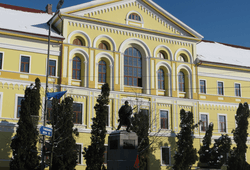 The Caraș-Severin prefecture building from the interwar period. | |
 Coat of arms | |
 | |
| Country | |
| Historic region | Banat |
| Capital city (Reședință de județ) | Lugoj |
| Established | 1919 |
| Ceased to exist | 1926 |
| Area | |
| • Total | 11,080 km2 (4,280 sq mi) |
| Population (1920) | |
| • Total | 424,254 |
| • Density | 38/km2 (99/sq mi) |
| Time zone | UTC+2 (EET) |
| • Summer (DST) | UTC+3 (EEST) |
The territory of the county was transferred to the Romania from the Kingdom of Hungary in 1920 under the Treaty of Trianon. The county was located in the southwestern part of Greater Romania, in the south and east region of the Banat. The county seat was Lugoj. Its territory consisted entirely of the current territory of the county, but also parts of the current counties of Timiș, Arad, and Mehedinți. It bordered on the west with Timiș-Torontal County and the Kingdom of Yugoslavia, to the south with Yugoslavia, to the east with the counties Mehedinți and Hunedoara, and to the north by Arad County. The county had a total area over 11,000 square kilometres (4,200 sq mi), making it the largest county geographically of interwar Romania. Its territory corresponded to the former Hungarian division of Krassó-Szörény County. The county existed for seven years, being divided in 1926 into Caraș County and Severin County.
Administration
The county was divided administratively into fourteen districts (plăṣi). There were five urban municipalities (cities): Lugoj (capital), Caransebeș, Reșița, Oravița and Orșova.[5][6]
Population
According to the census data of 1920, the total population of the county was 424,254 inhabitants. The population density was 38 inhabitants/km2.
References
| Wikimedia Commons has media related to Caraș-Severin County. |
- National Institute of Statistics, "Populația după etnie" Archived 16 August 2009 at the Wayback Machine
- National Institute of Statistics, "Populația la recensămintele din anii 1948, 1956, 1966, 1977, 1992 și 2002" Archived 22 September 2006 at the Wayback Machine
- Covaci, Maria (1969). "Ștefan Plavăț" in Anale de Istorie, Vol. XV, Nr. 4. Institutul de Studii Istorice și Social-Politice de pe lîngă C.C. al P.C.R, Bucharest. p. 145.
- "Mandate de CJ pe judete si competitori" (in Romanian). Biroul Electoral Central. 10 June 2016. Retrieved 16 June 2016.
- Portretul României Interbelice - Județul Caraș
- Portretul României Interbelice - Județul Severin