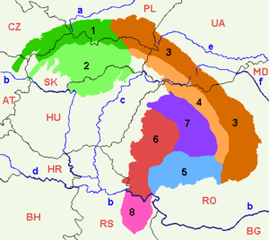
Southern Carpathians
The Southern Carpathians (also known as the Transylvanian Alps;[1][2] Romanian: Carpații Meridionali [karˈpatsij meˌridjoˈnalʲ]; Hungarian: Déli-Kárpátok) are a group of mountain ranges located in southern Romania.[3] They cover the part of the Carpathian Mountains located between the Prahova River in the east and the Timiș and Cerna Rivers in the west. To the south they are bounded by the Balkan mountain range.
| Southern Carpathians | |
|---|---|
| Romanian: Carpații Meridionali | |
 Negoiu Peak (2535m) | |
| Highest point | |
| Peak | Moldoveanu |
| Elevation | 2,544 m (8,346 ft) |
| Coordinates | 45°30′N 24°15′E |
| Geography | |
 Location of the Southern Carpathians in Romania
| |
| Country | Romania |
| Parent range | Carpathians |
| Geology | |
| Orogeny | Alpine orogeny |
| Age of rock | Mostly Triassic |
Heights
The Southern Carpathians are the second highest group of mountains in the Carpathian Mountain range (after Tatra), reaching heights of over 2,500 meters. Although considerably smaller than the Alps, they are classified as having an alpine landscape. Their high mountain character, combined with great accessibility, makes them popular with tourists and scientists.
The highest peaks are:
- Moldoveanu Peak, 2,544 metres – Făgăraș Mountains
- Negoiu, 2,535 metres – Făgăraș Mountains
- Parângu Mare, 2,519 metres – Parâng Mountains
- Peleaga, 2,509 metres – Retezat Mountains
- Omu Peak 2,507 metres – Bucegi Mountains
Despite the heights, some of the most accessible passages in the Carpathians in Romania are along the rivers, which cross the mountain range (the Olt River) or form wide valleys (along the Prahova River Valley or along the Jiu River Valley).
Geology
The South Carpathians represent an intricate pile of tectonic nappes, overthrusted from west eastwards during the Austrian (Middle Cretaceous) and Laramian paroxysmal phases, corresponding to various plate fragments. The napes are (from west eastwards): the Supragetic, Getic, Severin and Danubian Units. The Getic Nappe was identified by Murgoci (1905),[4] while the general understanding over the Alpine structure of the South Carpathians was later refined by Codarcea (1940),[5] Codarcea et al. (1961),[6] Năstăseanu et al. (1981),[7] Săndulescu (1984),[8] Săndulescu and Dimitrescu (2004),[9] and Mutihac (1990).[10] The first to apply the global tectonics concepts for the Romanian Carpathians were Rădulescu and Săndulescu (1973).[11]
The Supragetic, Getic Nappes as well as the Danubian Units represent units with both a metamorphic basement and a sedimentary cover, while the Severin Nappe includes only a sedimentary sequence. The Getic Nappe and the Danubian Units sediments include a Palaeozoic sequence (Upper Carboniferous, Lower Permian) and a Mesozoic sequence (Lowermost Jurassic – Middle Cretaceous). The Supragetic Nappe comprises mainly metamorphosed rocks (gneisses, micashists), while the Severin Nappe includes only Upper Jurassic – Lower Cretaceous sediments.
Mountain ranges

From east to west, four mountain groups can be identified, separated by different river valleys.
- Bucegi Mountains group – between the Prahova and Dâmboviţa Rivers.
- Bucegi Mountains (Munții Bucegi)
- Piatra Craiului (literally: "Rock of the King")
- Leaotă Mountains (Munții Leaotă)
- Făgăraş Mountains group – between the Dâmbovița River and the Olt River.
- Făgăraş Mountains (Munții Făgărașului)
- Iezer Mountains (Munții Iezer; literally: "Mountains of the Deep Lake")
- Cozia Mountains (Munții Cozia)
- Parâng Mountains group – between the Olt River and the Jiu River.
- Parâng Mountains (Munții Parâng)
- Şureanu Mountains (Munții Șureanu/M. Sebeșului)
- Cindrel Mountains (Munții Cindrel/M. Cibinului)
- Lotru Mountains (Munții Lotrului; literally: "Mountains of the Thief")
- Căpăţână Mountains (Munții Căpățânii; literally: "Mountains of the Skull")
- Retezat-Godeanu Mountains group – between the Jiu River and the Timiș and Cerna Rivers.
- Retezat Mountains (Munții Retezat; literally: "Hewed Mountains")
- Godeanu Mountains (Munții Godeanu)
- Vâlcan Mountains (Munții Vâlcan)
- Mehedinţi Mountains (Munții Mehendinți)
- Cerna Mountains (Munții Cernei)
- Ţarcu Mountains (Munții Țarcu; literally: "Pen Mountains").
The first two groups are steepest on the North side, and the last two are steepest on the South side.
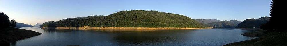
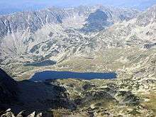
Gallery
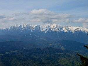 Bucegi as seen from Postavaru massif
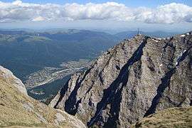 Caraiman Cross on mountain top
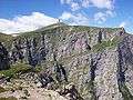 Coștila 400 meters high wall
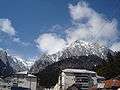 View from Bușteni
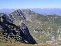 Scara summit in Bucegi Mountains
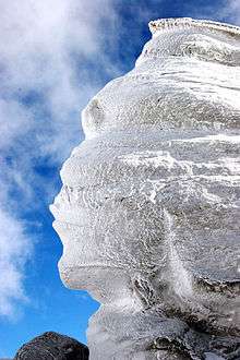 The Sphinx of Bucegi
 Piatra Craiului Mountains
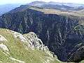 Jepii Mici Peak in Bucegi Mountains
 Lake Bâlea in Făgăraș Mountains
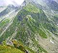 Challenging hiking trail
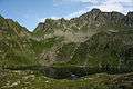 Podragu Lake
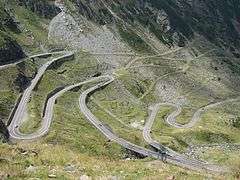 Transfăgărășan alpine road
_67.jpg) Regular footpath in Făgăraș Mountains
Regular footpath in Făgăraș Mountains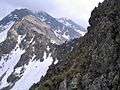 Custura Sărătii (in the center of the photo)
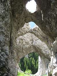 La Zaplaz landmark
 Piatra Craiului ridge in winter
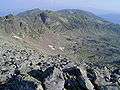 Landscape in Parâng Mountains
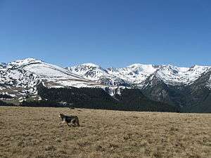 Parâng alpine scenery
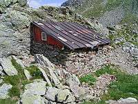 Shelter in Parâng mountains
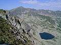 One of many Parâng glacial lakes
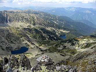 Glacial lakes in the Retezat Mountains
 Bucura Peak in the distance
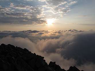 Sunset on Retezat Peak
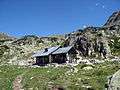 Salvamont shelter in Retezat
 Waterfall in Retezat National Park
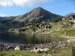 Bucura Lake
See also
- Romanian Carpathians
- Divisions of the Carpathians
- Iron Gates, at the South-Western end
- Prahova Valley, at the Eastern end
References
- Comănescu, Laura, & Alexandru Nedelea. 2016. Geomorphosites Assessments of the Glacial and Periglacial Landforms from Southern Carpathoans. In: Maria Radoane & Alfred Vespremeanu-Stroe (eds.), Landform Dynamics and Evolution in Romania, pp. 215–248. Cham: Springer, p. 202.
- Quinn, Joyce Ann, & Susan L Woodward. 2015. Earth's Landscape: An Encyclopedia of the World's Geographic Features. Santa Barbara, CA: ABC-CLIO, p. 138.
- Carpathians.pl Archived 2010-04-06 at the Wayback Machine
- Murgoci, G.M., 1905. Sur l'existence d'une grande nappe de recouvrement dans les Carpathes meridionales. C. R. Acad. Sci., 7: 31.
- Codarcea , A., 1940. Vues nouvelles sur la tectonique du Banat meridional et du Plateau de Mehedinți. D. S. Inst. Geol. Rom., 20: 1–74.
- Codarcea, A., Răileanu, G., Pavelescu, L., Gherasi, N., Năstăseanu, S., Bercia, I. and Mercus, D., 1961. Guide des excursions. Carpates Meridionales, București, 130 pp.
- Năstăseanu, S., Bercia, I., Iancu, V., Vlad and Hârtopanu, I., 1981. The structure of the South Carpathians (Mehedinți – Banat Area). Guidebooks series, 22. IGR, Bucuresti, 3–100 pp.
- Săndulescu, M., 1984. Geotectonica României. Editura Tehnică, București, 336 pp.
- Săndulescu, M. and Dimitrescu, R., 2004. Geological structure of the Romanian Carpathians, Florence, 48 pp.
- Mutihac, V., 1990. Structura geologică a teritoriului României. Editura Tehnică, Bucharest, 419 pp.
- Rădulescu, D. and Săndulescu, M., 1973. The plate-tectonics concept and the geological structure of the Carpathians. Tectonophysics, 16: 155–161.
External links
| Wikimedia Commons has media related to Southern Carpathians. |
Divisions, Groups, and Ranges of the Carpathian Mountains | ||||||
|---|---|---|---|---|---|---|
| Western Carpathians |
|  | ||||
| Eastern Carpathians |
| |||||
| Southern Carpathians | ||||||
| Western Romanian Carpathians | ||||||
| Serbian Carpathians |
| |||||
| Adjacent regions |
| |||||
| Grouping by country |
| |||||