Cerna (Danube)
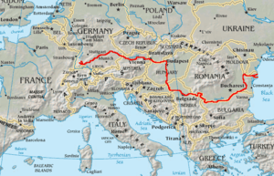
The Cerna (Hungarian: Cserna) is a river in Romania, a left tributary of the river Danube.[1][2] The Cerna has its source on the south-east side of the Godeanu Mountains and flows into the Danube near the town Orșova. The upper reach of the river is sometimes called Cernișoara. With a length of 79 km (49 mi) and its basin of 1,380 km2 (530 sq mi),[2] it carves an erosive tectonic valley with numerous gorges, quite deep sometimes. There is a man-made lake on it (Tierna), just before it crosses the Băile Herculane spa, to perpetuate the old toponimic od Dierna. The upper course of the Cerna is part of the Domogled-Valea Cernei National Park. The Cerna flows through the villages and towns Cerna-Sat, Țațu, Băile Herculane, Pecinișca, Bârza, Topleț, Coramnic and Orșova.
| Cerna | |
|---|---|
| Location | |
| Country | Romania |
| Counties | Gorj, Caraș-Severin, Mehedinți |
| Towns | Băile Herculane, Orșova |
| Physical characteristics | |
| Source | Godeanu Mountains |
| Mouth | Danube |
• location | Orșova |
• coordinates | 44°44′22″N 22°24′44″E |
| Length | 79 km (49 mi) |
| Basin size | 1,380 km2 (530 sq mi) |
| Basin features | |
| Progression | Danube→ Black Sea |
| Tributaries | |
| • right | Belareca |
Tributaries
The following rivers are tributaries of the river Cerna (from source to mouth):[2]
- Left: Arsaca, Jelerău, Valea Mare
- Right: Șturu, Măneasa, Valea Cărbunelui, Valea lui Iovan, Balmez, Naiba, Olanul, Craiova, Iauna, Topenia, Iuta, Prisăcina, Belareca, Jardașița Mare, Sacherștița
References
- "Planul național de management. Sinteza planurilor de management la nivel de bazine/spații hidrografice, anexa 7.1" (PDF, 5.1 MB). Administrația Națională Apele Române. 2010. p. 483.
- Atlasul cadastrului apelor din România. Partea 1 (in Romanian). Bucharest: Ministerul Mediului. 1992. pp. 230–232. OCLC 895459847. River code: VI.2
External links
| Wikimedia Commons has media related to Cerna River, Caraș-Severin County. |
- Trasee turistice – județul Caraș
- Trasee turistice – județul Gorj
- Trasee turistice – județul Mehedinți
