Bournemouth, Christchurch and Poole
Bournemouth, Christchurch and Poole is a unitary authority area in the ceremonial county of Dorset, England. It was created on 1 April 2019 by the merger of the areas that were previously administered by the unitary authorities of Bournemouth and Poole, and the non-metropolitan district of Christchurch.[3] The authority covers much of the area of the South Dorset conurbation.
Bournemouth, Christchurch and Poole | |
|---|---|
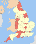
 Bournemouth, Christchurch and Poole shown within Dorset | |
| Coordinates: 50.723°N 1.882°W | |
| Sovereign state | United Kingdom |
| Constituent country | England |
| Region | South West England |
| Ceremonial county | Dorset |
| Admin HQ | Bournemouth Town Hall Complex [1] |
| Government | |
| • Type | Unitary authority |
| • Governing body | Bournemouth, Christchurch and Poole Council |
| • Chair | David Flagg |
| • Leader | Vikki Slade |
| Area | |
| • Total | 62.3 sq mi (161.3 km2) |
| Area rank | 176th (of 317) |
| Population (mid-2019 est.) | |
| • Total | 395,331 |
| • Rank | 12th (of 317) |
| • Density | 6,350/sq mi (2,453/km2) |
| Time zone | UTC+0 (Greenwich Mean Time) |
| Postcodes | |
| Area code(s) | 01202 01425 |
| ISO 3166-2 | TBD |
| ONS code | E06000058 |
| Website | www |
Background
Bournemouth and Christchurch were historically part of the County of Hampshire, whilst Poole was a part of Dorset. However, by the mid 20th century the area had begun to coalesce as a conurbation, and in the 1974 Local Government Act, the three areas were brought together under the Ceremonial County of Dorset, whilst still forming separate districts. In 1997 Poole and Bournemouth became unitary authorities, whilst Christchurch remained within Dorset County Council.
The new authority was formed as a result of local government reorganisation in the ceremonial county of Dorset. Under the plans, dubbed "Future Dorset", all councils within the county were abolished and replaced with two new unitary authorities. One was formed from the existing unitary authorities of Bournemouth and Poole, which merged with the non-metropolitan district of Christchurch to create the unitary authority to be known as Bournemouth, Christchurch and Poole. The other was created from the merger of the existing non-metropolitan districts of Weymouth and Portland, West Dorset, North Dorset, Purbeck and East Dorset to form a new Dorset authority.[4]
Christchurch Borough Council formally opposed the plans, whilst every other existing authority in Dorset supported the plans.[5] Christchurch Borough Council unsuccessfully challenged the proposals in the High Court.[6] Several Conservative Councillors in Christchurch were suspended from the party for their opposition to the plan, with several of them subsequently standing as independents in the 2019 election.[7]
Bournemouth, Christchurch and Poole Council
Statutory instruments for the creation of the new authority were made on behalf of the Secretary of State for Housing, Communities and Local Government on 25 May 2018, and a shadow authority was formed the following day.[8][9] The Shadow Authority was composed of the existing borough councillors from Bournemouth, Christchurch and Poole, as well as the County Councillors representing Christchurch. The shadow authority had 125 members, and first met on 6th June 2018.[10] However, in the Local Government Boundary Commission's review, they reduced the number of wards for the new authority to 33 multi-member wards, with 76 councillors in total.[11] The first elections took place in 2019 alongside other local elections, and led to the Conservatives holding the most seats, but lacking a majority, meaning that the council remained under No overall control. Subsequent to the election, the Liberal Democrats, the second largest party in the council, led the creation of the Unity Alliance Administration, made up of the Liberal Democrats (15), Independents (11), Poole People (7), Labour (3), Green Party (2) and Alliance for Local Living (1). The Unity Alliance therefore had 39 members, the number required for a majority. The remaining councillors, belonging to the Conservative Party (36) and UKIP (1) remained in opposition.
History
The area around Poole Harbour has been inhabited for at least around 2,500 years[12], with the Durotriges, a Celtic groups, settling the Dorset area in the Iron Age. The area continued to be important during Roman Rule, with Poole being one of the areas Roman troops landed[12], and with the Second Augustan Legion under Emperor Vespasian founding Hamworthy in 43AD[13], which today lies in the Southeast of the authority. Following the initial Saxon invasions in the 7th century, the area came under the Kingdom of Wessex. As shires developed, the area now covering Christchurch and Bournemouth became part of Hampshire (the Shire of Southampton) whilst Poole became part of Dorset.
Geography
The authority lies in the South East of the ceremonial county of Dorset around 150 km from London. Dorset as a whole is part of the South West region of England, which is used for statistical purposes. The three former boroughs are all historically seaside towns with tourism playing an important part in the local economy. Bournemouth and Poole lie north of Poole Harbour, whilst Christchurch contains Christchurch Harbour, with the Isle of Wight and Solent to the East and English Channel to the South and West.
Climate
Bournemouth, Christchurch and Poole has an Oceanic Temperate Climate. The presence of the Gulf Stream ensures that the British Isles maintain an all-year-round ambient temperature, and, because of its position on the south coast of England, the area has slightly warmer winters and cooler summers than settlements further inland.
| Climate data for Bournemouth Hurn 33 feet (10 metres) asl, 1981–2010,[Note 1] Extremes 1960– | |||||||||||||
|---|---|---|---|---|---|---|---|---|---|---|---|---|---|
| Month | Jan | Feb | Mar | Apr | May | Jun | Jul | Aug | Sep | Oct | Nov | Dec | Year |
| Record high °C (°F) | 14.7 (58.5) |
17.8 (64.0) |
21.0 (69.8) |
25.0 (77.0) |
27.6 (81.7) |
33.8 (92.8) |
33.9 (93.0) |
34.1 (93.4) |
27.9 (82.2) |
25.2 (77.4) |
19.8 (67.6) |
16.0 (60.8) |
34.1 (93.4) |
| Average high °C (°F) | 8.4 (47.1) |
8.5 (47.3) |
11.0 (51.8) |
13.5 (56.3) |
17.0 (62.6) |
19.8 (67.6) |
22.1 (71.8) |
22.0 (71.6) |
19.3 (66.7) |
15.3 (59.5) |
11.5 (52.7) |
8.7 (47.7) |
14.8 (58.6) |
| Average low °C (°F) | 1.5 (34.7) |
1.2 (34.2) |
2.7 (36.9) |
3.8 (38.8) |
7.2 (45.0) |
9.8 (49.6) |
11.9 (53.4) |
11.6 (52.9) |
9.4 (48.9) |
7.1 (44.8) |
3.7 (38.7) |
1.6 (34.9) |
6.0 (42.7) |
| Record low °C (°F) | −13.4 (7.9) |
−10.9 (12.4) |
−10.2 (13.6) |
−5.7 (21.7) |
−3.6 (25.5) |
0.4 (32.7) |
2.6 (36.7) |
2.1 (35.8) |
−1.4 (29.5) |
−6.4 (20.5) |
−9.6 (14.7) |
−10.5 (13.1) |
−13.4 (7.9) |
| Average rainfall mm (inches) | 86.9 (3.42) |
62.5 (2.46) |
64.7 (2.55) |
53.9 (2.12) |
49.5 (1.95) |
51.6 (2.03) |
47.8 (1.88) |
51.8 (2.04) |
65.3 (2.57) |
100.7 (3.96) |
100.5 (3.96) |
100.0 (3.94) |
835.2 (32.88) |
| Average rainy days | 12.8 | 9.6 | 10.8 | 9.1 | 8.8 | 7.7 | 7.9 | 7.3 | 9.0 | 12.6 | 12.5 | 12.3 | 120.4 |
| Mean monthly sunshine hours | 66.5 | 84.5 | 121.4 | 185.1 | 218.5 | 229.5 | 232.0 | 214.6 | 159.1 | 115.2 | 80.1 | 60.3 | 1,766.8 |
| Source: Met Office[14] | |||||||||||||
| Climate data for Christchurch, Dorset, England | |||||||||||||
|---|---|---|---|---|---|---|---|---|---|---|---|---|---|
| Month | Jan | Feb | Mar | Apr | May | Jun | Jul | Aug | Sep | Oct | Nov | Dec | Year |
| Average high °C (°F) | 8 (46) |
8 (46) |
11 (52) |
13 (55) |
17 (63) |
19 (66) |
22 (72) |
22 (72) |
19 (66) |
15 (59) |
11 (52) |
9 (48) |
14.5 (58.1) |
| Average low °C (°F) | 2 (36) |
2 (36) |
3 (37) |
4 (39) |
7 (45) |
10 (50) |
12 (54) |
12 (54) |
10 (50) |
7 (45) |
4 (39) |
3 (37) |
6.3 (43.3) |
| Average precipitation mm (inches) | 62.9 (2.48) |
50.3 (1.98) |
40.7 (1.60) |
45.5 (1.79) |
29.2 (1.15) |
35.6 (1.40) |
31.8 (1.25) |
35.5 (1.40) |
51.5 (2.03) |
75.3 (2.96) |
69.0 (2.72) |
67.2 (2.65) |
594.5 (23.41) |
| Source: MSN[15] | |||||||||||||
| Climate data for Poole, Dorset, England | |||||||||||||
|---|---|---|---|---|---|---|---|---|---|---|---|---|---|
| Month | Jan | Feb | Mar | Apr | May | Jun | Jul | Aug | Sep | Oct | Nov | Dec | Year |
| Average high °C (°F) | 8 (46) |
8 (46) |
11 (52) |
13 (55) |
17 (63) |
19 (66) |
22 (72) |
22 (72) |
19 (66) |
15 (59) |
11 (52) |
9 (48) |
14.5 (58.1) |
| Average low °C (°F) | 2 (36) |
2 (36) |
3 (37) |
4 (39) |
7 (45) |
10 (50) |
12 (54) |
12 (54) |
10 (50) |
7 (45) |
4 (39) |
3 (37) |
6.3 (43.3) |
| Average precipitation mm (inches) | 62.9 (2.48) |
50.3 (1.98) |
40.7 (1.60) |
45.5 (1.79) |
29.2 (1.15) |
35.6 (1.40) |
31.8 (1.25) |
35.5 (1.40) |
51.5 (2.03) |
73.5 (2.89) |
69.0 (2.72) |
67.2 (2.65) |
592.6 (23.33) |
| Source: MSN[15] | |||||||||||||
- In accordance with World Meteorological Organization (WMO) recommendations, the Met Office maintains long-term averages of the UK climate, based on standard 30-year periods. The latest 30-year period is for 1981–2010.
Demographics

The major settlements within Bournemouth, Christchurch and Poole are Bournemouth, Poole, Christchurch and Merley / Oakley. Within the ceremonial county of Dorset, Bournemouth and Poole are the largest two settlements, whilst Christchurch is the fourth, after Weymouth.
Bournemouth, Christchurch and Poole roughly overlaps with the South-East Dorset Conurbation, although the latter also spreads to the former East Dorset Borough and parts of the New Forest district of Hampshire. As such, the area lies within the South West Hampshire/South East Dorset Green Belt, created between 1958 and 1980, which regulates environmental and planning policy to manage development expansion.
See also
- 2019 structural changes to local government in England
- South East Dorset conurbation
References
- "BCP Council Cabinet Minutes of the Meeting held on 12 February 2020 at 9.30 am" (PDF).
- "Introducing your new council" (PDF).
- Ministry of Housing, Communities and Local Government (25 May 2018). "The Bournemouth, Dorset and Poole (Structural Changes) Order 2018". legislation.gov.uk. Archived from the original on 25 May 2018. Retrieved 28 May 2018.
- "Future Dorset - Two new authorities for Dorset". futuredorset.co.uk. Archived from the original on 31 May 2018. Retrieved 30 May 2018.
- "Council submits alternative to merger". BBC News. 2018. Archived from the original on 9 November 2018. Retrieved 8 November 2018.
- "Council's merger appeal bid refused". BBC News. 10 August 2018. Archived from the original on 9 November 2018. Retrieved 8 November 2018.
- "Tories suspended over merger row". BBC News. 12 March 2019. Retrieved 19 April 2020.
- "Parliament passes councils merger plan". 25 May 2018 – via www.bbc.co.uk.
- "Historic day, as Parliamentary process to create new councils concludes - Future Dorset". futuredorset.co.uk.
- bcpjointcommittee (6 June 2018). "BCP Shadow Authority Hold Inaugural Meeting 06/06/2018". BCP Shadow Authority. Retrieved 19 April 2020.
- "LGBCE | Ward boundaries finalised for new Bournemouth, Christchurch and Poole Council | LGBCE Site". www.lgbce.org.uk. Retrieved 19 April 2020.
- Cochrane, C. Poole Bay and Purbeck, 300BC to AD1660. Longman. ISBN 0-905868-14-5.
- Legg, Rodney. (2005). The book of Poole : harbour and town. Tiverton, Devon: Halsgrove. ISBN 1-84114-411-8. OCLC 61177082.
- "Hurn Climatic Averages 1981–2010". Met Office. Archived from the original on 2 October 2013. Retrieved 23 December 2012.
External links
| Unitary authorities | |
|---|---|
| Major settlements | |
| Rivers | |
| Topics | |