Borivali
Borivali is an affluent coastal suburb of Mumbai and is located at its north-western end. Recent real estate statistics show Borivali holds its recorded position as the primary residential zone of Mumbai. Notable for its upmarket locality overseeing the Gorai Creek it is amongst the preferred destinations for prime property seekers. The estimated population of Borivali in 2019 was 13,077.
Borivali | |
|---|---|
Neighborhood | |
 View of Borivali skyline from Sanjay Gandhi National Park | |
| Coordinates: 19.23°N 72.86°E | |
| Country | |
| State | Maharashtra |
| District | Mumbai Suburban |
| City | Mumbai |
| Government | |
| • Type | Municipal Corporation |
| • Body | Brihanmumbai Municipal Corporation (MCGM) |
| Population (2011) | |
| • Total | 13,000 |
| Languages | |
| • Official | Marathi |
| Time zone | UTC+5:30 (IST) |
| PIN | 400066 (East), 400091 (West), 400092 (West), 400103 (Mandapeshwar) |
| Area code(s) | 022 |
| Vehicle registration | MH-47 |
| Lok Sabha constituency | Mumbai North |
| Vidhan Sabha constituency | Borivali[1] Magathane[2] |


History
Borivali has developed from what was once a congregate region of smaller towns namely; Eksar, Poisar, Vazira, Shimpoli, Mandpeshwar, Kanheri, Tulsi, Magathane and Gorai, which were situated on and around Mount Poinsur, between the Dahisar River and Poisar River.
It is believed that the name "Borivali" comes from the existence of a lot of bushes of a sweet fruit called "borr (Marathi) meaning "berries" in English. Hence, the name means the town of berries literally "bori-vali". The existence of the ancient temple of Lord Ganesha "Shree Svayambhu Ganpati Devalaya" in Vazira Naka area, meaning the "self-manifested" or the one that is created from its own accord in Hinduism.
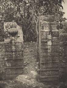
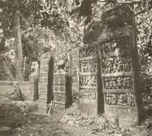
The pre-historic era's "Mandpeshwar" (“An 8th Century remains of a beautiful Edifice structure, Mandapeshwar caves is a rock cut architecture and a Hindu shrine of lord Shiva located near Borivali IC Colony, at walking distance from Dahisar Railway Station”) and "Kanheri caves" stand testament to the rich history of this place. Borivali was spelt "Berewlee" by the then ruled India under the British Raj Era. It is also spelt and pronounced as "Borivli".
Borivali is densely populated but continues to retain some green cover due to the presence of the Sanjay Gandhi National Park,[3] previously known as the "Borivali National Park" in the east and the mangroves in the west end of Borivali.
Landmarks
One of the many gardens that Borivali boasts of is the Veer Savarkar Udyan on Lokmanya Tilak Road. It has four entrances from T.P.S. Road, Factory Lane and Babhai and is an ideal place for all which have facilities like jogging track, boating area, kids' play-garden, skating etc. Gorai Udyan is at Gorai Sector-1.
In 2009, Jhansi Ki Rani Laxmibai Joggers' Park[4] was inaugurated on Link Road adjacent to the Eskay Resort. The plot measures around 4 acres, has a jogging track surrounding a body of water where boating facilities have been started and features slabs with information on various freedom fighters scripted on them, besides seating areas for senior citizens. This Jogger's Park has a small fee for entry. Another Joggers' Park is located in Chikuwadi.
Transport
Road Ways: Autorickshaws, Taxis, BEST buses and Trains are the public modes of transport available in and to Borivali. Borivali (east) is well connected with Western Express Highway while Borivali (west) is linked to the New Link Road. Connectivity is set to increase with the two metro lines set to pass through Borivali viz. Mumbai Metro Line 2 and Mumbai Metro Line 7.
Railway station
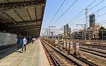
Borivali railway station is a railway station on the Western line of the Mumbai Suburban Railway network. It is one of the major platforms of the Mumbai metropolitan city and the biggest railway station in the Western railway. The platform has access to all stations from Churchgate to Virar. The platform has good connectivity for Express trains which goes to different states around the country. It has 10 platforms with every platform being busy for almost 18–20 hours a day. It is believed to be one of the blind-friendly railway stations on the western railway. Information obtained under the Right to Information (RTI) Act reveals that It is the most crowded station in Mumbai with around 2.87 lakh passengers traveling from there daily. Inspired by Prime Minister Narendra Modi’s Swachh Bharat Abhiyan, nearly 500 volunteers from an NGO ‘Making A Difference’ (MAD) has given a new look to Borivali Railway Station. This is a symbolical message to the people regarding the Swachh Bharat Abhiyan by Prime Minister Narendra Modi.
Notable People
- Rohit Sharma, Indian cricketer, Swami Vivekanand International School student[5]
- Jaywant Dalvi, Marathi author
- Dhondutai Kulkarni, Hindustani classical singer
- Ratnakar Pai, Hindustani classical singer
- Drashti Dhami, TV actress
- Avdhoot Gupte, Marathi classical singer
- Bhavya Gandhi, child artist known as Tapu in "Taarak Mehta Ka Ooltah Chashmah"
- Tanuj Mahashabde, artist known as Iyer in "Taarak Mehta Ka Ooltah Chashmah"
- Rohan Shah, actor, acted in Channel V and "Aao Wish Karein" (movie)
- Asha Bhosale, singer
- Bose Krishnamachari, Malayali painter
- Vinod Tawde, Member of Legislative Assembly, Minister
- Ram Naik, UP Governor, former minister
- Arun Nair, Digital Media Mogul and Philanthropist
- Haribhai P. Chaudhary, politician , National Leader (Bharatiya Janata Party)
Attractions
- Gorai Beach is on the western end of Borivali. One can reach here by crossing the Gorai Creek in a ferry. Rickshaw is available on the other side of the ferry. On holidays the beach is full of visitors and locals. Plenty of accommodation options are also available at Gorai beach.[6]
- Essel World: One of Mumbai's largest amusement parks.[7]
- Water Kingdom: Asia's largest water park.[8]
- Sanjay Gandhi National Park is one of the famous national park within the metro limit and one of the most visited park in the world.
- Mandapeshwar Caves
- Global Vipassana Pagoda
- Saibaba Mandir in Saibaba Nagar
- Mumbai Cricket Association (MCA) Gymkhana
- Mandpeshwar Caves
- Ambe Mata Mandir
- Swatantryaveer Savarkar Udyan: One of the biggest garden for kids, senior citizens
- Omkareshwar Mandir near national park is the Lord Shankar temple where people visit daily
- Ganpati Mandir in Vazira Naka is the ancient temple where hundreds of people go and worship the lord Ganesh
Schools & Colleges
- Rustomjee International School & Junior College
- Namdar Gopal Krishna Gokhale High School
- R. C. Patel High School
- VIBGYOR Group of Schools[9]
- Swami Vivekanand International School
- Saint Francis D'Assisi High School
- Mary Immaculate Girls' High School
- Our Lady of Vailankanni High School
- Abhinav Vidya Mandir
- S.E. International School
- Himalaya High School, Borivali (West)
- St. Johns High School, Borivali (East)
- M.J. Junior College Of Science, Borivali (West)
- Don Bosco High School
- Sheth Gopalji Hemraj High School
- Gopal's Garden High School
- Smt. Jayaben Khot High School
- St. Anne's High School
- Mumbai World High School, Borivali (West)
- Dr. Sarvepalli Radhakrishnan Vidyalaya
- Narayana E Techno School, I C Colony, Borivali (West)
- Sheth Daulatram Mohandas High School, Daulat Nagar, Borivali (East)
- Sri Sri Ravishankar Vidya Mandir, Kulup Wadi, Near National Park, Borivali (East)
- Matushri Kashiben Vrajlal Valia International Vidyalaya, Factory Lane, Borivali (West)
- Chogale High School, Borivali (East)
- St. Lawrence High School, Devidas Road, LIC Colony, Borivali West
- S.P.S.Suvidyalaya, Vazira naka, Borivali (West)
- Poisur Municipal School, Poisar, Borivali (West)
References
- Covers western part of the suburb
- Covers eastern part of the suburb
- "The Sanjay Gandhi National Park" (SGNP)
- https://timesofindia.indiatimes.com/city/mumbai/Borivli-residents-get-a-joggers-park/articleshow/3932344.cms
- "Rohit makes a mark with T20". NDTV. 25 September 2007. Retrieved 16 April 2008.
- "Gorai Beach". Retrieved 26 March 2012.
- "Esselworld". www.esselworld.in. Retrieved 5 December 2017.
- "Water Kingdom - Asia's Largest Theme Water Park". www.waterkingdom.in. Retrieved 5 December 2017.
- "ICSE | CBSE School in Borivali, Mumbai - VIBGYOR High". www.vibgyorhigh.com. Retrieved 25 November 2017.