Biru County
Biru County (Tibetan: འབྲི་རུ་རྫོང་། ; Chinese: 比如县) is the most populated county within Nagqu of the Tibet Autonomous Region. The name means "female yak". Either of the following pronunciations can be considered correct in Standard Tibetan: [bìru] ~ [pìru] (conventionally written Biru in English) or [ɖìru] ~ [ʈìru] (conventionally Driru).


Biru County 比如县 • འབྲི་རུ་རྫོང་། | |
|---|---|
County | |
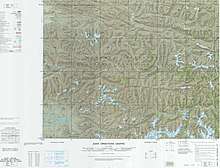
.png) Location of Biru County (red) within Nagqu City (yellow) and the Tibet Autonomous Region | |
 Biru Location of the seat in Tibet Autonomous Region | |
| Coordinates: 31°46′39″N 93°33′00″E | |
| Country | People's Republic of China |
| Autonomous region | Tibet |
| Prefecture-level city | Nagqu |
| Time zone | UTC+8 (China Standard) |
| Biru County | |||||||||||
|---|---|---|---|---|---|---|---|---|---|---|---|
| Chinese name | |||||||||||
| Simplified Chinese | 比如县 | ||||||||||
| Traditional Chinese | 比如縣 | ||||||||||
| |||||||||||
| Tibetan name | |||||||||||
| Tibetan | འབྲི་རུ་རྫོང་། | ||||||||||
| |||||||||||
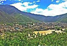
Diru/Driru/ Biru lies in the southwest part of the former province of Kham. To its east is Chamdo and to its west Nagchu. Diru/Driru/Biru is located on the Gyalmo Ngulchu River (upper part of Gyalmo Ngulchu). Diru is bordered by Sog county སོག་རྫོང་། to the northwest and the extreme east of Palbar (Banbar County) དཔལ་འབར་རྫོང་, is also surrounded by Lhari county ལྷ་རི་རྫོང་/ to the south, and extreme north to the Nagchu county.
The Biru Skull Wall

At the 2009 PRC census, the county's population was 60,179, of whom:
| Name of group | Number | Percentage |
|---|---|---|
| Tibetans | 59,824 | 99.21% |
| Han | 313 | 0.69% |
| Bai | 11 | 0.02% |
| Uyghurs | 9 | 0.02% |
| Others | 22 | 0.05% |
| District | 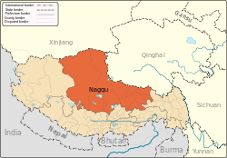 | |
|---|---|---|
| Counties | ||
| Towns and villages |
| |
| Geography |
| |