Bannang Sata District
Bannang Sata (Thai: บันนังสตา, pronounced [bān.nāŋ sā.tāː]; Malay: Benang Setar) is a district (amphoe) in the southern part of Yala Province, southern Thailand.
Bannang Sata บันนังสตา | |
|---|---|
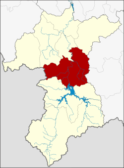 District location in Yala Province | |
| Coordinates: 6°16′0″N 101°15′52″E | |
| Country | Thailand |
| Province | Yala |
| Seat | Bannang Sata |
| Area | |
| • Total | 629.0 km2 (242.9 sq mi) |
| Population (2014) | |
| • Total | 58,616 |
| • Density | 84.5/km2 (219/sq mi) |
| Time zone | UTC+7 (ICT) |
| Postal code | 95130 |
| Geocode | 9503 |
History
The name Bannang Sata is the Thai corruption of Benang Setar (Jawi: بنڠ ستار), its original Malay name. Benang means 'sewing thread', while setar is a 'tree with small, sour fruit' (Bouea macrophylla).[1]
In the past the district was named Ba Cho (บาเจาะ) controlled by Mueang Raman, created in 1907.[2] The name Ba Cho is a Thai corruption of 'Bachok (Jawi: باچوق), its original Malay name. Later, the district office was moved to a new location and renamed Bannang Sata.[3]
Geography
Neighboring districts are (from the northwest clockwise): Yaha, Krong Pinang, and Raman of Yala Province; Rueso and Si Sakhon of Narathiwat Province; Than To of Yala Province; and Kedah state of Malaysia.
Administration
Central administration
Bannang Sata is divided into six sub-districts (tambons), which are further subdivided into 50 administrative villages (mubans).
| No. | Name | Thai | Villages | Pop.[4] |
|---|---|---|---|---|
| 1. | Bannang Sata | บันนังสตา | 11 | 19,445 |
| 2. | Bacho | บาเจาะ | 5 | 8,318 |
| 3. | Tano Pute | ตาเนาะปูเต๊ะ | 10 | 9,741 |
| 4. | Tham Thalu | ถ้ำทะลุ | 5 | 2,998 |
| 5. | Taling Chan | ตลิ่งชัน | 13 | 13,879 |
| 6. | Khuean Bang Lang | เขื่อนบางลาง | 6 | 4,235 |
Local administration
There are two sub-district municipalities (thesaban tambons) in the district:
- Bannang Sata (Thai: เทศบาลตำบลบันนังสตา) consisting of parts of sub-district Bannang Sata.
- Khuean Bang Lang (Thai: เทศบาลตำบลเขื่อนบางลาง) consisting of sub-district Khuean Bang Lang.
There are five sub-district administrative organizations (SAO) in the district:
- Bannang Sata (Thai: องค์การบริหารส่วนตำบลบันนังสตา) consisting of parts of sub-district Bannang Sata.
- Bacho (Thai: องค์การบริหารส่วนตำบลบาเจาะ) consisting of sub-district Bacho.
- Tano Pute (Thai: องค์การบริหารส่วนตำบลตาเนาะปูเต๊ะ) consisting of sub-district Tano Pute.
- Tham Thalu (Thai: องค์การบริหารส่วนตำบลถ้ำทะลุ) consisting of sub-district Tham Thalu.
- Taling Chan (Thai: องค์การบริหารส่วนตำบลตลิ่งชัน) consisting of sub-district Taling Chan.
References
- Chote Suvatti (1938). A Check-list of Aquatic Fauna in Siam (excluding Fishes). Bureau of Fisheries. p. 81.
- "แจ้งความกระทรวงมหาดไทย เรื่อง ย้ายที่ว่าการอำเภอบาเจาะเมืองราห์มันไปตั้งที่ตำบลบันนังสตาขึ้นเมืองราห์มัน ย้ายที่ว่าการอำเภอเบตงตั้งที่บ้านชดาบ ส่วนที่ว่าการอำเภอเบตงในเวลานี้ให้ตั้งเป็นกิ่งอำเภอ" (PDF). Royal Gazette (in Thai). 24 (39): 1037–1038. 1907-12-29.
- "แจ้งความกระทรวงมหาดไทย เรื่อง ย้ายที่ว่าการอำเภอบาเจาะไปตั้งที่ตำบลบันนังสตาแล้ว ขอเปลี่ยนนามอำเภอบาเจาะว่าอำเภอบันนังสตา" (PDF). Royal Gazette (in Thai). 24 (52): 1405. 1908-03-29.
- "Population statistics 2014" (in Thai). Department of Provincial Administration. Retrieved 2015-05-20.