Forreston, South Australia
Forreston is a locality near Adelaide, South Australia. It is located in the Adelaide Hills Council local government area 3 km northeast of Gumeracha.
| Forreston South Australia | |||||||||||||||
|---|---|---|---|---|---|---|---|---|---|---|---|---|---|---|---|
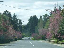 The main street of Forreston, South Australia in full bloom at springtime | |||||||||||||||
 Forreston | |||||||||||||||
| Coordinates | 34°48′0″S 138°54′0″E | ||||||||||||||
| Population |
| ||||||||||||||
| Established | 1850 | ||||||||||||||
| Postcode(s) | 5233 | ||||||||||||||
| Location | |||||||||||||||
| LGA(s) | Adelaide Hills Council | ||||||||||||||
| State electorate(s) | Newland | ||||||||||||||
| Federal Division(s) | Mayo | ||||||||||||||
| |||||||||||||||
History
The town was named in honour of its founder, Alexander Forrest (not to be confused with the Western Australian explorer and surveyor of the same name).
Forreston is curious in that, being only 3 km from Gumeracha, it did so well. Alexander Forrest, a blacksmith by trade, arrived in South Australia in 1848, settling in the Forreston area in 1850 and laying out the village in 1858. The Gumeracha North School opened in 1860 and closed in 1967.[3] At one stage, it had a post office, store, wine shop, wheelwright, blacksmith, butcher, school and more.[4] In 1884, gold was found at nearby Watts Gully in 1884, yielding nuggets as large as 14 ounces, and the town peaked.[5] However, the town is no more, with only reminders in its historical buildings, including Forrest's original home, of its vibrant commercial past.
The region relies heavily on grazing, dairying and market gardening.
Geography
Forreston is located 3 km northeast of Gumeracha on the road to Williamstown. Forreston is served by facilities in Gumeracha.
Transport
The area is not serviced by the Adelaide Metro public transport network, but regular public coaches are operated from Tea Tree Plaza Interchange to nearby Gumeracha, Birdwood and Mount Pleasant by LinkSA.[6]
References
- Australian Bureau of Statistics (31 October 2012). "Forreston (State Suburb)". 2011 Census QuickStats. Retrieved 3 February 2016.

- Australian Bureau of Statistics (25 October 2007). "Forreston (State Suburb)". 2006 Census QuickStats. Retrieved 3 February 2016.
- State Library of SA - Place Names Accessed 16 June 2006.
- Community Webs - Forreston Archived 1 September 2006 at the Wayback Machine includes 1900 map of the town.
- Adelaide Hills Council - Historical Town Information Archived 25 June 2006 at the Wayback Machine Accessed 16 June 2006.
- "Timetable Route 800-801-802-803" (PDF). LinkSA. 12 March 2017. Retrieved 24 July 2018.
External links