62nd Street/New Utrecht Avenue station
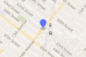
62nd Street/New Utrecht Avenue is a New York City Subway station complex shared by the open-cut BMT Sea Beach Line and the elevated BMT West End Line. It is located at New Utrecht Avenue and 62nd Street in Borough Park and Bensonhurst, Brooklyn, and is served by the D and N trains at all times, as well as by some W trains during rush hours.
62 Street/New Utrecht Avenue | |||||||||||
|---|---|---|---|---|---|---|---|---|---|---|---|
 | |||||||||||
| Station statistics | |||||||||||
| Address | New Utrecht Avenue & 62nd Street Brooklyn, NY 11219 | ||||||||||
| Borough | Brooklyn | ||||||||||
| Locale | Bensonhurst, Borough Park | ||||||||||
| Coordinates | 40.626086°N 73.997887°W | ||||||||||
| Division | B (BMT) | ||||||||||
| Line | BMT Sea Beach Line BMT West End Line | ||||||||||
| Services | D N W | ||||||||||
| Transit connections | |||||||||||
| Levels | 2 | ||||||||||
| Other information | |||||||||||
| Station code | 615[1] | ||||||||||
| Accessible | |||||||||||
| Traffic | |||||||||||
| Passengers (2019) | 1,501,183[2] | ||||||||||
| Rank | 297 out of 424[2] | ||||||||||
| |||||||||||
| |||||||||||
| |||||||||||


Prior to the rebuilding of the two current subway lines at this location during the 1910s, this location was known as Bath Junction. Until then, there was a track connection between the lines, primarily to enable Sea Beach trains to and from Coney Island to access West End Line trackage to reach the Brooklyn Bridge and the Park Row Terminal in Lower Manhattan. From 2016 to 2019, the complex underwent an extensive renovation.
History
Bath Junction
Bath Junction was located near the present site of the station. It took the name as a railroad junction of the New York & Sea Beach Railway (Sea Beach Line) with the Brooklyn, Bath Coney Island Railroad (West End Line). The NY&SB called the station at the junction Bath Junction, while the BB&CI called it Sea Beach Junction. Soon, however, they settled on the common name. Bath Junction was located at grade near the current intersection of New Utrecht Avenue and 62nd Street.
The junction included a switching track connecting the two lines, so that NY&SB trains might reach the Brooklyn Bridge via the BB&CI tracks. Both lines merged with the BMT Culver Line at Ninth Avenue and later the BMT Fifth Avenue Line and BMT Myrtle Avenue Line.
After both lines were rebuilt as rapid transit lines of the Brooklyn Rapid Transit Company, the name "Bath Junction" was dropped. A connector was no longer necessary, as the West End Line was able to reach Manhattan on its own, and was not even realistic to plan, as one line dropped into a cut and the other became elevated. The multi-level station complex was created to allow passenger transfer between the two lines.
Later history
In 1985, this station had only 189 paying daily riders on a typical weekday, not counting farebeaters, making it one of the least used stations in the system.[3] As of 2018, the station had 4,673 paying riders on a typical weekday, equating to 1,503,742 total riders in 2018.[2]
This entire station complex, along with eight other stations along the Sea Beach Line, underwent a rehabilitation involving the installation of 4 ADA-accessible elevators from 2015 to July 2019. The transfer between the two stations was closed until July 2019 for installation of the elevators; an out-of-system transfer was provided.[4][5][6] The project to make the station ADA-accessible was originally proposed to be completed in spring 2019.[7] At one point, construction was expected to continue until October, but the elevators entered service on July 19, 2019.[8][9]
Station layout
| 2F Platform level |
Northbound local | ← |
| Island platform | ||
| Peak-direction express | No regular service (Ninth Avenue or Bay Parkway) | |
| Island platform | ||
| Southbound local | | |
| 1F | Mezzanine | Station agent, MetroCard machines |
| G | Street level | Entrances/exits |
| B1 Platform level |
Side platform | |
| Northbound local | ← ← | |
| Reversible express | No regular service | |
| Center track | Trackbed | |
| Southbound local | | |
| Side platform | ||
BMT West End Line platforms
62 Street | |||||||
|---|---|---|---|---|---|---|---|
.jpg) New elevators at the West End Line platforms | |||||||
| Station statistics | |||||||
| Division | B (BMT) | ||||||
| Line | BMT West End Line | ||||||
| Services | D | ||||||
| Structure | Elevated | ||||||
| Platforms | 2 island platforms cross-platform interchange | ||||||
| Tracks | 3 (2 in regular service) | ||||||
| Other information | |||||||
| Opened | June 24, 1916 | ||||||
| Station code | 063[1] | ||||||
| Accessible | |||||||
| Opposite-direction transfer available | Yes | ||||||
| Station succession | |||||||
| Next north | Ninth Avenue (express): no regular service 55th Street (local): D | ||||||
| Next | Atlantic Avenue–Barclays Center: D | ||||||
| Next south | 71st Street (local): D Bay Parkway (express): no regular service | ||||||
| Next | Bay Parkway: D | ||||||
| |||||||
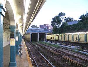
62nd Street is an express station on the BMT West End Line that opened on June 24, 1916 as the terminal station of the first phase of the opening of the West End Line.[10][11]
The station has three tracks and two island platforms. The middle express track is only used for re-routings and non-revenue movements.
Exits
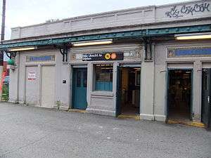
There are two fare control areas. The full-time side is at 62nd Street (south end of station) and has the transfer to the BMT Sea Beach Line. The part-time side is at 60th Street (north end).[12] The 60th Street exit is where the famous chase scene in the 1971 film, The French Connection ends. This side was renovated and is HEET access for most of the day. A booth formerly existed here, but is now mostly empty space in the station house. New windows and lighting restored this mezzanine to good condition. However, the staircases from the street still have wooden boards. The station-house for the BMT Sea Beach Line used to have a newsstand and two additional doors on the left side. From October 2010 to May 2012, this station was renovated with two new fare controls, new canopy and platform edges, and repainted side roof and beams.
On the street, the southern station entrance is set back from New Utrecht Avenue. It is to the left when facing the Tomche Shabbos food pantry warehouse; there is a small, fenced-in overgrown area separating them, with a small MTA informational sign on the chain link. The station house is also visible from 62nd Street, but there is a small MTA lot for separating street from station, designated for bus turnarounds, MTA maintenance, and MTA employee parking only. A staircase leads to the second floor of the station house, where a covered, open-air passageway provides access the south ends of the elevated platforms.[12]
BMT Sea Beach Line platforms
New Utrecht Avenue | |||||||||||
|---|---|---|---|---|---|---|---|---|---|---|---|
 Eastern end of platforms before renovations | |||||||||||
| Station statistics | |||||||||||
| Division | B (BMT) | ||||||||||
| Line | BMT Sea Beach Line | ||||||||||
| Services | N W | ||||||||||
| Structure | Open-cut | ||||||||||
| Platforms | 2 side platforms | ||||||||||
| Tracks | 4 (2 in regular service) | ||||||||||
| Other information | |||||||||||
| Opened | June 22, 1915[13] | ||||||||||
| Station code | 073[1] | ||||||||||
| Accessible | |||||||||||
| Opposite-direction transfer available | Yes | ||||||||||
| Station succession | |||||||||||
| Next north | Fort Hamilton Parkway: N | ||||||||||
| Next | Eighth Avenue: N | ||||||||||
| Next south | 18th Avenue: N | ||||||||||
| Next | none: W Coney Island–Stillwell Avenue: N | ||||||||||
| |||||||||||
New Utrecht Avenue Station (Dual System BRT) | |||||||||||
| MPS | New York City Subway System MPS | ||||||||||
| NRHP reference No. | 05000678[14] | ||||||||||
| Added to NRHP | July 6, 2005 | ||||||||||
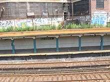
New Utrecht Avenue on the BMT Sea Beach Line has four tracks and two side platforms. Platform extensions are to the north end of the station and beyond the main staircase. Although most of the station is in an open cut, both ends of both platforms are underneath tunnels. This segment of the station has been listed on the National Register of Historic Places since 2005.[15]
As part of a renovation project at nine stations along the Sea Beach Line, the Manhattan-bound platform at this station was closed from January 18, 2016 to May 22, 2017.[16][17] The Coney Island-bound platform was closed for a much longer period of time, from July 31, 2017 to July 1, 2019.[18][19]
Exits
The north end has two staircases to the full-time booth, where the transfer to the elevated BMT West End Line is available. The south end at 15th Avenue and 63rd Street is HEET access and formerly had a booth.[12] The north end has unusual bricks on the staircase walls, suggesting the staircases were redone when the platform was extended. The original entrance had only one staircase to platform level. After the platform extension, the staircase was redone in a T formation along with the installation of brick walls.
References
- "Station Developers' Information". Metropolitan Transportation Authority. Retrieved June 13, 2017.
- "Facts and Figures: Annual Subway Ridership 2014–2019". Metropolitan Transportation Authority. 2020. Retrieved May 26, 2020.
- Levine, Richard (November 5, 1986). "COLUMN ONE: TRANSPORT". The New York Times. ISSN 0362-4331. Retrieved October 2, 2016.
- "Two elevators coming to the N line during massive rehabilitation". October 4, 2013. Archived from the original on March 13, 2014. Retrieved May 24, 2014.
- "Transfer passageway will be closed for elevator installation". Metropolitan Transportation Authority. November 23, 2017. Retrieved November 23, 2017.
- "Planned Service Changes for: Monday, November 27, 2017". travel.mtanyct.info. Metropolitan Transportation Authority. Retrieved November 23, 2017.
- "T6041317 ADA Accessibility at New Utrecht Avenue Station on the Sea Beach Line and 62 St Station on the West End Line". web.mta.info. Metropolitan Transportation Authority. Archived from the original on September 3, 2017. Retrieved September 3, 2017.
- "Capital Program Oversight Committee Meeting November 2018" (PDF). Metropolitan Transportation Authority. November 13, 2018. p. 92. Retrieved November 10, 2018.
- "MTA Installs Four Elevators, Other ADA Features at New Utrecht Av/62 St Station Complex". mta.info. Metropolitan Transportation Authority. July 19, 2019. Retrieved July 19, 2019.
- "Realty Boom Is Predicted for Borough Park Section". Brooklyn Daily Eagle. June 24, 1916. Retrieved September 16, 2015.
- "Parade, Pageant Mark Celebration: Borough Park Civic Bodies and School Children Join in Festivities: West End Line Opened: First Train From Manhattan Over New "L" Extension of Dual System to Sixty-Second Street". Brooklyn Daily Eagle. June 24, 1916. Retrieved September 16, 2015.
- "MTA Neighborhood Maps: Bensonhurst" (PDF). mta.info. Metropolitan Transportation Authority. 2015. Retrieved August 15, 2016.
- "Through Tube to Coney, 48 Minutes: First Train on Fourth Avenue Route Beats West End Line Eleven Minutes". Brooklyn Daily Eagle. June 22, 1915. Retrieved June 29, 2015.
- "NPS Focus". National Register of Historic Places. National Park Service. Retrieved December 9, 2011.
- Kings County Listing at the National Register of Historic Places (Structure #05000678)
- "N Line Sea Beach - 2016". web.mta.info. Retrieved January 18, 2016.
- "9 Brooklyn N train stations to shut down for 14 months". am New York. January 14, 2016. Archived from the original on January 18, 2016. Retrieved January 18, 2016.
- Katinas, Paula (December 18, 2014). "Commuter headache: MTA to renovate N train stations". Brooklyn Daily Eagle. Archived from the original on October 27, 2018. Retrieved January 18, 2016.
- "New York City Subway Map" (PDF). mta.info. Metropolitan Transportation Authority. May 1, 2017. Archived from the original (PDF) on May 2, 2017. Retrieved May 2, 2017.
- DeJesus, Jaime (May 17, 2017). "Manhattan-bound service to return to N stations on Sea Beach Line". brooklynreporter.com. Retrieved May 18, 2017.
- "Manhattan-Bound Service Returns to N Stations on Sea Beach Line". www.mta.info. Metropolitan Transportation Authority. May 17, 2017. Archived from the original on July 30, 2017. Retrieved May 26, 2017.
External links
| Wikimedia Commons has media related to New Utrecht Avenue/62nd Street (New York City Subway). |
- nycsubway.org – BMT Sea Beach Line: New Utrecht Avenue
- nycsubway.org – BMT West End Line: 62nd Street
- Station Reporter — 62nd Street/New Utrecht Avenue Complex
- The Subway Nut — New Utrecht Avenue Pictures
- 62nd Street entrance from Google Maps Street View
- 60th Street entrance from Google Maps Street View
- 15th Avenue entrance from Google Maps Street View
- Sea Beach Line platforms from Google Maps Street View
- West End Line platforms from Google Maps Street View
| Sea Beach Line | |
|---|---|
| West End Line |
|
| |