Zemio Airport
| Zemio Airport | |||||||||||
|---|---|---|---|---|---|---|---|---|---|---|---|
| Summary | |||||||||||
| Airport type | Public | ||||||||||
| Owner | Government | ||||||||||
| Serves | Zemio, Central African Republic | ||||||||||
| Elevation AMSL | 1,995 ft / 608 m | ||||||||||
| Coordinates | 05°02′12″N 25°08′55″E / 5.03667°N 25.14861°ECoordinates: 05°02′12″N 25°08′55″E / 5.03667°N 25.14861°E | ||||||||||
| Map | |||||||||||
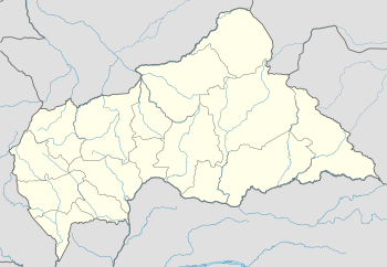 IMO Location of the airport in Central African Republic | |||||||||||
| Runways | |||||||||||
| |||||||||||
Zemio Airport (IATA: IMO, ICAO: FEFZ) is an airport serving the village of Zemio, in the Haut-Mbomou prefecture of the Central African Republic. The airport is located just northeast of the village.
See also

- Transport in the Central African Republic
- List of airports in the Central African Republic
References
- ↑ Airport information for Zemio Airport at Great Circle Mapper.
- ↑ "Zemio Airport". Google Maps. Google. Retrieved 10 July 2018.
External links
- OpenStreetMap - Zemio
- FallingRain - Zemio Airport
- OurAirports - Zemio Airport
- Accident history for Zemio Airport at Aviation Safety Network
This article is issued from
Wikipedia.
The text is licensed under Creative Commons - Attribution - Sharealike.
Additional terms may apply for the media files.