Zellertal
| Zellertal | ||
|---|---|---|
| ||
 Zellertal Location of Zellertal within Donnersbergkreis district 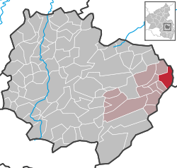 | ||
| Coordinates: 49°38′57″N 08°08′22″E / 49.64917°N 8.13944°ECoordinates: 49°38′57″N 08°08′22″E / 49.64917°N 8.13944°E | ||
| Country | Germany | |
| State | Rhineland-Palatinate | |
| District | Donnersbergkreis | |
| Municipal assoc. | Göllheim | |
| Government | ||
| • Mayor | Raimund Osterroth | |
| Area | ||
| • Total | 6.93 km2 (2.68 sq mi) | |
| Elevation | 205 m (673 ft) | |
| Population (2017-12-31)[1] | ||
| • Total | 1,157 | |
| • Density | 170/km2 (430/sq mi) | |
| Time zone | CET/CEST (UTC+1/+2) | |
| Postal codes | 67308 | |
| Dialling codes | 06355 | |
| Vehicle registration | KIB | |
| Website | www.goellheim.de | |

Zellertal is a municipality in the Donnersbergkreis district, in Rhineland-Palatinate, Germany.
The villages of Zell, Harxheim and Niefernheim form Zellertal.
Zellertal is in Zellertal region, which in turn is part of the Palatinate wine region and borders on the Rhenish Hesse wine region.
Economy
The local economy is based on viticulture and tourism related to viticulture. See Rhineland-Palatinate for a further description of the local viticulture.
References
- ↑ Statistisches Landesamt Rheinland-Pfalz "Bevölkerungsstand 2017 - Gemeindeebene" Check
|url=value (help). Statistisches Landesamt Rheinland-Pfalz (in German). 2018.
External links
- Guide to businesses in the Zellertal region (in German)
This article is issued from
Wikipedia.
The text is licensed under Creative Commons - Attribution - Sharealike.
Additional terms may apply for the media files.