Stetten, Rhineland-Palatinate
| Stetten | |
|---|---|
 Stetten Location of Stetten within Donnersbergkreis district 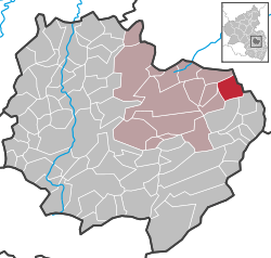 | |
| Coordinates: 49°40′19″N 8°5′38″E / 49.67194°N 8.09389°ECoordinates: 49°40′19″N 8°5′38″E / 49.67194°N 8.09389°E | |
| Country | Germany |
| State | Rhineland-Palatinate |
| District | Donnersbergkreis |
| Municipal assoc. | Kirchheimbolanden |
| Government | |
| • Mayor | Claus-Jürgen Baaden |
| Area | |
| • Total | 6.54 km2 (2.53 sq mi) |
| Elevation | 235 m (771 ft) |
| Population (2017-12-31)[1] | |
| • Total | 639 |
| • Density | 98/km2 (250/sq mi) |
| Time zone | CET/CEST (UTC+1/+2) |
| Postal codes | 67294 |
| Dialling codes | 06355 |
| Vehicle registration | KIB |
| Website | www.kirchheimbolanden.de |
Stetten is a municipality in Rhineland-Palatinate, Germany.
History
The first documented record of Stetten occurred in 835.
Stetten was very badly damaged by 1635 due to the Thirty Years' War.
The region of Stetten, Palatinate was previously a district of the Kingdom of Bavaria. It became part of Rhineland-Palatinate in 1946.
References
- ↑ Statistisches Landesamt Rheinland-Pfalz "Bevölkerungsstand 2017 - Gemeindeebene" Check
|url=value (help). Statistisches Landesamt Rheinland-Pfalz (in German). 2018.
External links
- www.kirchheimbolanden.de — official website (in German)
- www.ngw.nl — coat of arms
- www.tus-stetten.de — TuS 1860 Stetten/Pfalz e. V. (in German)
This article is issued from
Wikipedia.
The text is licensed under Creative Commons - Attribution - Sharealike.
Additional terms may apply for the media files.