Winnweiler
| Winnweiler | ||
|---|---|---|
| ||
 Winnweiler Location of Winnweiler within Donnersbergkreis district 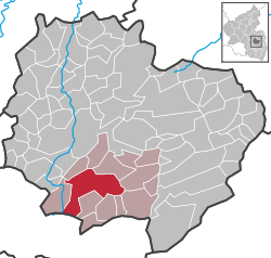 | ||
| Coordinates: 49°34′09″N 7°51′14″E / 49.56917°N 7.85389°ECoordinates: 49°34′09″N 7°51′14″E / 49.56917°N 7.85389°E | ||
| Country | Germany | |
| State | Rhineland-Palatinate | |
| District | Donnersbergkreis | |
| Municipal assoc. | Winnweiler | |
| Government | ||
| • Mayor | Robert Simon (SPD) | |
| Area | ||
| • Total | 21.80 km2 (8.42 sq mi) | |
| Elevation | 240 m (790 ft) | |
| Population (2017-12-31)[1] | ||
| • Total | 4,748 | |
| • Density | 220/km2 (560/sq mi) | |
| Time zone | CET/CEST (UTC+1/+2) | |
| Postal codes | 67722 | |
| Dialling codes | 06302 | |
| Vehicle registration | KIB | |
| Website | www.winnweiler.de | |

Winnweiler is a municipality in the Donnersbergkreis, in Rhineland-Palatinate, Germany. It is situated on the upper course of the river Alsenz, approx. 15 km (9.3 mi) north-east of Kaiserslautern. Winnweiler is the seat of the Verbandsgemeinde ("collective municipality") Winnweiler. Winnweiler station is on the Alsenz Valley Railway (Alsenztalbahn), running between Hochspeyer and Bad Münster am Stein.
The settlement in Rhenish Franconia was first mentioned in an 891 deed, from the 12th century onwards it was a possession of the Counts of Falkenstein. As a Lorraine exclave it fell to the House of Habsburg upon the marriage of Maria Theresa of Austria with Duke Francis III Stephen in 1736. It was thereafter administered as an Oberamt of Further Austria until its occupation by French troops in 1797.
Notable people
- Wilhelm Heinrich Erb (1840 – 1921), neurologist
References
- ↑ Statistisches Landesamt Rheinland-Pfalz "Bevölkerungsstand 2017 - Gemeindeebene" Check
|url=value (help). Statistisches Landesamt Rheinland-Pfalz (in German). 2018.