Zápy
| Zápy | |||
|---|---|---|---|
| Municipality and market town | |||
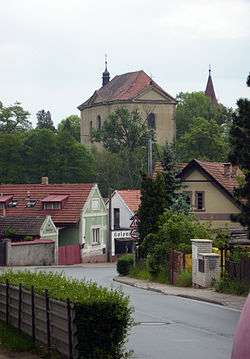 Church of Saint James the Elder | |||
| |||
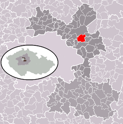 | |||
 Zápy Location in the Czech Republic | |||
| Coordinates: 50°9′48″N 14°40′42″E / 50.16333°N 14.67833°ECoordinates: 50°9′48″N 14°40′42″E / 50.16333°N 14.67833°E | |||
| Country |
| ||
| Region | Central Bohemian Region | ||
| District | Prague-East District | ||
| Area | |||
| • Total | 3.38 sq mi (8.76 km2) | ||
| Elevation | 659 ft (201 m) | ||
| Population (2011) | |||
| • Total | 816 | ||
| • Density | 240/sq mi (93/km2) | ||
| Time zone | UTC+1 (CET) | ||
| • Summer (DST) | UTC+2 (CEST) | ||

Zápy is a market town and municipality in Prague-East District in the Central Bohemian Region of the Czech Republic. It is located 5 kilometres from the town of Čelákovice. The municipality covers an area of 8.76 km² and in 2006 it had a population of 662.
References
- This article was initially translated from the Czech Wikipedia.
| Wikimedia Commons has media related to Zápy. |
This article is issued from
Wikipedia.
The text is licensed under Creative Commons - Attribution - Sharealike.
Additional terms may apply for the media files.