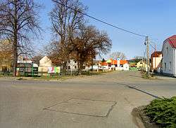
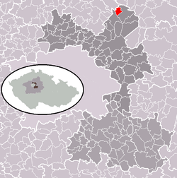
Konětopy (Prague-East District)
| Konětopy (District of Prague-East) | |||
|---|---|---|---|
| Municipality and village | |||
 | |||
| |||
 | |||
| Country |
| ||
| Region | Central Bohemian Region | ||
| District | Prague-East | ||
| Area | |||
| • Total | 1.17 sq mi (3.02 km2) | ||
| Elevation | 604 ft (184 m) | ||
| Population (2011) | |||
| • Total | 294 | ||
| • Density | 250/sq mi (97/km2) | ||
| Time zone | UTC+1 (CET) | ||
| • Summer (DST) | UTC+2 (CEST) | ||

Konětopy is a village and municipality in the District of Prague-East in the Central Bohemian Region, Czech Republic.
References
- This article was initially translated from the Czech Wikipedia.
Coordinates: 50°16′35″N 14°39′26″E / 50.2764°N 14.6572°E
This article is issued from
Wikipedia.
The text is licensed under Creative Commons - Attribution - Sharealike.
Additional terms may apply for the media files.