Struhařov (Prague-East District)
| Struhařov | |||
|---|---|---|---|
| Municipality and village | |||
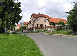 Common in Struhařov | |||
| |||
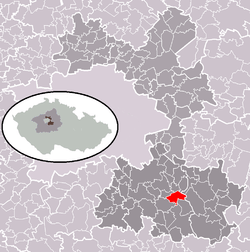 | |||
 Struhařov Location in the Czech Republic | |||
| Coordinates: 49°57′8″N 14°45′2″E / 49.95222°N 14.75056°ECoordinates: 49°57′8″N 14°45′2″E / 49.95222°N 14.75056°E | |||
| Country |
| ||
| Region | Central Bohemian Region | ||
| District | Prague-East District | ||
| Area | |||
| • Total | 2.23 sq mi (5.78 km2) | ||
| Elevation | 1,558 ft (475 m) | ||
| Population (2011) | |||
| • Total | 683 | ||
| • Density | 310/sq mi (120/km2) | ||
| Time zone | UTC+1 (CET) | ||
| • Summer (DST) | UTC+2 (CEST) | ||

Struhařov is a village and municipality in Prague-East District in the Central Bohemian Region of the Czech Republic. The municipality covers an area of 5.78 square kilometres (2.23 sq mi) and as of 2010 it had a population of 681.
First written notice about the village is from year 1397.
Gallery
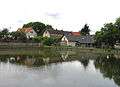 Common pond
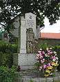 World War I memorial
References
| Wikimedia Commons has media related to Struhařov (Prague-East District). |
- This article was initially translated from the Czech Wikipedia.
This article is issued from
Wikipedia.
The text is licensed under Creative Commons - Attribution - Sharealike.
Additional terms may apply for the media files.