Dobřejovice
| Dobřejovice | |||
|---|---|---|---|
| Municipality and village | |||
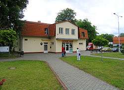 Municipal office in Dobřejovice | |||
| |||
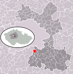 | |||
 Dobřejovice Location in the Czech Republic | |||
| Coordinates: 49°58′53″N 14°34′38″E / 49.98139°N 14.57722°ECoordinates: 49°58′53″N 14°34′38″E / 49.98139°N 14.57722°E | |||
| Country |
| ||
| Region | Central Bohemian Region | ||
| District | Prague-East District | ||
| Area | |||
| • Total | 1.48 sq mi (3.83 km2) | ||
| Elevation | 1,076 ft (328 m) | ||
| Population (2010) | |||
| • Total | 908 | ||
| Time zone | UTC+1 (CET) | ||
| • Summer (DST) | UTC+2 (CEST) | ||
| Post code | 251 70 | ||
| Wikimedia Commons has media related to Dobřejovice. |
Dobřejovice is a village in the Central Bohemian Region of the Czech Republic. On August 28, 2006 it had 757 inhabitants. The first written record of the village is from 1309. The municipality lies at an altitude of 328 metres and covers an area of 3.83 km².
Gallery
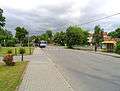 Common in Dobřejovice
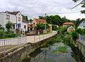 U Potoka street
External links
- Village website (cz)
This article is issued from
Wikipedia.
The text is licensed under Creative Commons - Attribution - Sharealike.
Additional terms may apply for the media files.