Yuzhnoye Butovo District
| Yuzhnoye Butovo District | |
|---|---|
 Location of Yuzhnoye Butovo District on the map of Moscow | |
.JPG) Street scene, Yuzhnoye Butovo District | |
.png) |
.png) |
|
| |
| Location | |
| Country | Russia |
| Federal subject | Moscow |
| Statistics | |
| Area | 27 km2 (10 sq mi)[1] |
| Population (2016 est.) | 207,903 inhabitants[1] |
| Density | 7,700.11/km2 (19,943.2/sq mi)[2] |
| Time zone | MSK (UTC+03:00)[3] |
| Official website | |
| Yuzhnoye Butovo District on WikiCommons | |
Yuzhnoye Butovo District (Southern Butovo, Russian: Ю́жное Бу́тово) is the biggest residential district in South-Western Administrative Okrug of Moscow, Russia. The district's history dates back to 1612, and it is named after a Don Cossack Butov. The area of the district is 27 square kilometres (10 sq mi)[1]. The population (July 2016) was 207,903.
Butovo memorial
Situated approximately 27 km south-east of Moscow, Butovo is the site of the Butovo firing range, a mass grave dating from the "Great Purge" of the 1930s. In excess of 20,000 people were shot and buried there from August 1937 to October 1938 . It has become a shrine to Joseph Stalin's victims and has an Orthodox church on the grounds.
References
- 1 2 3 "General Information" (in Russian). Yuzhnoye Butovo District. Retrieved April 12, 2018.
- ↑ The value of density was calculated automatically by dividing the 2016 population estimate by the area specified in the infobox. Please note that this value is only approximate as the area specified in the infobox does not necessarily correspond to the area of the entity proper or is reported for the same year as the population.
- ↑ Правительство Российской Федерации. Федеральный закон №107-ФЗ от 3 июня 2011 г. «Об исчислении времени», в ред. Федерального закона №271-ФЗ от 03 июля 2016 г. «О внесении изменений в Федеральный закон "Об исчислении времени"». Вступил в силу по истечении шестидесяти дней после дня официального опубликования (6 августа 2011 г.). Опубликован: "Российская газета", №120, 6 июня 2011 г. (Government of the Russian Federation. Federal Law #107-FZ of June 31, 2011 On Calculating Time, as amended by the Federal Law #271-FZ of July 03, 2016 On Amending Federal Law "On Calculating Time". Effective as of after sixty days following the day of the official publication.).
External links

Coordinates: 55°32′46″N 37°32′39″E / 55.54611°N 37.54417°E
| Central Administrative Okrug | 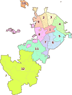 | |
|---|---|---|
| Northern Administrative Okrug | ||
| North-Eastern Administrative Okrug | ||
| Eastern Administrative Okrug | ||
| South-Eastern Administrative Okrug | ||
| Southern Administrative Okrug | ||
| South-Western Administrative Okrug | ||
| Western Administrative Okrug | ||
| North-Western Administrative Okrug | ||
| Zelenogradsky Administrative Okrug | ||
| Novomoskovsky Administrative Okrug |
| |
| Troitsky Administrative Okrug |
| |
This article is issued from
Wikipedia.
The text is licensed under Creative Commons - Attribution - Sharealike.
Additional terms may apply for the media files.