Severnoye Tushino District
| Severnoye Tushino District Северное Тушино (Russian) | |
|---|---|
 Location of Severnoye Tushino District on the map of Moscow | |
 | |
_(1997).png) |
.png) |
|
| |
| Location | |
| Country | Russia |
| Federal subject | Moscow |
| Statistics | |
| Time zone | MSK (UTC+03:00)[1] |
| Official website | |
| Severnoye Tushino District on WikiCommons | |
Severnoye Tushino District or Northern Tushino (Russian: райо́н Северное Тушино) is an administrative district (raion) of North-Western Administrative Okrug, and one of the 125 raions of Moscow, Russia.[2] In the district there are Alyoshkinsky forest and Severnoye Tushino park.
Location
The neighborhood is in the northern part of North-Western Administrative Okrug. On the South it borders on Yuzhnoye Tushino. The southern border consists of the Khimkinsky and Yana Raynisa boulevards that continue into Salomei Neris Street. On the East it borders on Levoberezhny District. There is Khimka reservoir, also known as the Moscow Canal.
History
Social Situation
Despite of the high alcohol and drug abuse and suicide rate, the neighborhood is considered to be highly desirable due to its proximity to parks, beaches and solid housing and transportation infrastructure. Within the last 20 years the neighborhood has been through a revival due to an influx of immigrants from former Soviet states like Armenia, Georgia, Uzbekistan, etc.
See also
| Wikimedia Commons has media related to North Tushino. |
References
Notes
- ↑ Правительство Российской Федерации. Федеральный закон №107-ФЗ от 3 июня 2011 г. «Об исчислении времени», в ред. Федерального закона №271-ФЗ от 03 июля 2016 г. «О внесении изменений в Федеральный закон "Об исчислении времени"». Вступил в силу по истечении шестидесяти дней после дня официального опубликования (6 августа 2011 г.). Опубликован: "Российская газета", №120, 6 июня 2011 г. (Government of the Russian Federation. Federal Law #107-FZ of June 31, 2011 On Calculating Time, as amended by the Federal Law #271-FZ of July 03, 2016 On Amending Federal Law "On Calculating Time". Effective as of after sixty days following the day of the official publication.).
- ↑ Государственный комитет Российской Федерации по статистике. Комитет Российской Федерации по стандартизации, метрологии и сертификации. №ОК 019-95 1 января 1997 г. «Общероссийский классификатор объектов административно-территориального деления. Код 45», в ред. изменения №278/2015 от 1 января 2016 г.. (State Statistics Committee of the Russian Federation. Committee of the Russian Federation on Standardization, Metrology, and Certification. #OK 019-95 January 1, 1997 Russian Classification of Objects of Administrative Division . Code 45, as amended by the Amendment #278/2015 of January 1, 2016. ).
Sources
| Central Administrative Okrug | 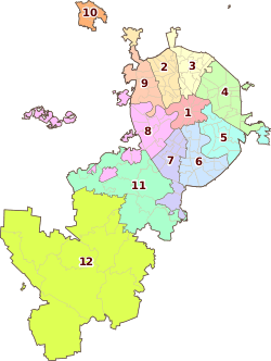 | |
|---|---|---|
| Northern Administrative Okrug | ||
| North-Eastern Administrative Okrug | ||
| Eastern Administrative Okrug | ||
| South-Eastern Administrative Okrug | ||
| Southern Administrative Okrug | ||
| South-Western Administrative Okrug | ||
| Western Administrative Okrug | ||
| North-Western Administrative Okrug | ||
| Zelenogradsky Administrative Okrug | ||
| Novomoskovsky Administrative Okrug |
| |
| Troitsky Administrative Okrug |
| |
Coordinates: 55°51′31″N 37°26′47″E / 55.85861°N 37.44639°E