Khoroshevo-Mnevniki District
| Khoroshevo-Mnevniki District район Хорошево-Мневники (Russian) | |
|---|---|
 Location of Khoroshevo-Mnevniki District in Moscow | |
| Coordinates: 55°46′37″N 37°28′09″E / 55.77694°N 37.46917°ECoordinates: 55°46′37″N 37°28′09″E / 55.77694°N 37.46917°E | |
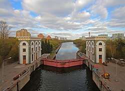 Moskva River locks near Karamyshev Embankment, Khoroshevo-Mnevniki District | |
.png) |
.png) |
|
| |
| Location | |
| Country | Russia |
| Federal subject | Moscow |
| Statistics | |
| Area | 15 km2 (5.8 sq mi)[1] |
| Population (2010 Census) | 166,804 inhabitants[2] |
| • Urban | 99.95% |
| • Rural | 0.05% |
| Density | 11,120.27/km2 (28,801.4/sq mi)[3] |
| Time zone | MSK (UTC+03:00)[4] |
| Official website | |
| Khoroshevo-Mnevniki District on WikiCommons | |
Khoroshevo-Mnevniki, sometimes called Khoroshyovo-Mnevniki (Russian: район Хорошёво-Мне́вники[5]) or Khoroshyovo-Mnyovniki (Russian: район Хорошёво-Мнёвники[6]), is a neighborhood of North-Western Borough of the federal city of Moscow, Russia. It is about 7 km west of the center of Moscow, with the Moscow river bordering the western and southern sides. The area of the neighborhood is 15 square kilometres (5.8 sq mi).[1] Population: 166,804 (2010 Census);[2] 146,968 (2002 Census).[7]
It is the second most populous neighborhood of the borough (after Mitino).[2]
Attractions
Approximately one third of the district is occupied by Serebryany Bor (park) ('Silver Forest'). Also in the district are Holy Trinity Church in Khoroshevo, and Terekhovo village.
.jpg)
Moscow, Serebryany Bor. Lake Bezdonnoe ('Bottomless Lake')
References
- 1 2 "General Information" (in Russian). Khoroshevo-Mnevniki District. Retrieved April 12, 2018.
- 1 2 3 Russian Federal State Statistics Service (2011). "Всероссийская перепись населения 2010 года. Том 1" [2010 All-Russian Population Census, vol. 1]. Всероссийская перепись населения 2010 года (2010 All-Russia Population Census) (in Russian). Federal State Statistics Service. Retrieved June 29, 2012.
- ↑ The value of density was calculated automatically by dividing the 2010 Census population by the area specified in the infobox. Please note that this value is only approximate as the area specified in the infobox does not necessarily correspond to the area of the entity proper or is reported for the same year as the population.
- ↑ Правительство Российской Федерации. Федеральный закон №107-ФЗ от 3 июня 2011 г. «Об исчислении времени», в ред. Федерального закона №271-ФЗ от 03 июля 2016 г. «О внесении изменений в Федеральный закон "Об исчислении времени"». Вступил в силу по истечении шестидесяти дней после дня официального опубликования (6 августа 2011 г.). Опубликован: "Российская газета", №120, 6 июня 2011 г. (Government of the Russian Federation. Federal Law #107-FZ of June 31, 2011 On Calculating Time, as amended by the Federal Law #271-FZ of July 03, 2016 On Amending Federal Law "On Calculating Time". Effective as of after sixty days following the day of the official publication.).
- ↑ Moskva Entsiklopediya (Moscow: Sovetskaya Entsiklopedya, 1980), p. 640.
- ↑ General Information About the District (in Russian)
- ↑ Russian Federal State Statistics Service (May 21, 2004). "Численность населения России, субъектов Российской Федерации в составе федеральных округов, районов, городских поселений, сельских населённых пунктов – районных центров и сельских населённых пунктов с населением 3 тысячи и более человек" [Population of Russia, Its Federal Districts, Federal Subjects, Districts, Urban Localities, Rural Localities—Administrative Centers, and Rural Localities with Population of Over 3,000] (XLS). Всероссийская перепись населения 2002 года [All-Russia Population Census of 2002] (in Russian). Retrieved August 9, 2014.
See also
| Central Administrative Okrug | 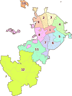 | |
|---|---|---|
| Northern Administrative Okrug | ||
| North-Eastern Administrative Okrug | ||
| Eastern Administrative Okrug | ||
| South-Eastern Administrative Okrug | ||
| Southern Administrative Okrug | ||
| South-Western Administrative Okrug | ||
| Western Administrative Okrug | ||
| North-Western Administrative Okrug | ||
| Zelenogradsky Administrative Okrug | ||
| Novomoskovsky Administrative Okrug |
| |
| Troitsky Administrative Okrug |
| |
This article is issued from
Wikipedia.
The text is licensed under Creative Commons - Attribution - Sharealike.
Additional terms may apply for the media files.