Vostochnoye Degunino District
| Vostochnoye Degunino District | |
|---|---|
 Location of Vostochnoye Degunino District on the map of Moscow | |
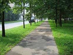 Street view, Dubninskaya, Vostochnoye Degunino District | |
.png) |
.png) |
|
| |
| Location | |
| Country | Russia |
| Federal subject | Moscow |
| Statistics | |
| Area | 3.77 km2 (1.46 sq mi)[1] |
| Population (2017 est.) | 95,700 inhabitants[1] |
| Density | 25,384.62/km2 (65,745.9/sq mi)[2] |
| Time zone | MSK (UTC+03:00)[3] |
| Official website | |
| Vostochnoye Degunino District on WikiCommons | |
Vostochnoye Degunino District (Russian: Восточное Дегунино - Eastern Degunino) is an administrative district (raion) of Northern Administrative Okrug, and one of the 125 raions of Moscow, Russia.[4] The area of the district is 3.77 square kilometers (1.46 sq mi)[1]. Population: 95,700 (2017 est.).
See also
References
Notes
- 1 2 3 "General Information" (in Russian). Vostochnoye Degunino District. Retrieved February 5, 2018.
- ↑ The value of density was calculated automatically by dividing the 2017 population estimate by the area specified in the infobox. Please note that this value is only approximate as the area specified in the infobox does not necessarily correspond to the area of the entity proper or is reported for the same year as the population.
- ↑ Правительство Российской Федерации. Федеральный закон №107-ФЗ от 3 июня 2011 г. «Об исчислении времени», в ред. Федерального закона №271-ФЗ от 03 июля 2016 г. «О внесении изменений в Федеральный закон "Об исчислении времени"». Вступил в силу по истечении шестидесяти дней после дня официального опубликования (6 августа 2011 г.). Опубликован: "Российская газета", №120, 6 июня 2011 г. (Government of the Russian Federation. Federal Law #107-FZ of June 31, 2011 On Calculating Time, as amended by the Federal Law #271-FZ of July 03, 2016 On Amending Federal Law "On Calculating Time". Effective as of after sixty days following the day of the official publication.).
- ↑ Государственный комитет Российской Федерации по статистике. Комитет Российской Федерации по стандартизации, метрологии и сертификации. №ОК 019-95 1 января 1997 г. «Общероссийский классификатор объектов административно-территориального деления. Код 45», в ред. изменения №278/2015 от 1 января 2016 г.. (State Statistics Committee of the Russian Federation. Committee of the Russian Federation on Standardization, Metrology, and Certification. #OK 019-95 January 1, 1997 Russian Classification of Objects of Administrative Division . Code 45, as amended by the Amendment #278/2015 of January 1, 2016. ).
Sources
| Central Administrative Okrug | 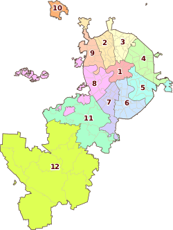 | |
|---|---|---|
| Northern Administrative Okrug | ||
| North-Eastern Administrative Okrug | ||
| Eastern Administrative Okrug | ||
| South-Eastern Administrative Okrug | ||
| Southern Administrative Okrug | ||
| South-Western Administrative Okrug | ||
| Western Administrative Okrug | ||
| North-Western Administrative Okrug | ||
| Zelenogradsky Administrative Okrug | ||
| Novomoskovsky Administrative Okrug |
| |
| Troitsky Administrative Okrug |
| |
Coordinates: 55°52′41″N 37°33′57″E / 55.87806°N 37.56583°E
This article is issued from
Wikipedia.
The text is licensed under Creative Commons - Attribution - Sharealike.
Additional terms may apply for the media files.