Yonna, Oregon
| Yonna | |
|---|---|
| Unincorporated community | |
 Yonna  Yonna | |
| Coordinates: 42°16′05″N 121°28′03″W / 42.26806°N 121.46750°WCoordinates: 42°16′05″N 121°28′03″W / 42.26806°N 121.46750°W | |
| Country | United States |
| State | Oregon |
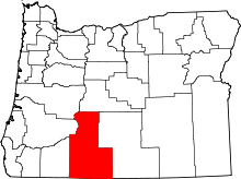
| County | Klamath |
| Elevation | 4,144 ft (1,263 m) |
| Time zone | UTC-8 (Pacific (PST)) |
| • Summer (DST) | UTC-7 (PDT) |
| GNIS feature ID | 1161605[1] |
| Coordinates and elevation from Geographic Names Information System[1] | |
Yonna is an unincorporated community in Klamath County, Oregon, United States.[1] It lies east of Oregon Route 140 in Yonna Valley, northeast of Dairy and near the base of Short Lake Mountain.[2]
At one time known as Alkali Valley, the area is now known by its Klamath name, Yonna Valley. According to Oregon Geographic Names, the name may come from yana, meaning "below" as in the valley, or it may derived from yaina, meaning "mountain". A post office was established in Yonna Valley in 1906. It closed in 1913.[3]
References
- 1 2 3 "Yonna". Geographic Names Information System. United States Geological Survey. November 28, 1980. Retrieved January 20, 2017.
- ↑ Oregon Atlas & Gazetteer (7th ed.). Yarmouth, Maine: DeLorme. 2008. p. 71. ISBN 0-89933-347-8.
- ↑ McArthur, Lewis A.; McArthur, Lewis L. (2003) [1928]. Oregon Geographic Names (7th ed.). Portland, Oregon: Oregon Historical Society Press. p. 1067. ISBN 978-0875952772.
This article is issued from
Wikipedia.
The text is licensed under Creative Commons - Attribution - Sharealike.
Additional terms may apply for the media files.