Pine Grove, Klamath County, Oregon
| Pine Grove | |
|---|---|
| Unincorporated community | |
 Pine Grove Location within the state of Oregon  Pine Grove Pine Grove (the US) | |
| Coordinates: 42°10′55″N 121°40′16″W / 42.18194°N 121.67111°WCoordinates: 42°10′55″N 121°40′16″W / 42.18194°N 121.67111°W | |
| Country | United States |
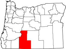
| State | Oregon |
| County | Klamath |
| Elevation | 4,153 ft (1,266 m) |
| Time zone | UTC-8 (Pacific (PST)) |
| • Summer (DST) | UTC-7 (PDT) |
| GNIS feature ID | 1125399[1] |
| Coordinates and elevation from Geographic Names Information System[1] | |
Pine Grove is an unincorporated community in Klamath County, Oregon, United States. Pine Grove lies south of Oregon Route 140 just east of its interchange with Oregon Route 39 near Altamont.[2]
Pine Grove had a station on the Oregon, California and Eastern Railway, which by 1929 reached from Klamath Falls to Bly. A 1941 timetable lists Pine Grove as the third stop east of Klamath Falls between Hager and Olene.[3]
After 1990, the rail line passing through Pine Grove became part of a rail trail, the OC&E Woods Line State Trail, managed by the Oregon Parks and Recreation Department. One of the trailheads on the 100-mile (160 km) trail is at Pine Grove.[4]
References
- 1 2 "Pine Grove". Geographic Names Information System. United States Geological Survey. November 28, 1980. Retrieved January 17, 2017.
- ↑ Oregon Atlas & Gazetteer (7th ed.). Yarmouth, Maine: DeLorme. 2008. p. 70. ISBN 0-89933-347-8.
- ↑ Culp, Edwin D. (1978). Stations West: The Story of the Oregon Railways. New York: Bonanza Books. pp. 160–62. OCLC 4751643.
- ↑ "OC&E Woods Line State Trail" (PDF). Oregon Parks and Recreation Department. Retrieved January 18, 2017.
This article is issued from
Wikipedia.
The text is licensed under Creative Commons - Attribution - Sharealike.
Additional terms may apply for the media files.