Falcon Heights, Oregon
| Falcon Heights | |
|---|---|
| Unincorporated community | |
 Falcon Heights  Falcon Heights | |
| Coordinates: 42°08′15″N 121°45′24″W / 42.13750°N 121.75667°WCoordinates: 42°08′15″N 121°45′24″W / 42.13750°N 121.75667°W | |
| Country | United States |
| State | Oregon |
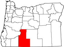
| County | Klamath |
| Elevation | 4,409 ft (1,344 m) |
| Time zone | UTC-8 (Pacific (PST)) |
| • Summer (DST) | UTC-7 (PDT) |
| GNIS feature ID | 1161658[1] |
| Coordinates and elevation from Geographic Names Information System[1] | |
Falcon Heights is an unincorporated community in Klamath County in the U.S. state of Oregon.[1] It lies south of Klamath Falls and east of Midland along Old Midland Road.[2]
Falcon Heights is a gated community originally created by the federal government as housing for United States Air Force personnel stationed at nearby Kingsley Field. It consists of 290 housing units built in 1958, acquired by a Klamath Falls development company in 1997, and sold to individual buyers. The Falcon Heights Homeowners Association, overseen by an elected board of directors, manages the 118-acre (48 ha) community.[3]
References
- 1 2 3 "Falcon Heights". Geographic Names Information System. United States Geological Survey. May 22, 1986. Retrieved January 27, 2017.
- ↑ Oregon Atlas & Gazetteer (7th ed.). Yarmouth, Maine: DeLorme. 2008. p. 70. ISBN 0-89933-347-8.
- ↑ Beaver, Ty (January 30, 2010). "Neighborhood Profile: Falcon Heights". Herald and News. Retrieved January 27, 2017.
This article is issued from
Wikipedia.
The text is licensed under Creative Commons - Attribution - Sharealike.
Additional terms may apply for the media files.