Lorella, Oregon
| Lorella, Oregon | |
|---|---|
| Unincorporated community | |
 Lorella, Oregon  Lorella, Oregon | |
| Coordinates: 42°08′13″N 121°16′19″W / 42.137°N 121.272°WCoordinates: 42°08′13″N 121°16′19″W / 42.137°N 121.272°W | |
| Country | United States |
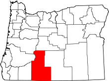
| State | Oregon |
| County | Klamath |
| Elevation | 4,190 ft (1,280 m) |
| Time zone | UTC-8 (Pacific (PST)) |
| • Summer (DST) | UTC-7 (PDT) |
| ZIP code | 97623 |
| Area code(s) | 458 and 541 |
Lorella, formerly Haynesville, is an unincorporated community in Klamath County, Oregon, United States.[1] It lies southeast of Bonanza along East Langell Valley Road.[2] The Lost River flows through the Langell Valley and near Lorella.[2]
It became known as Lorella, for a local resident, on December 13, 1894, shortly after the establishment of a post office on August 3, 1887. Joseph K. Haynes was first postmaster. The office closed in March 1930.[3]
References
- ↑ "Lorella". Geographic Names Information System. United States Geological Survey. Retrieved 2010-12-16.
- 1 2 Oregon Atlas & Gazetteer (7th ed.). Yarmouth, Maine: DeLorme. 2008. p. 71. ISBN 0-89933-347-8.
- ↑ McArthur, Lewis A.; McArthur, Lewis L (2003) [1928]. Oregon geographic names. Portland, Oregon: Oregon Historical Society Press. p. 592. ISBN 0-87595-277-1.
This article is issued from
Wikipedia.
The text is licensed under Creative Commons - Attribution - Sharealike.
Additional terms may apply for the media files.