Yelta, Victoria
| Yelta Victoria | |||||||||||||||
|---|---|---|---|---|---|---|---|---|---|---|---|---|---|---|---|
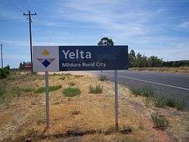 Entry sign | |||||||||||||||
 Yelta | |||||||||||||||
| Coordinates | 34°07′S 141°59′E / 34.117°S 141.983°ECoordinates: 34°07′S 141°59′E / 34.117°S 141.983°E | ||||||||||||||
| Population | 281 (2011 census)[1] | ||||||||||||||
| Postcode(s) | 3505 | ||||||||||||||
| Location | |||||||||||||||
| LGA(s) | Rural City of Mildura | ||||||||||||||
| State electorate(s) | Mildura | ||||||||||||||
| Federal Division(s) | Mallee | ||||||||||||||
| |||||||||||||||
Yelta is a small locality in Victoria, Australia. It was for a short time in the 1870s and 1880s the Victorian administrative centre of what is now Sunraysia and the Millewa. This role was then taken over by Mildura. At the 2011 census, Yelta and the surrounding area had a population of 281.[1]
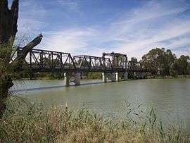
It is notable for containing the terminus of the Melbourne-Mildura railway line.[2]
History
In 1869, Yelta Mission was built on the banks of the Murray River.[3] Local aboriginals called a small billabong near the site of the mission, Yelta.
Military History
During World War 2, Yelta was the location of RAAF No.29 Inland Aircraft Fuel Depot (IAFD), completed in 1942 and closed on 14 June 1944. Usually consisting of 4 tanks, 31 fuel depots were built across Australia for the storage and supply of aircraft fuel for the RAAF and the US Army Air Forces at a total cost of £900,000 ($1,800,000).[4]
References
- 1 2 Australian Bureau of Statistics (31 October 2012). "Yelta (State Suburb)". 2011 Census QuickStats. Retrieved 5 November 2012.

- ↑ http://www.vicrailstations.com/Yelta/Yelta/Yelta.html
- ↑ "Koorie Heritage Trust: Glossary". Mission Voices. Australian Broadcasting Corporation. Retrieved 5 November 2012.
- ↑ Australia. Royal Australian Air Force. Historical Section (1995), Logistics units, AGPS Press, ISBN 978-0-644-42798-2