Birdwoodton, Victoria
| Birdwoodton Victoria | |||||||||||||||
|---|---|---|---|---|---|---|---|---|---|---|---|---|---|---|---|
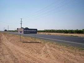 Entering Birdwoodton | |||||||||||||||
 Birdwoodton | |||||||||||||||
| Coordinates | 34°11′47″S 142°03′31″E / 34.19639°S 142.05861°ECoordinates: 34°11′47″S 142°03′31″E / 34.19639°S 142.05861°E | ||||||||||||||
| Population | 643 (2016 census)[1] | ||||||||||||||
| Postcode(s) | 3505 | ||||||||||||||
| Time zone | AEST (UTC+10) | ||||||||||||||
| • Summer (DST) | AEST (UTC+11) | ||||||||||||||
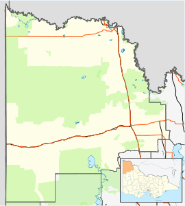
| Location | |||||||||||||||
| LGA(s) | Rural City of Mildura | ||||||||||||||
| Region | Sunraysia | ||||||||||||||
| State electorate(s) | Mildura | ||||||||||||||
| Federal Division(s) | Mallee | ||||||||||||||
| |||||||||||||||
Birwoodton is a locality situated in the Sunraysia region, in north western Victoria, Australia. The place by road, is situated about 4 kilometres south of Merbein and 14 kilometres northwest of Mildura.
Named after William Birdwood, 1st Baron Birdwood, leader of the ANZAC forces at the Battle of Gallipoli, it was established as an agricultural soldier settler scheme soon after World War I. The Post Office opened on 19 July 1920 (closed in 1978).[3]
The locality is predominantly devoted to grape production.
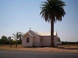
The Anglican Catholic church in Birdwoodton
Notes and references
- ↑ Australian Bureau of Statistics (27 June 2017). "Birdwoodton (State Suburb)". 2016 Census QuickStats. Retrieved 2017-12-31.

- ↑ Travelmate Archived 25 March 2007 at the Wayback Machine.
- ↑ Premier Postal History, Post Office List, retrieved 2008-04-11
External links
- Map of Birdwoodton {PDF}
This article is issued from
Wikipedia.
The text is licensed under Creative Commons - Attribution - Sharealike.
Additional terms may apply for the media files.