Wooburn
| Wooburn | |
|---|---|
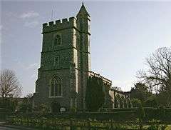 St. Paul's parish church | |
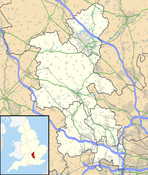 Wooburn Wooburn shown within Buckinghamshire | |
| Population | 10,792 (2011 Census including Hedsor)[1] |
| OS grid reference | SU908877 |
| Civil parish | |
| District | |
| Shire county | |
| Region | |
| Country | England |
| Sovereign state | United Kingdom |
| Post town | High Wycombe |
| Postcode district | HP10 |
| Dialling code | 01628 |
| Police | Thames Valley |
| Fire | Buckinghamshire |
| Ambulance | South Central |
| EU Parliament | South East England |
| UK Parliament | |
Wooburn is a village in Buckinghamshire, England.[2] It is located off the A4094 road between Wooburn Green and Bourne End in the very south of the county near the River Thames, about two miles south west of Beaconsfield and four miles east of Marlow. Wooburn is one of the two principal settlements within Wooburn, a civil parish in Wycombe district.[3]
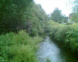
The village toponym is derived from the Old English for "walled stream". This refers to the River Wye, which has its source near West Wycombe and runs through the village to join the River Thames at Bourne End. The river runs along the boundary of Warren Nature Reserve, a Local Nature Reserve which adjoins Wooburn Park. In the Domesday Book of 1086 the village was recorded as Waborne though earlier, in 1075, it had been referred to as Waburna.[4][5] The Church of England parish church of Saint Paul is medieval but was extensively altered by the Gothic Revival architect William Butterfield in 1869. It has a flint nave and a tall tower. There are some half timbered houses facing the churchyard and nearby there is a flint school house.
The manor house of Wooburn was once a palace of the Bishops of Lincoln.
References
- ↑ "Civil Parish population 2011". Neighbourhood Statistics. Office for National Statistics. Retrieved 15 November 2016.
- ↑ Ordnance Survey: Landranger map sheet 175 Reading & Windsor (Henley-on-Thames & Bracknell) (Map). Ordnance Survey. 2012. ISBN 9780319232149.
- ↑ "Ordnance Survey Election Maps". www.ordnancesurvey.co.uk. Ordnance Survey. Retrieved 18 February 2016.
- ↑ Professor J.J.N.Palmer. "Open Doomsday: Wooburn". www.opendomesday.org. Anna Powell-Smith. Retrieved 3 February 2016.
- ↑ Mills, A.D. (2011) [first published 1991]. A Dictionary of British Place Names (First edition revised 2011 ed.). Oxford: Oxford University Press. p. 507. ISBN 9780199609086.
External links
![]()
| Towns (component areas and hamlets) |  | |
|---|---|---|
| Other civil parishes (component villages and hamlets) |
| |
| Former districts and boroughs | ||
| Former constituencies | ||