Williams, Lawrence County, Indiana
| Williams | |
|---|---|
| census-designated place | |
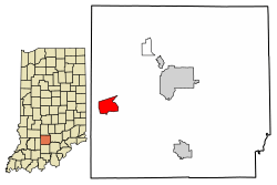 Location of Williams in Lawrence County, Indiana. | |
| Coordinates: 38°48′16″N 86°38′50″W / 38.80444°N 86.64722°WCoordinates: 38°48′16″N 86°38′50″W / 38.80444°N 86.64722°W | |
| Country | United States |
| State | Indiana |
| County | Lawrence |
| Township | Spice Valley |
| Elevation[1] | 574 ft (175 m) |
| ZIP code | 47470 |
| FIPS code | 18-84338[2] |
| GNIS feature ID | 451629 |
Williams is an unincorporated census-designated place in Spice Valley Township, Lawrence County, Indiana. Williams is situated on the White River. Williams is home to Williams Dam, a hydroelectric dam that once powered the electricity for stone industries across Southern Indiana, especially in nearby Bedford and Bloomington.
History
The Williams post office was established in 1876.[3] Byrd E. Williams was an early postmaster.[4] Williams was platted in 1889.[5] From 1910 to 1911, Williams Dam was being built on the East Fork of the White River. It was finally opened in 1913, giving electricity to stone industries in the region. The dam did this for almost four decades until being decommissioned in the 1950s. Almost 60 years later, Free Flow Power Corp., a startup company from Boston, looked into recommissioning the dam, giving the area a renewable energy power. The corporation planned to spend over $12 million by installing turbines on the plant.[6][7]
Williams Covered Bridge
The Williams Covered Bridge, also known as the Lawrence County Covered Bridge, is the longest double-span covered bridge still open to traffic in Indiana. It crosses the East Fork of the White River, in Section 7, Township 4 North, and Range 2 West, southwest of Williams. This double span Howe truss structure has a length of 376 feet, or 402 feet including the 13-foot overhang at each end, with a portal clearance 16 feet wide by 12 feet 6 inches high. Built in 1884 by Joseph J. Daniels, the bridge receives its name from the nearby town, which was named in honor of early settler Isaac Williams. Though no historical marker is present, the Williams Covered Bridge was added to the National Register of Historic Places in 1981 and is listed as #14-47-02 in the 1989 World Guide.
The Williams Covered Bridge was totally refurbished and is no longer open to traffic as of September 15, 2013.
Demographics
| Historical population | |||
|---|---|---|---|
| Census | Pop. | %± | |
| U.S. Decennial Census[8] | |||
Geography
Williams is located at 38°48′16″N 86°38′50″W / 38.80444°N 86.64722°W.
References
- ↑ "US Board on Geographic Names". United States Geological Survey. 2007-10-25. Retrieved 2008-01-31.
- ↑ "American FactFinder". United States Census Bureau. Retrieved 2008-01-31.
- ↑ "Lawrence County". Jim Forte Postal History. Retrieved 31 December 2014.
- ↑ Baker, Ronald L. (October 1995). From Needmore to Prosperity: Hoosier Place Names in Folklore and History. Indiana University Press. p. 348. ISBN 978-0-253-32866-3.
Byrd E. Williams became postmaster in 1900.
- ↑ History of Lawrence and Monroe Counties, Indiana: Their People, Industries, and Institutions. B.F. Bowen. 1914. p. 206.
- ↑ History of Lawrence and Monroe Counties, Indiana: Their People, Industries, and Institutions. B.F. Bowen. 1914. p. 57.
- ↑ John Russell (December 29, 2013). "Indiana's Williams Dam could power up again". IndyStar. Retrieved February 5, 2018.
- ↑ "Census of Population and Housing". Census.gov. Retrieved June 4, 2016.