Shawswick Township, Lawrence County, Indiana
| Shawswick Township | |
|---|---|
| Township | |
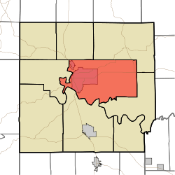 Location in Lawrence County | |
| Coordinates: 38°51′N 86°26′W / 38.850°N 86.433°WCoordinates: 38°51′N 86°26′W / 38.850°N 86.433°W | |
| Country |
|
| State |
|
| County | Lawrence |
| Government | |
| • Type | Indiana township |
| Area | |
| • Total | 69.87 sq mi (181.0 km2) |
| • Land | 69.52 sq mi (180.1 km2) |
| • Water | 0.34 sq mi (0.9 km2) 0.49% |
| Elevation | 686 ft (209 m) |
| Population (2010) | |
| • Total | 20,469 |
| • Density | 294.4/sq mi (113.7/km2) |
| ZIP codes | 47421, 47436, 47451 |
| GNIS feature ID | 0453842 |
Shawswick Township is one of nine townships in Lawrence County, Indiana, United States. As of the 2010 census, its population was 20,469 and it contained 9,653 housing units.[1]
History
Shawswick Township was established in 1818.[2] The township was named from a combination of the surnames Shaw and Wick. Wick was the name of a judge and Shaw was the name of a war hero; the final name Shawswick was formed in a compromise.[3]
The Helton-Mayo Farm was listed in the National Register of Historic Places in 1995.[4]
Geography
According to the 2010 census, the township has a total area of 69.87 square miles (181.0 km2), of which 69.52 square miles (180.1 km2) (or 99.50%) is land and 0.34 square miles (0.88 km2) (or 0.49%) is water.[1]
Cities, towns, villages
Unincorporated towns
- Crawford at 38°50′45″N 86°23′50″W / 38.8459°N 86.3972°W
- East Oolitic at 38°53′56″N 86°30′43″W / 38.8989°N 86.5119°W
- Englewood at 38°50′40″N 86°29′53″W / 38.8445°N 86.4980°W
- Erie at 38°52′57″N 86°22′53″W / 38.8826°N 86.3814°W
- Riverview at 38°50′32″N 86°32′30″W / 38.8423°N 86.5417°W
- Shawswick at 38°53′44″N 86°24′52″W / 38.8956°N 86.4144°W
(This list is based on USGS data and may include former settlements.)
Cemeteries
The township contains these nine cemeteries: Beech Grove, Breckinridge, Crawford, Green Hill, Ikerd, Scoggan, Sherril, Starr and Williams.
Major highways
Airports and landing strips
- Virgil I Grissom Municipal Airport
School districts
- North Lawrence Community Schools
Political districts
- Indiana's 4th congressional district
- State House District 62
- State House District 65
- State Senate District 44
References
- "Shawswick Township, Lawrence County, Indiana". Geographic Names Information System. United States Geological Survey. Retrieved 2009-10-08.
- United States Census Bureau 2008 TIGER/Line Shapefiles
- IndianaMap
- 1 2 "Population, Housing Units, Area, and Density: 2010 - County -- County Subdivision and Place -- 2010 Census Summary File 1". United States Census. Retrieved 2013-05-10.
- ↑ History of Lawrence, Orange, and Washington Counties, Indiana: From the Earliest Time to the Present. Higginson Book Company. 1884. p. 59.
- ↑ History of Lawrence and Monroe Counties, Indiana: Their People, Industries, and Institutions. B.F. Bowen. 1914. p. 61.
- ↑ National Park Service (2010-07-09). "National Register Information System". National Register of Historic Places. National Park Service.
External links
- Indiana Township Association
- United Township Association of Indiana
- City-Data.com page for Shawswick Township
Places adjacent to Shawswick Township, Lawrence County, Indiana | ||||||||||
|---|---|---|---|---|---|---|---|---|---|---|
| ||||||||||