William H. Natcher Parkway
| |
|---|---|
| Route information | |
| Length | 72.184 mi[1] (116.169 km) |
| Major junctions | |
| South end |
|
| |
| North end |
|
| Location | |
| Counties | Warren, Butler, Ohio, Daviess |
| Highway system | |

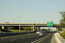
The William H. Natcher Green River Parkway is a limited-access freeway from Bowling Green to Owensboro in the US state of Kentucky. The Natcher is one of nine highways that are part of Kentucky's parkway system. The parkway is currently undergoing heavy infrastructural changes and upgrades to help it transition to Interstate status. It will be signed as Interstate 165 by the end of 2019 .
Parkway description
The parkway begins at an interchange with US Route 231 (US 231) south of Interstate 65 (I-65, exit 20) near Bowling Green. It travels along the west side of the city in a northwesterly direction, through rolling farmlands and near coal mines, for 72.184 miles (116.169 km) before meeting its northern terminus at an interchange with U.S. Route 60 in Owensboro. At exit 43, the parkway intersects with the Wendell H. Ford Western Kentucky Parkway, the longest and oldest road in the state's parkway system. The Natcher Parkway bypasses the cities of Morgantown, Beaver Dam and Hartford. The parkway carries the unsigned designation of Kentucky Route 9007 (WN 9007).[2]
History

Conceived as the "Owensboro–Bowling Green Parkway," it was instead named the Green River Parkway when it opened on December 15, 1972. It received its current name in 1994 following the death of William H. Natcher, a United States Congressman who represented the Second District of Kentucky for three decades. Natcher is best known for his record-setting string of 18,401 roll call votes, even being wheeled in on a hospital gurney to vote shortly before his death.
Glen Lily overpass
In 1973, the Glen Lily Road (KY 2665) overpass over the parkway was awarded the title of “Most Beautiful Bridge” by the American Institute of Steel Construction in the Highway Grade Separation category.[3]
Additional interchange and name combinations
The first added interchange built for the Natcher Parkway was the KY 70 interchange (exit 27, now exit 29) near Morgantown. Constructed in the 1999-2000 fiscal year, it was built to provide access to the city's industrial district.[4]
In 2006, the old and new names were combined into the current name, in order to be consistent with most of the Commonwealth's other parkways, all of which (except for the Audubon Parkway) had their original names changed in the same manner to honor various Kentucky politicians. However, the newly designed marker signs that were installed on the Natcher Parkway in the summer of 2006 do not bear the words "Green River."
Toll removal
On November 21, 2006, toll plazas on the Natcher were removed. State law requires that toll collection cease when enough tolls are collected to pay off the parkway's construction bonds. The Natcher and the nearby Audubon Parkway, were the last two roads in the Kentucky parkway system to have their tolls removed.
Prior to the removal of the tolls, toll plazas were located at exit 7 (now exit 9) in Bowling Green, exit 34 (now exit 36) in Cromwell–Morgantown, and exit 48 (now exit 50) in Hartford. Motorists traveling between the I-65 exit and exit 7 in the Bowling Green area were not charged a toll.[5]
Natcher Parkway Extension
In November 2011, the Natcher was extended by an additional 2.5 miles (4.0 km) from I-65 southward to US 231 (Scottsville Road) on the south side of Bowling Green. This was done to provide some relief of traffic on Scottsville Road as that roadway is the busiest thoroughfare in the city. [6] The project also included a new interchange to KY 622 near Plano, at milepost one.
Interstate 66
The East–West Trans America Highway was proposed in the ISTEA in 1991 and was narrowed down to the I-66 Southern Kentucky Corridor in the National Highway Designation Act of 1995:
In 1995, the National Highway System Designation Act amended Section 1105 (c) (3) of ISTEA and in Kentucky listed I-66 as centered on the cities of Pikeville, Jenkins, Hazard, London, Somerset, Columbia, Bowling Green, Hopkinsville, Benton and Paducah. The Southern Kentucky Corridor (I-66) would connect with the proposed King Coal Highway (also called I-73 / 74 North-South Corridor) in West Virginia as listed in Section 1105 (c) (5) in ISTEA (1991).
The preferred I-66 route followed US 68 between Bowling Green and Hopkinsville, however the I-66 spur along the Natcher Parkway eventually entered the highway plans. The Kentucky Transportation Cabinet finished its feasibility study of the I-66 project in 2005 and concluded that I-66 was not cost beneficial for the foreseeable future to justify its construction or any further study, thereby cancelling the state of Kentucky's participation in the I-66 project. The only remaining study of I-66 was conducted under the Federal Highway Administration and the Illinois Department of Transportation (IDOT) under the 66 Corridor Study, a Tier 1 Environmental Impact Study. This study was cancelled August 6, 2015, by IDOT and subsequently the FHWA announced the cancellation of the Tier 1 Environmental Impact Study in the Federal Register, ending the last I-66 project and therefore officially cancelling the I-66 Trans America Highway.
Interstate 165
| |
|---|---|
| Location | Bowling Green–Owensboro |
Interstate 165 (I-165) is the future designation of the William H. Natcher Parkway. While the Natcher Parkway is not currently an Interstate, it is, for the majority, at Interstate standards. In early 2016 funding was set aside[7] to rebuild and restore sections of the parkway to interstate standards. From July to August 2017, construction consisting of shoulder work, draining and repaving was completed. Additional work is underway along the entirety of the parkway. In July 2018, parkway major modernization upgrades began in the Warren County section, consisting of ramp extensions, guardrail replacement, lighting updates and bridge wall replacement. Traffic flow was restricted to one lane, wide loads were prohibited and the speed limit set to 55 mph. This work is expected to continue through the end of 2018. The US 231 interchange (exit 9) will be partially or completely revamped, and several interchange designs are being considered, including a dual-roundabout system. A new interchange will likely be constructed between the mile markers 3.4 and 4, allowing access to Elrod Road in Bowling Green[8].
The presumed number for the parkway was I-565, but on September 24, 2017, the AASHTO Special Committee on U.S. Route Numbering approved the Natcher Parkway as I-165.
On September 5, 2018, it was announced that the entire parkway would be signed with I-165 shields by the end of 2019, even before completion of the parkway's upgrades, thus officially bringing it to Interstate status.[9][10] It will also hold the additional designation of "William H. Natcher Expressway".[11]
Future
Interstate 67
The William Natcher Parkway is part of the Interstate 67 concept proposed by the I-67 Development Corporation, an association of local businessmen in the Owensboro area advocating the building of a new Interstate from I-65 in Bowling Green to I-69 in Washington, Indiana. The city of Owensboro, Daviess County Fiscal Court, Greater Owensboro Economic Development Corporation and Greater Owensboro Chamber of Commerce support the I-67 concept. The Kentucky Transportation Cabinet (KYTC) and the Indiana Department of Transportation (INDOT) have never proposed building I-67 nor endorse the specific concept proposed by the I-67 Development Corporation. KYTC has little interest because the route involves building a new Ohio River Bridge that would be entirely the financial responsibility of the KYTC, and has given high priority to build and complete the Ohio River bridges for I-65/I-265 in Louisville, I-75 between Covington and Cincinnati, Ohio, and I-69 between Henderson and Evansville, Indiana. The only possible way for the I-67 concept to become a reality is if Congress were to create the Indiana section as an Interstate Corridor, and that will only occur if the Indiana Congressional delegation propose the Federal legislation. KYTC already plans to convert the Natcher Parkway to I-165 instead as already provided in the 2015 FAST Act, so this issue of changing this plan to I-67 would have to be resolved within the Kentucky government first, which would need to work with the Kentucky Congressional Delegation also.
Exit list
See also
References
- 1 2 Division of Planning. "Official Milepoint Route Log Extract". Highway Information System. Kentucky Transportation Cabinet. Archived from the original on April 30, 2007. Retrieved April 8, 2007.
- ↑ Rand McNally (2016). "Kentucky" (Map). The Road Atlas (2016 Walmart ed.). c. 1:1,900,800. Chicago: Rand McNally. p. 42. ISBN 0-528-00626-6.
- ↑ KentuckyRoads.com -- Glen Lily Overpass
- ↑ Kentucky Transportation Cabinet (1999). Kentucky Official Highway Map (PDF) (Map). Scale not given. Frankfort: Kentucky Transportation Cabinet. Parkways and Toll Rates table.
- ↑ Kentucky Transportation Cabinet (1998). Kentucky Official Highway Map (PDF) (Map). Scale not given. Frankfort: Kentucky Transportation Cabinet. Parkways and Toll Rates table.
- ↑ Jaggers, Kiersten (December 21, 2011). "Travel: Work at Scottsville Road Interchange at Interstate 65". Columbia Magazine. Retrieved February 24, 2017.
- ↑ http://transportation.ky.gov/Program-Management/Documents/2016RecommendedProjectListing.pdf
- ↑ "Natcher Parkway Interchange at Elrod Road". transportation.ky.gov. Retrieved November 10, 2017.
- ↑ Embry, John (September 6, 2018). "Deal reached on I-165 designation". Beech Tree News. Retrieved September 10, 2018.
- ↑ Mason, Charles A. (June 26, 2016). "State Freight Plan puts Natcher interstate upgrade in pipeline". Bowling Green Daily News.
|access-date=requires|url=(help) - ↑ http://www.lrc.ky.gov/recorddocuments/bill/18RS/HJ146/bill.pdf
External links
Route map: