Westport Township, Dickinson County, Iowa
| Westport Township | |
|---|---|
| Township | |
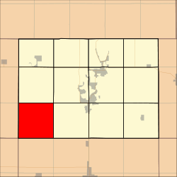 Location in Dickinson County | |
| Coordinates: 43°18′01″N 95°19′41″W / 43.30028°N 95.32806°WCoordinates: 43°18′01″N 95°19′41″W / 43.30028°N 95.32806°W | |
| Country |
|
| State |
|
| County | Dickinson |
| Area | |
| • Total | 93.05 km2 (35.93 sq mi) |
| • Land | 93.02 km2 (35.91 sq mi) |
| • Water | 0.03 km2 (0.01 sq mi) 0.03% |
| Elevation | 429 m (1,407 ft) |
| Population (2000) | |
| • Total | 143 |
| • Density | 1.5/km2 (4/sq mi) |
| Time zone | UTC-6 (CST) |
| • Summer (DST) | UTC-5 (CDT) |
| ZIP codes | 51338, 51345, 51347, 51351 |
| GNIS feature ID | 0468987 |
Westport Township is one of twelve townships in Dickinson County, Iowa, USA. As of the 2000 census, its population was 143.[1]
Geography
According to the United States Census Bureau, Westport Township covers an area of 35.93 square miles (93.05 square kilometers); of this, 35.91 square miles (93.02 square kilometers, 99.97 percent) is land and 0.01 square miles (0.03 square kilometers, 0.03 percent) is water.
Extinct towns
Adjacent townships
- Excelsior Township (north)
- Lakeville Township (northeast)
- Okoboji Township (east)
- Summit Township, Clay County (southeast)
- Waterford Township, Clay County (south)
- Harrison Township, Osceola County (west)
- Allison Township, Osceola County (northwest)
Cemeteries
The township contains Westport Cemetery.
School districts
- Clay Central-Everly Community School District
- Harris-Lake Park Community School District
- Hartley-Melvin-Sanborn Community School District
- Okoboji Community School District
Political districts
- Iowa's 5th congressional district
- State House District 06
- State Senate District 03
References
External links
Municipalities and communities of Dickinson County, Iowa, United States | ||
|---|---|---|
| Cities | ||
| Townships | ||
| Unincorporated community | ||
This article is issued from
Wikipedia.
The text is licensed under Creative Commons - Attribution - Sharealike.
Additional terms may apply for the media files.