Milford Township, Dickinson County, Iowa
| Milford Township | |
|---|---|
| Township | |
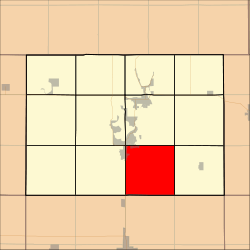 Location in Dickinson County | |
| Coordinates: 43°17′52″N 95°05′25″W / 43.29778°N 95.09028°WCoordinates: 43°17′52″N 95°05′25″W / 43.29778°N 95.09028°W | |
| Country |
|
| State |
|
| County | Dickinson |
| Area | |
| • Total | 91.98 km2 (35.51 sq mi) |
| • Land | 91.85 km2 (35.46 sq mi) |
| • Water | 0.12 km2 (0.05 sq mi) 0.13% |
| Elevation | 444 m (1,457 ft) |
| Population (2000) | |
| • Total | 869 |
| • Density | 9.5/km2 (24.5/sq mi) |
| Time zone | UTC-6 (CST) |
| • Summer (DST) | UTC-5 (CDT) |
| ZIP codes | 51351, 51364 |
| GNIS feature ID | 0468380 |
Milford Township is one of twelve townships in Dickinson County, Iowa, USA. As of the 2000 census, its population was 869.[1]
Geography
According to the United States Census Bureau, Milford Township covers an area of 35.51 square miles (91.98 square kilometers); of this, 35.46 square miles (91.85 square kilometers, 99.86 percent) is land and 0.05 square miles (0.12 square kilometers, 0.13 percent) is water.
Cities, towns, villages
- Milford (east half)
Unincorporated towns
Adjacent townships
- Center Grove Township (north)
- Richland Township (northeast)
- Lloyd Township (east)
- Lake Township, Clay County (southeast)
- Meadow Township, Clay County (south)
- Summit Township, Clay County (southwest)
- Okoboji Township (west)
- Lakeville Township (northwest)
Cemeteries
The township contains Milford Cemetery.
Major highways
Lakes
- Lower Gar Lake
School districts
- Okoboji Community School District
- Terril Community School District
Political districts
- Iowa's 5th congressional district
- State House District 06
- State Senate District 03
References
External links
| Wikimedia Commons has media related to Milford Township, Dickinson County, Iowa. |
Municipalities and communities of Dickinson County, Iowa, United States | ||
|---|---|---|
| Cities | ||
| Townships | ||
| Unincorporated community | ||
This article is issued from
Wikipedia.
The text is licensed under Creative Commons - Attribution - Sharealike.
Additional terms may apply for the media files.