Center Grove Township, Dickinson County, Iowa
| Center Grove Township | |
|---|---|
| Township | |
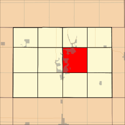 Location in Dickinson County | |
| Coordinates: 43°23′29″N 95°05′16″W / 43.39139°N 95.08778°WCoordinates: 43°23′29″N 95°05′16″W / 43.39139°N 95.08778°W | |
| Country |
|
| State |
|
| County | Dickinson |
| Area | |
| • Total | 93.63 km2 (36.15 sq mi) |
| • Land | 81.28 km2 (31.38 sq mi) |
| • Water | 12.35 km2 (4.77 sq mi) 13.19% |
| Elevation | 426 m (1,398 ft) |
| Population (2000) | |
| • Total | 7,478 |
| • Density | 92/km2 (238.3/sq mi) |
| Time zone | UTC-6 (CST) |
| • Summer (DST) | UTC-5 (CDT) |
| ZIP codes | 51331, 51351, 51355, 51360 |
| GNIS feature ID | 0467588 |
Center Grove Township is one of twelve townships in Dickinson County, Iowa, USA. As of the 2000 census, its population was 7,478.[1]
History
Center Grove Township was formed in 1866.[2]
Geography
According to the United States Census Bureau, Center Grove Township covers an area of 36.15 square miles (93.63 square kilometers); of this, 31.38 square miles (81.28 square kilometers, 86.81 percent) is land and 4.77 square miles (12.35 square kilometers, 13.19 percent) is water.
Cities, towns, villages
- Arnolds Park
- Milford (partial)
- Okoboji (southeast three-quarters)
- Spirit Lake (vast majority)
- West Okoboji (partial)
Adjacent townships
- Spirit Lake Township (north)
- Superior Township (northeast)
- Richland Township (east)
- Lloyd Township (southeast)
- Milford Township (south)
- Okoboji Township (southwest)
- Lakeville Township (west)
- Diamond Lake Township (northwest)
Cemeteries
The township contains these three cemeteries: Lake View, Lakeland Memory Gardens and Rose Hill.
Major highways
Airports and landing strips
- Airport Okoboji
- Dickinson County Memorial Hospital Heliport
- Lake Okoboji Seaplane Base
- Spirit Lake Municipal Airport
Lakes
- Center Lake
- Lower Gar Lake
- Minnewashta Lake
- Prairie Lake
- Upper Gar Lake
Landmarks
- Pillsbury Point State Park
- Summer Circle Park
School districts
- Okoboji Community School District
- Spirit Lake Community School District
Political districts
- Iowa's 5th congressional district
- State House District 06
- State Senate District 03
References
- United States Census Bureau 2007 TIGER/Line Shapefiles
- United States Board on Geographic Names (GNIS)
- United States National Atlas
- ↑ United States Census Bureau American FactFinder
- ↑ History of Emmet County and Dickinson County, Iowa. Pioneer Publishing Company. 1917. p. 282.
External links
| Wikimedia Commons has media related to Center Grove Township, Dickinson County, Iowa. |
Municipalities and communities of Dickinson County, Iowa, United States | ||
|---|---|---|
| Cities | ||
| Townships | ||
| Unincorporated community | ||
This article is issued from
Wikipedia.
The text is licensed under Creative Commons - Attribution - Sharealike.
Additional terms may apply for the media files.