Superior Township, Dickinson County, Iowa
| Superior Township | |
|---|---|
| Township | |
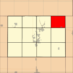 Location in Dickinson County | |
| Coordinates: 43°27′52″N 94°57′51″W / 43.46444°N 94.96417°WCoordinates: 43°27′52″N 94°57′51″W / 43.46444°N 94.96417°W | |
| Country |
|
| State |
|
| County | Dickinson |
| Area | |
| • Total | 74.2 km2 (28.65 sq mi) |
| • Land | 72.87 km2 (28.13 sq mi) |
| • Water | 1.34 km2 (0.52 sq mi) 1.81% |
| Elevation | 426 m (1,398 ft) |
| Population (2000) | |
| • Total | 300 |
| • Density | 4.1/km2 (10.7/sq mi) |
| Time zone | UTC-6 (CST) |
| • Summer (DST) | UTC-5 (CDT) |
| ZIP codes | 51334, 51360, 51363 |
| GNIS feature ID | 0468770 |
Superior Township is one of twelve townships in Dickinson County, Iowa, USA. As of the 2000 census, its population was 300.[1]
History
Superior Township was formed in 1872.[2]
Geography
According to the United States Census Bureau, Superior Township covers an area of 28.65 square miles (74.2 square kilometers); of this, 28.13 square miles (72.87 square kilometers, 98.21 percent) is land and 0.52 square miles (1.34 square kilometers, 1.81 percent) is water.
Cities, towns, villages
- Superior (vast majority)
Adjacent townships
- Emmet Township, Emmet County (east)
- Estherville Township, Emmet County (southeast)
- Richland Township (south)
- Center Grove Township (southwest)
- Spirit Lake Township (west)
Cemeteries
The township contains Superior Township Cemetery.
Major highways
Lakes
- Swan Lake
School districts
- Estherville Lincoln Central Com School District
- Spirit Lake Community School District
Political districts
- Iowa's 5th congressional district
- State House District 06
- State Senate District 03
References
- United States Census Bureau 2007 TIGER/Line Shapefiles
- United States Board on Geographic Names (GNIS)
- United States National Atlas
- ↑ United States Census Bureau American FactFinder
- ↑ History of Emmet County and Dickinson County, Iowa. Pioneer Publishing Company. 1917. p. 282.
External links
| Wikimedia Commons has media related to Superior Township, Dickinson County, Iowa. |
Municipalities and communities of Dickinson County, Iowa, United States | ||
|---|---|---|
| Cities | ||
| Townships | ||
| Unincorporated community | ||
This article is issued from
Wikipedia.
The text is licensed under Creative Commons - Attribution - Sharealike.
Additional terms may apply for the media files.