Westoverledingen
| Westoverledingen | ||
|---|---|---|
| ||
 Westoverledingen Location of Westoverledingen within Leer district 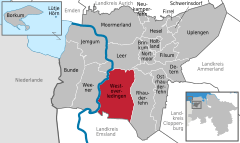  | ||
| Coordinates: 53°9′N 7°28′E / 53.150°N 7.467°ECoordinates: 53°9′N 7°28′E / 53.150°N 7.467°E | ||
| Country | Germany | |
| State | Lower Saxony | |
| District | Leer | |
| Government | ||
| • Mayor | Eberhard Lüpkes | |
| Area | ||
| • Total | 111.9 km2 (43.2 sq mi) | |
| Elevation | 4 m (13 ft) | |
| Population (2017-12-31)[1] | ||
| • Total | 20,912 | |
| • Density | 190/km2 (480/sq mi) | |
| Time zone | CET/CEST (UTC+1/+2) | |
| Postal codes | 26810 | |
| Dialling codes | 0 49 55 | |
| Vehicle registration | LER | |
| Website | wol.conne.net | |

Westoverledingen is a municipality in the Leer district, in Lower Saxony, Germany.
Towns and municipalities in Leer (district) | ||
|---|---|---|
References
| Authority control |
|---|
This article is issued from
Wikipedia.
The text is licensed under Creative Commons - Attribution - Sharealike.
Additional terms may apply for the media files.