Wendling
| Wendling | ||
|---|---|---|
| ||
 Wendling Location within Austria
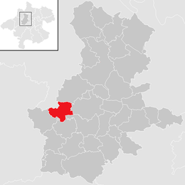
Location in the district
| ||
| Coordinates: 48°13′51″N 13°40′00″E / 48.23083°N 13.66667°ECoordinates: 48°13′51″N 13°40′00″E / 48.23083°N 13.66667°E | ||
| Country | Austria | |
| State | Upper Austria | |
| District | Grieskirchen | |
| Government | ||
| • Mayor | Ulrich Baumgartner-Flotzinger (ÖVP) | |
| Area | ||
| • Total | 12.9 km2 (5.0 sq mi) | |
| Elevation | 400 m (1,300 ft) | |
| Population (14 June 2016)[1] | ||
| • Total | 829 | |
| • Density | 64/km2 (170/sq mi) | |
| Time zone | UTC+1 (CET) | |
| • Summer (DST) | UTC+2 (CEST) | |
| Postal code | 4741 | |
| Area code | 07736 | |
| Vehicle registration | GR | |
| Website | www.tiscover.at/wendling | |

Wendling is a municipality in the district of Grieskirchen in the Austrian state of Upper Austria.
Geography
Wendling lies in the Hausruckviertel. About 9 percent of the municipality is forest, and 79 percent is farmland.
References
This article is issued from
Wikipedia.
The text is licensed under Creative Commons - Attribution - Sharealike.
Additional terms may apply for the media files.